My last full day. I tried to sleep in, but clearly my body was eager to leave Moab and soon I was on UT 128 driving along the Colorado River north towards the Rocky Mountains. This road was quite stunning and I managed to eek out a few more Red Rock views. When I emerged from a canyon near the “town” of Cisco, UT suddenly everything was over; no more red rocks, no more steep canyons, no more other-worldly scenery. Passing the boundary of the Colorado Plateau was like crossing into another world - a world more like our own.
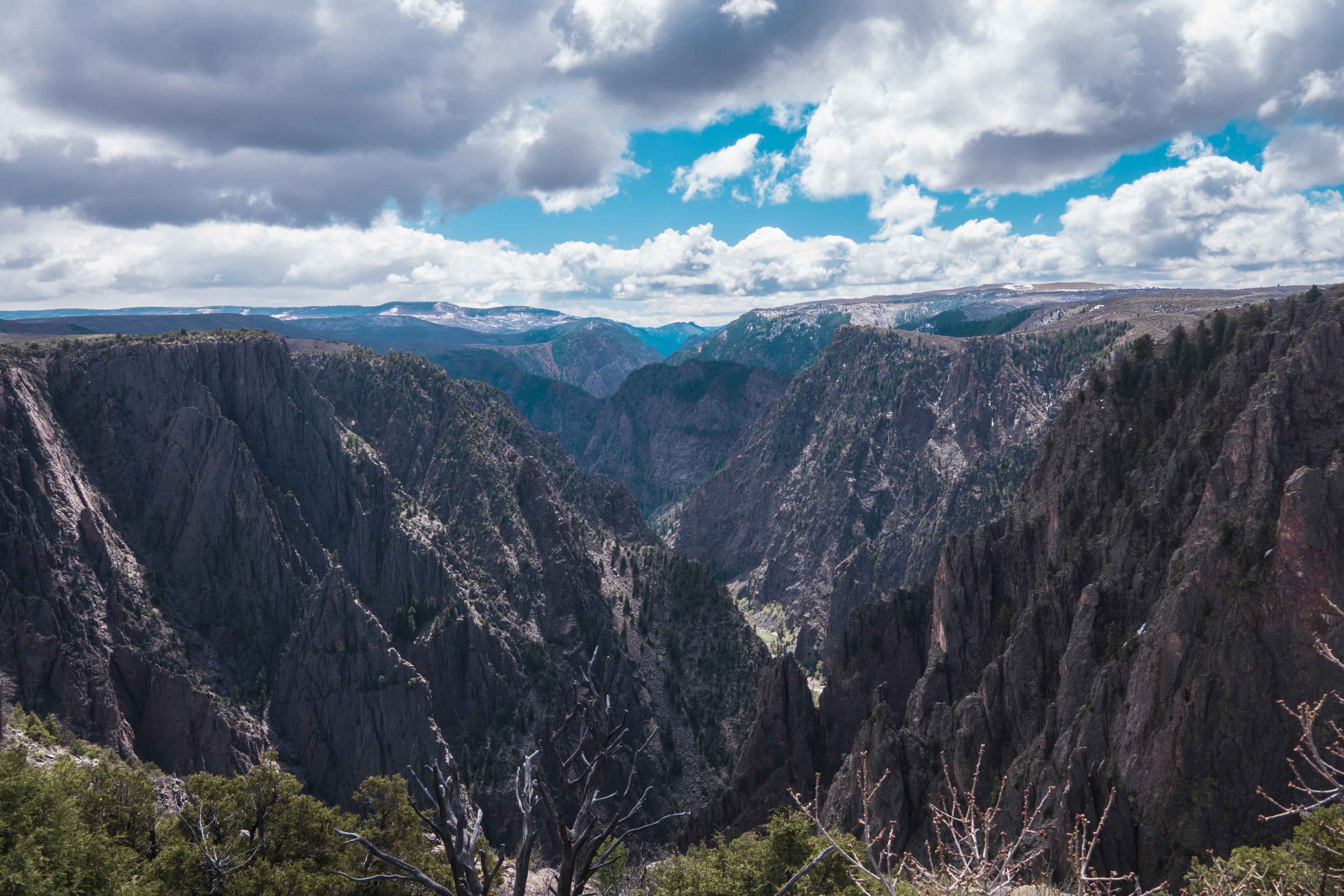
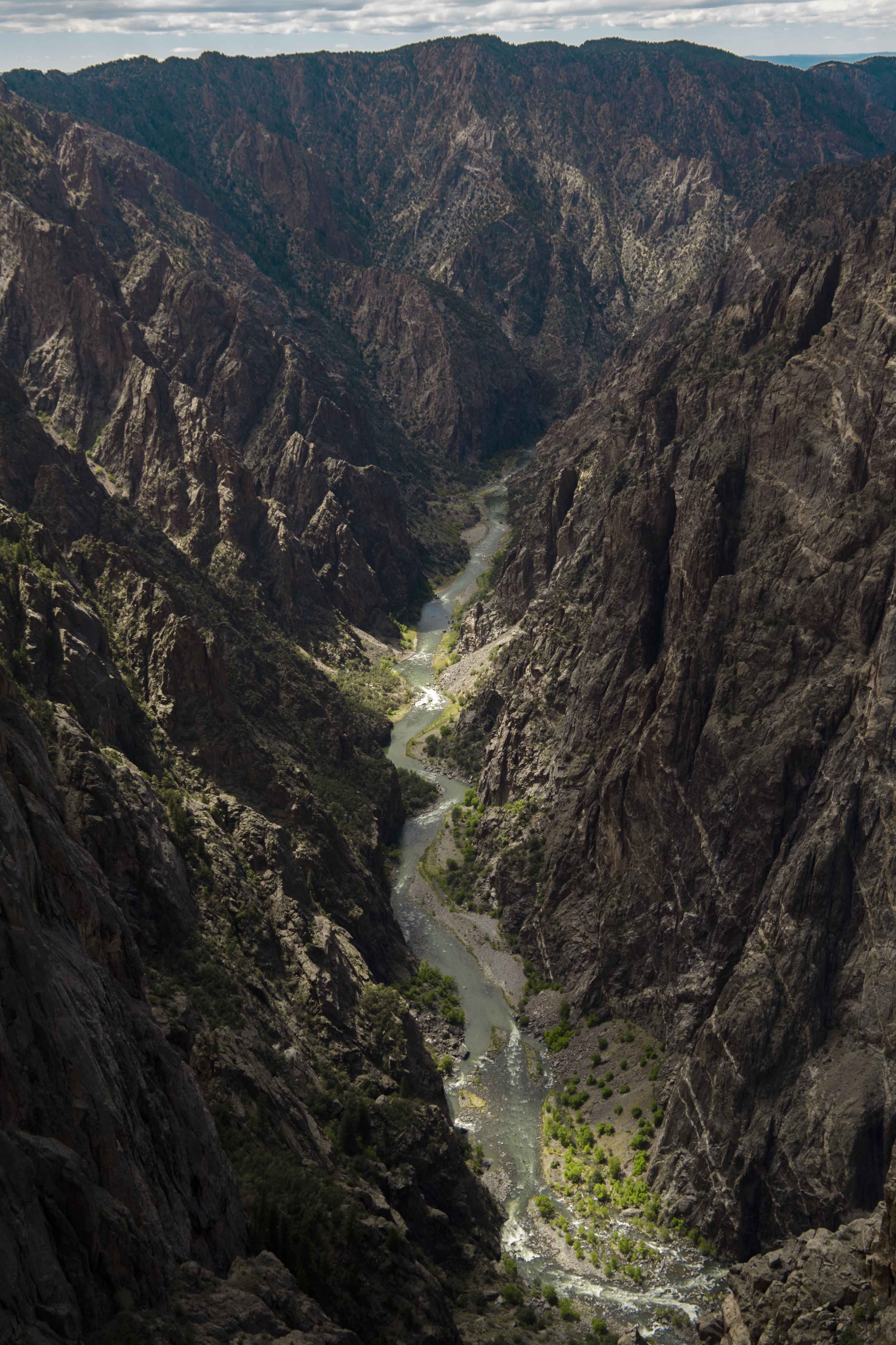
Soon I was in Colorado and heading east on US 50. In Montrose I had a Gordita and it was amazing. Not long after that a left turn on CO 347 brought me to Black Canyon of the Gunnison NP. At first blush the park seems to be nothing more than an expanse of high scrub land, but at the first viewpoint - BAM! There it is, an arrestingly steep and narrow canyon carved from black gneiss. The entire scene was different in almost every way possible from the canyons of Utah that I had left earlier that day.
The visitor center was staffed by a very helpful (and cute!) ranger who basically told me that in a full day I could see just about every part of the park and so I set out to do just that.
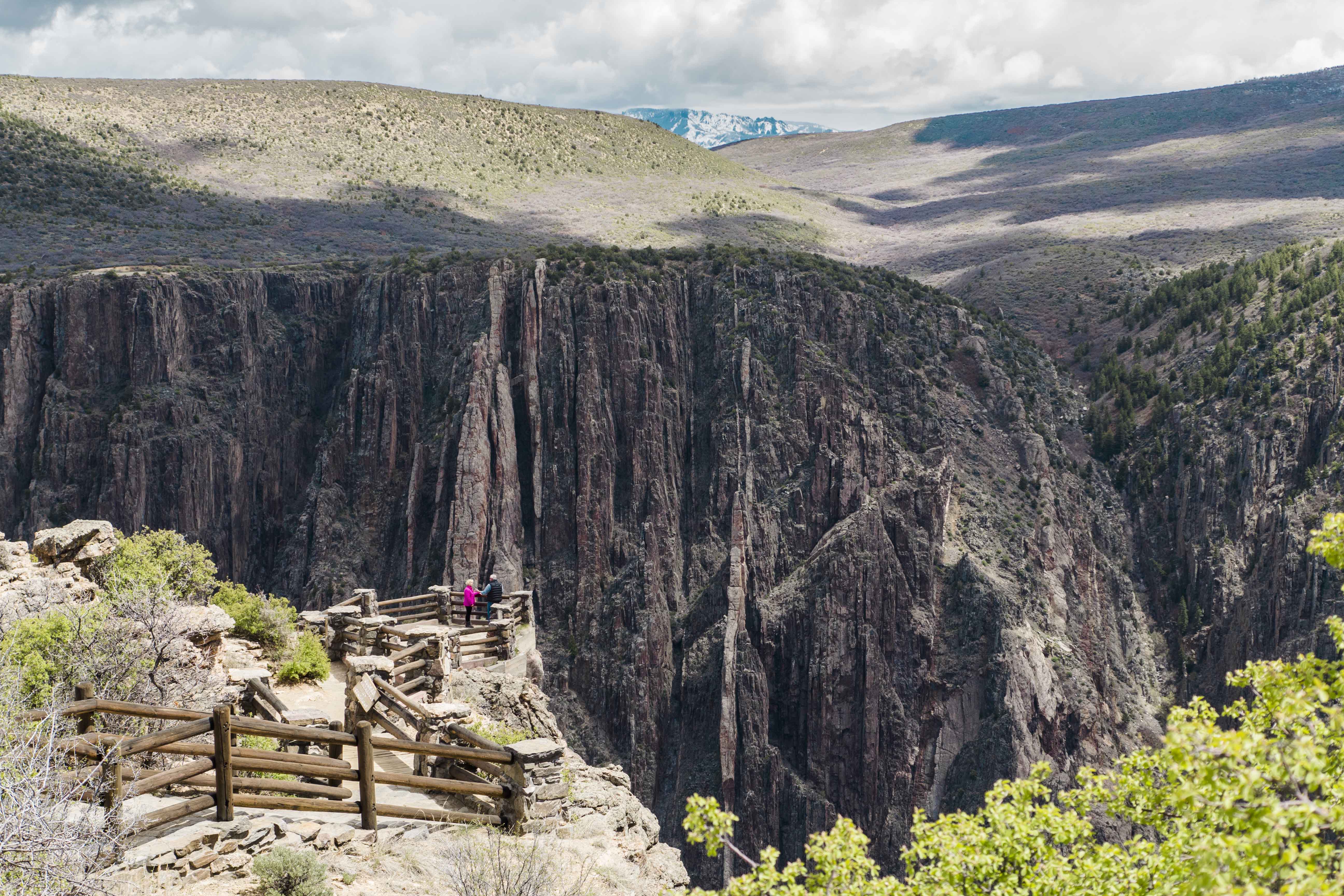
I started with a hike along the Oak Flat loop, which got me hundred feet or so down into the canyon. True to its name, this path also passed through stands of oak trees and after the deserts of Utah the forest around the trail seemed like Mirkwood. The views of the canyon were also good, but there were better to come…
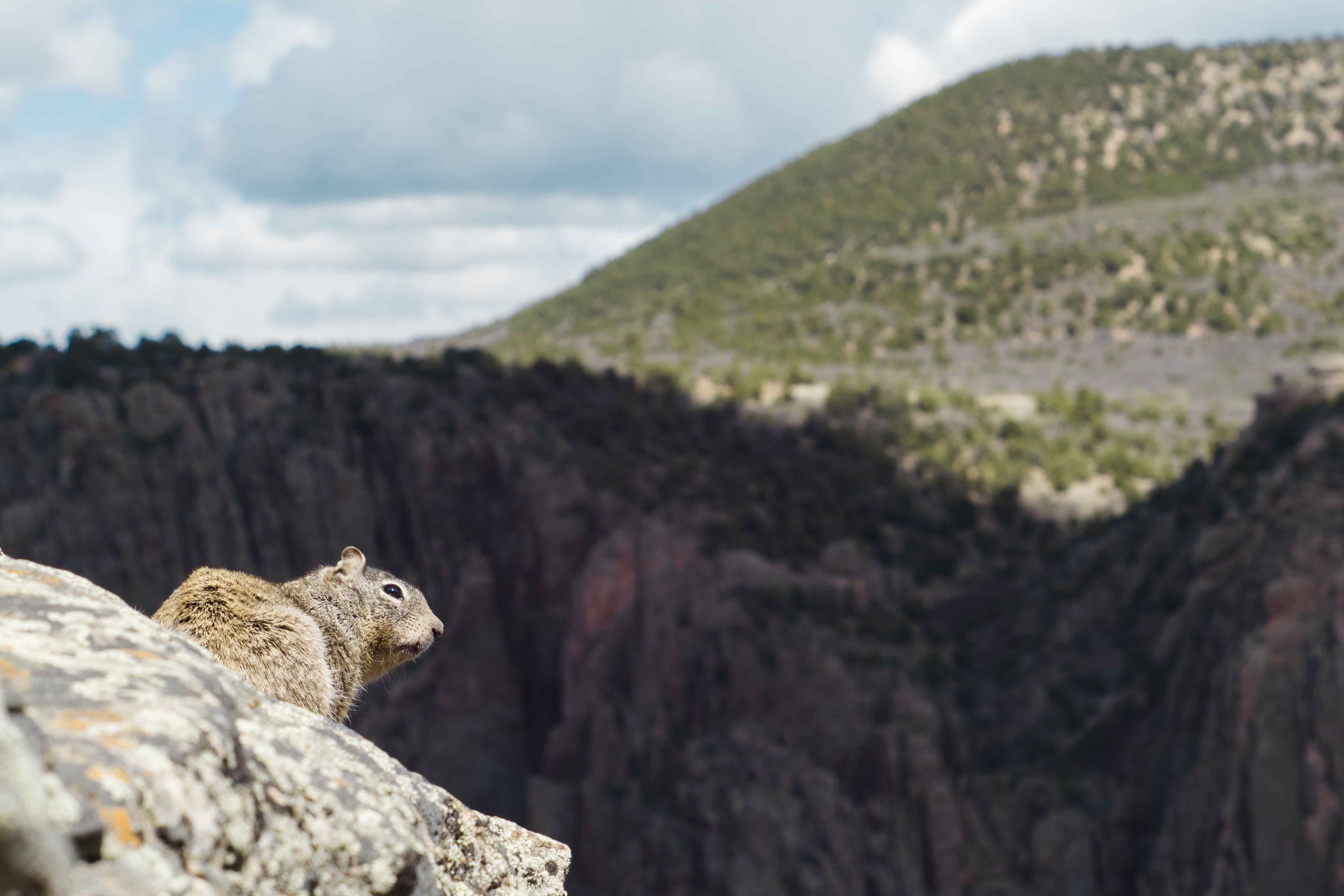
At a viewpoint I met a nice squirrel who seemed to appreciate the view as much as I did.
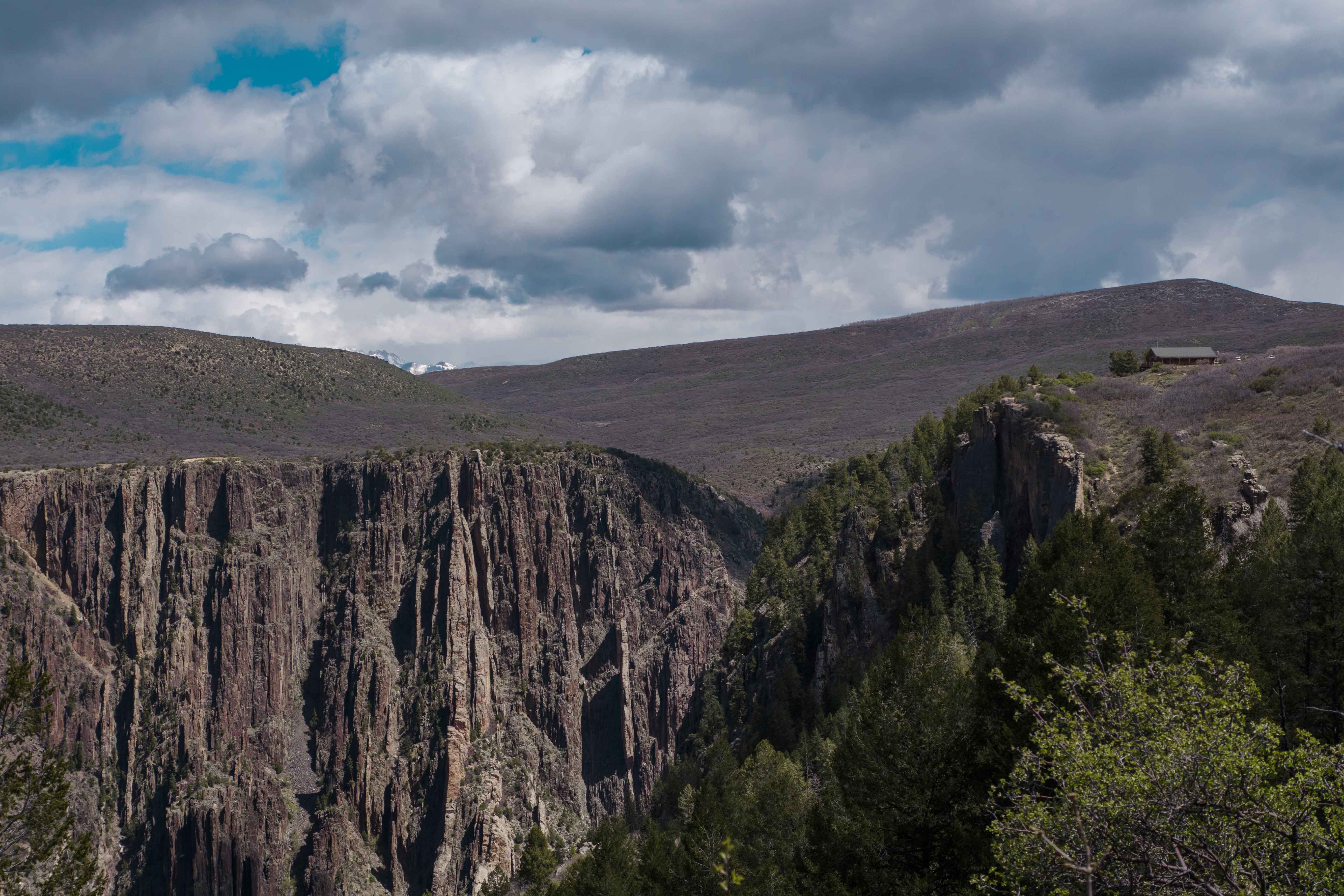
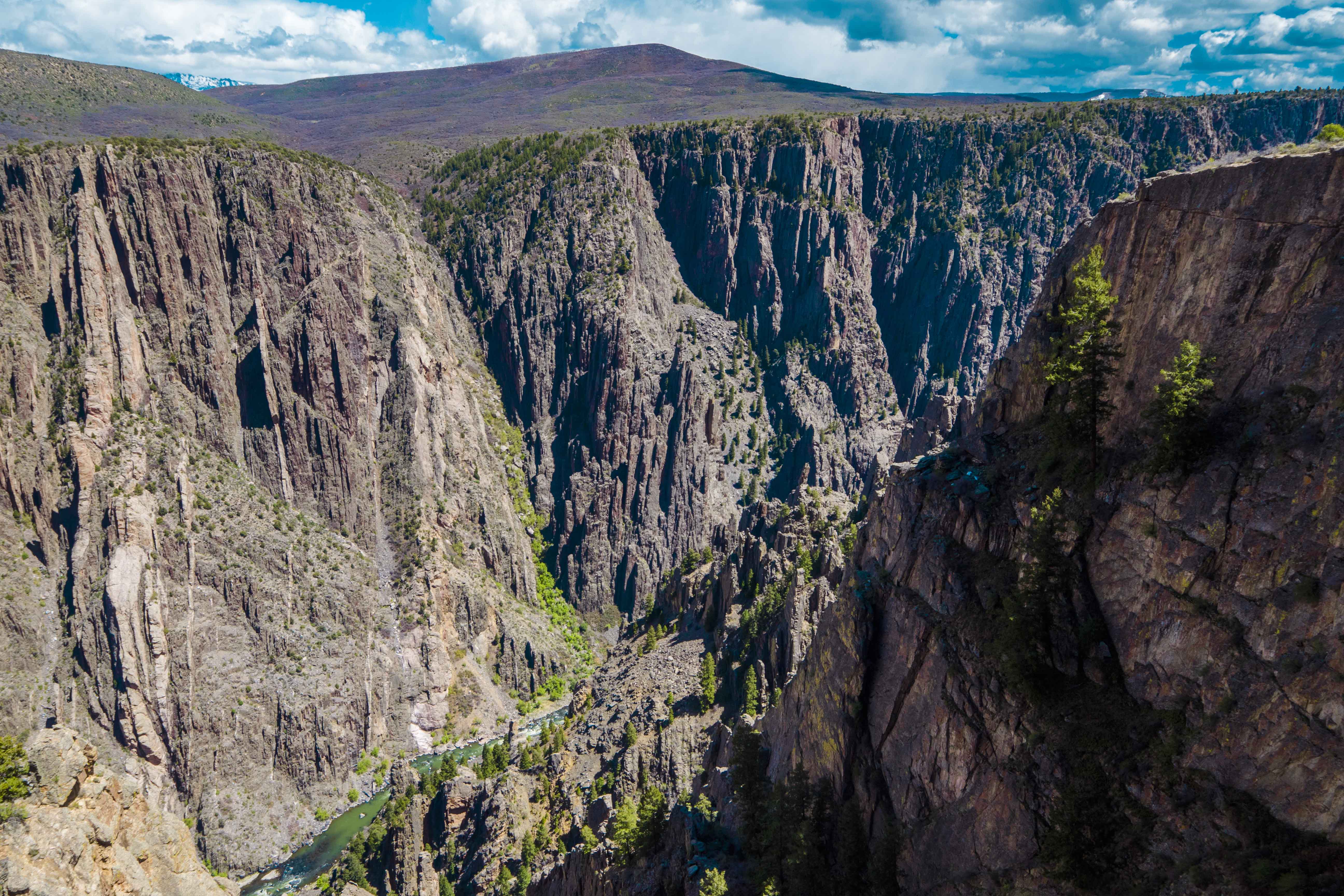
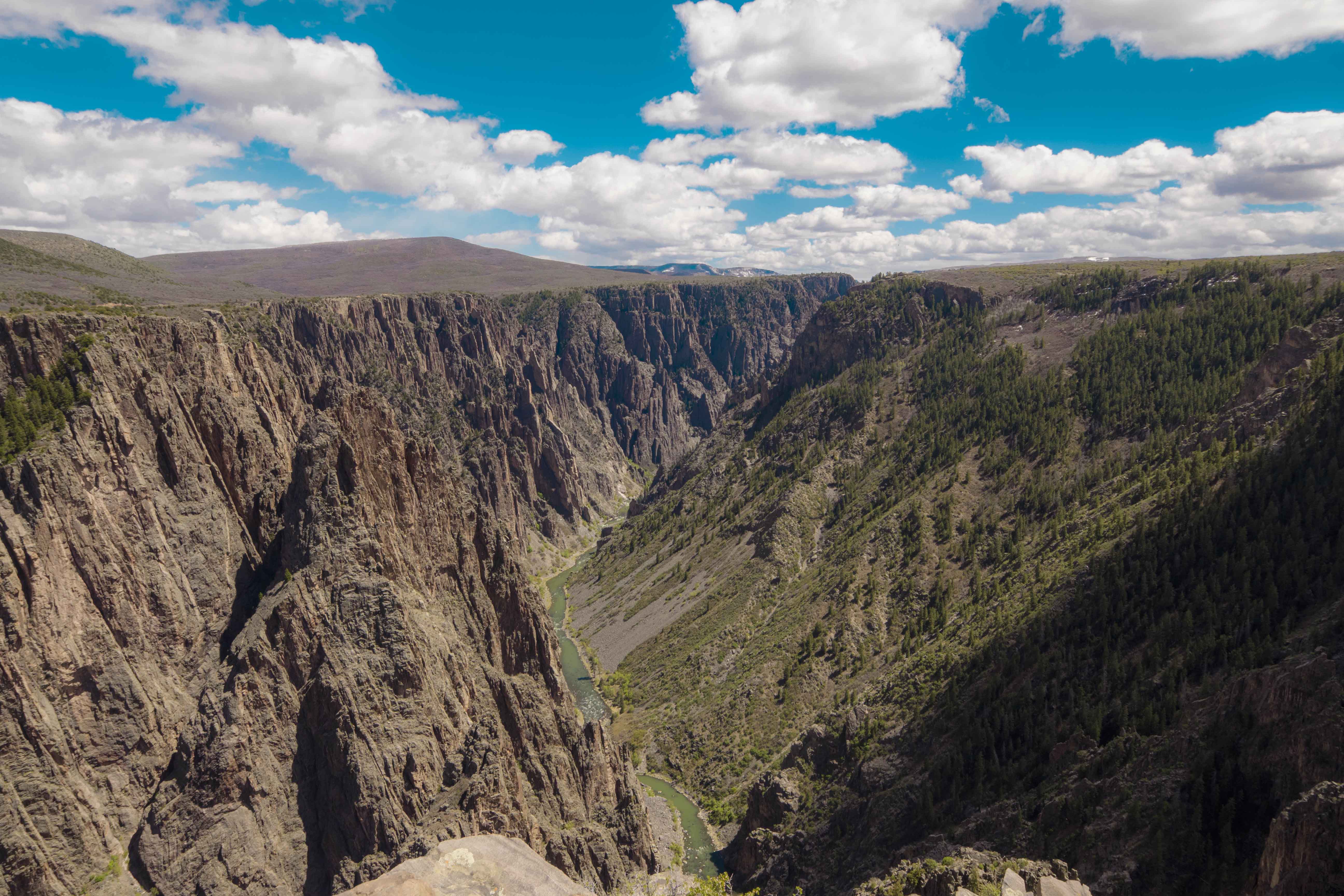
After the short hike I slowly drove along the rim road and stopped at just about every viewpoint there was. Each offered an unexpectedly different look down on the amazing canyon below. The jagged walls and dark, mottled rock almost camouflaged the true nature of the canyon and every different perspective seemed to reveal an entirely different gorge.
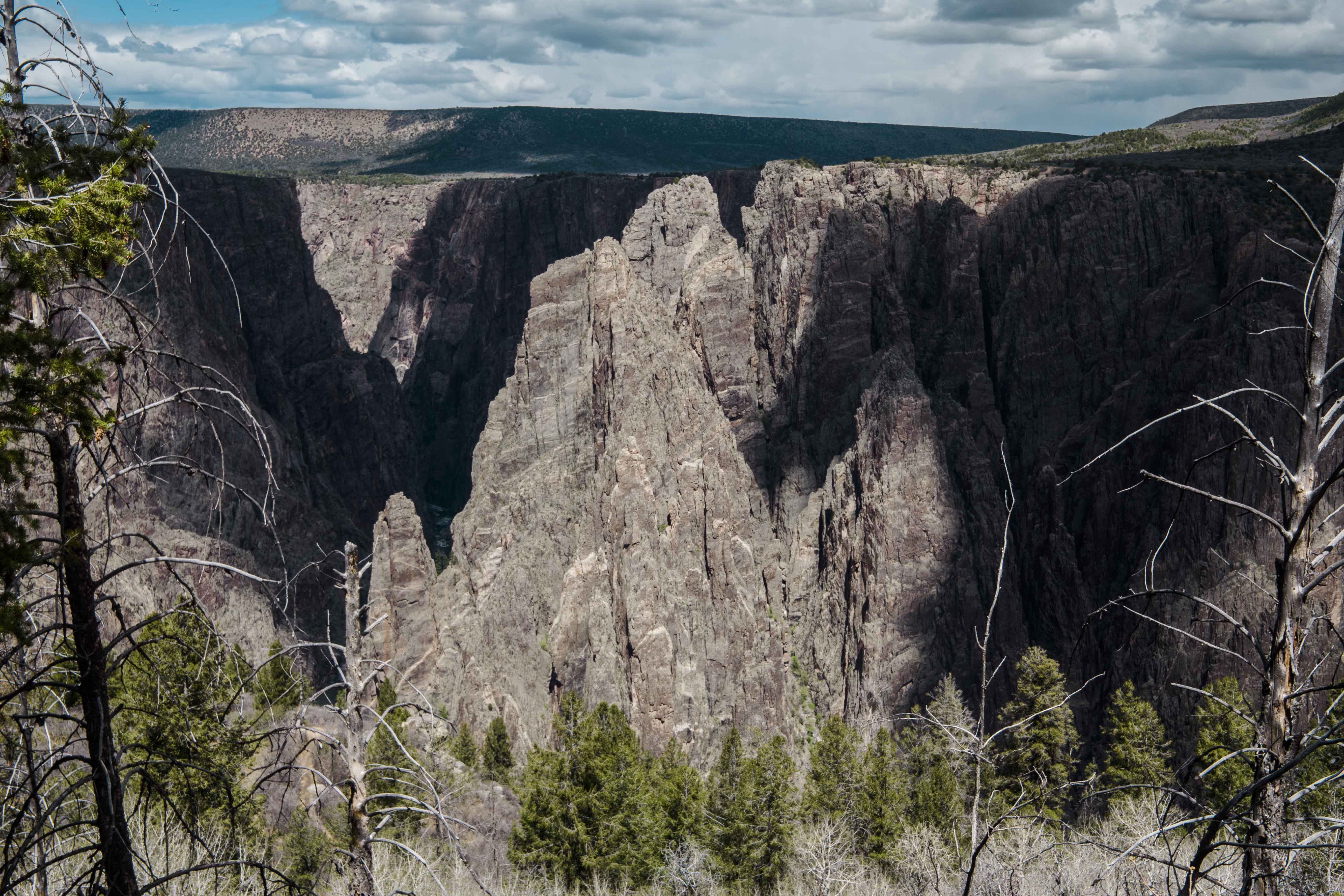
A clear highlight was the Painted Wall (also the tallest cliff in Colorado!). Here the impurities in the gneiss and schist stand out like paint splattered across a great, stone canvas.
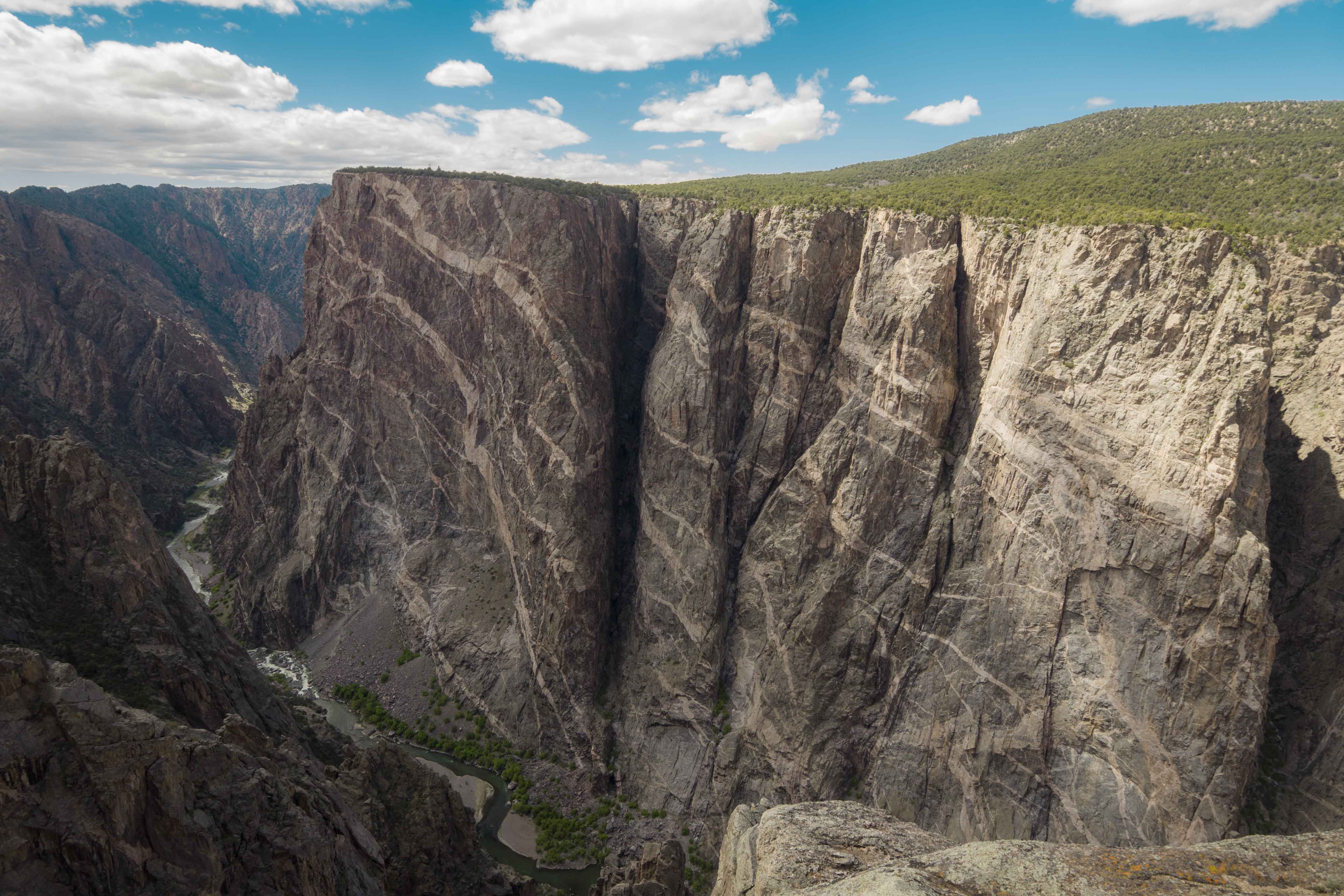
Below this, and extending far to the distant planes, the Gunnison River rages, bright blue and green with the shining sun, all the while broken by rapids that foam white and who’s violent roar could be heard on the rim 1,800 feet above.
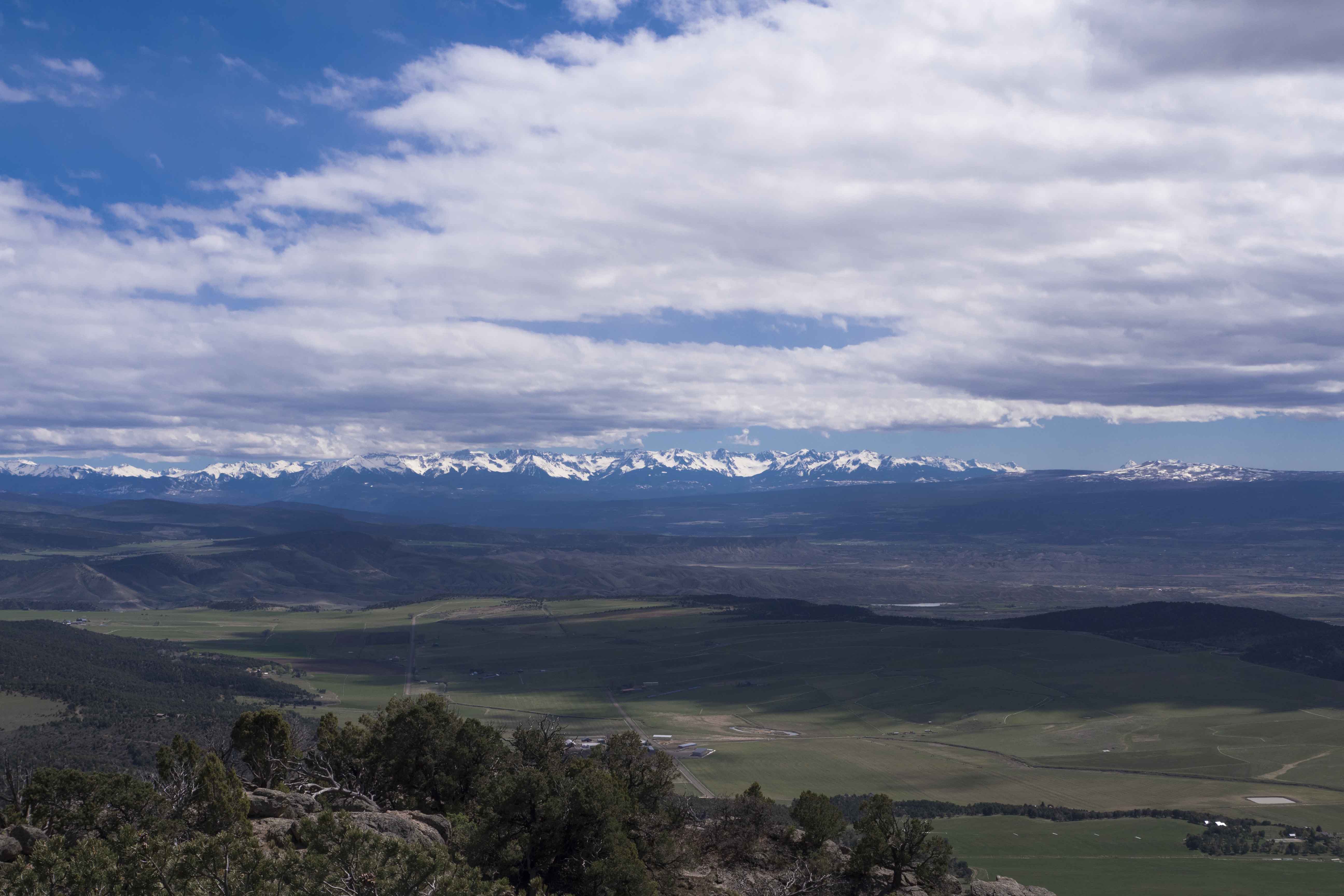
At the end of the road I took another hike to Warner Point, where I could see south the snow-covered San Juan mountains.
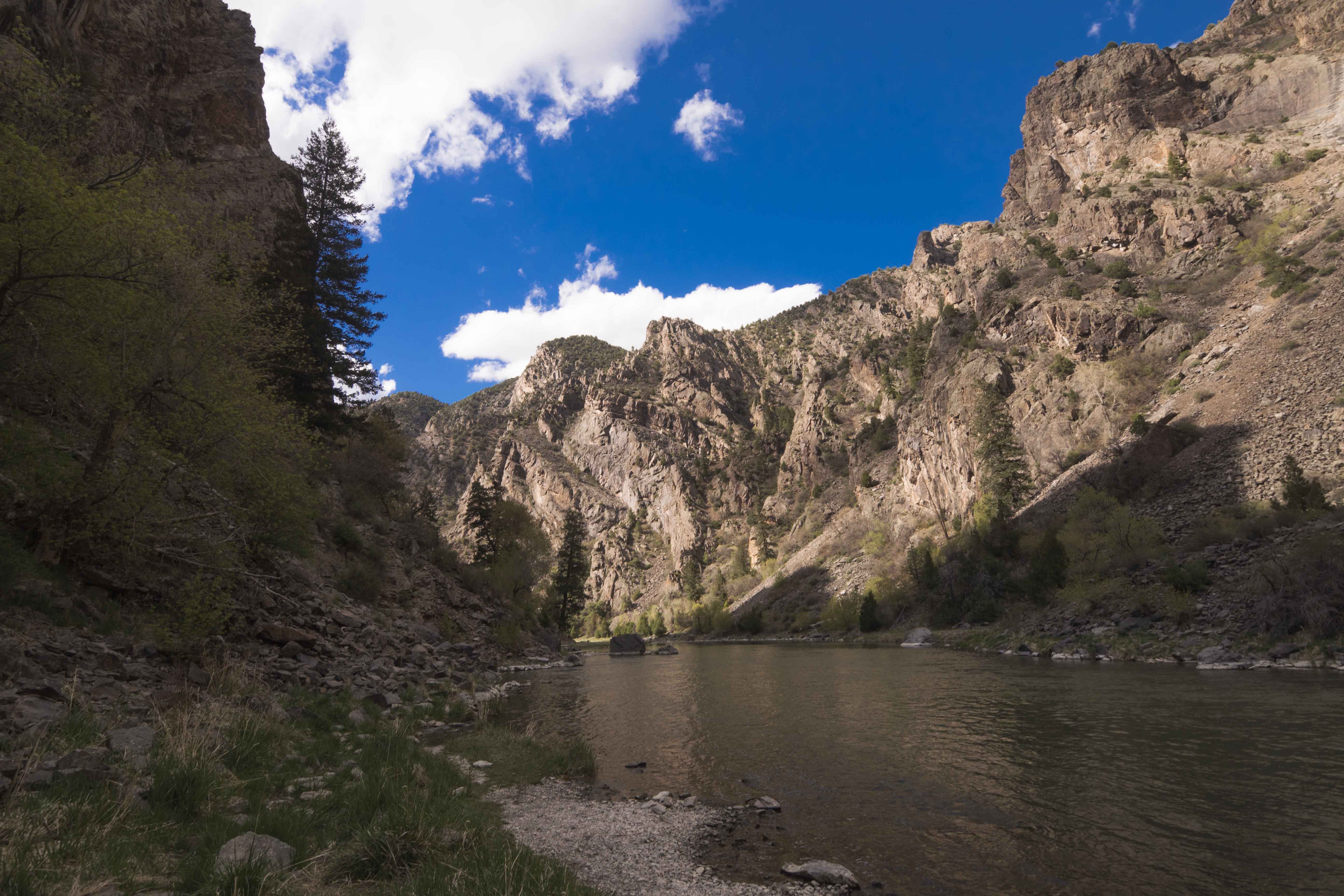
Next I drove down to the river via the East Portal Road, a brake burning 16% grade for 5 miles straight down. I’m not joking about the brakes, either; by the time I reached the bottom they were pretty stinky!. Here along the river are two dams and the remnants of a town that sprung up to build a water diversion tunnel to supply the Uncompahgre Valley with sweet, sweet water. The tunnel still functions and takes it’s cut of the Gunnison right at the bottom of the road. The surrounding land is very idyllic and the campground was full of fishermen. Of course it was very different than the rivers in Utah and reminded me of the Middle Fork of the Salmon as it winds through the canyons of central Idaho. Those canyons are nowhere near as steep as the Black Canyon, however; inside the park the river gradient reaches an astonishing 240 feet/mile and is only 40 feet wide in some places.
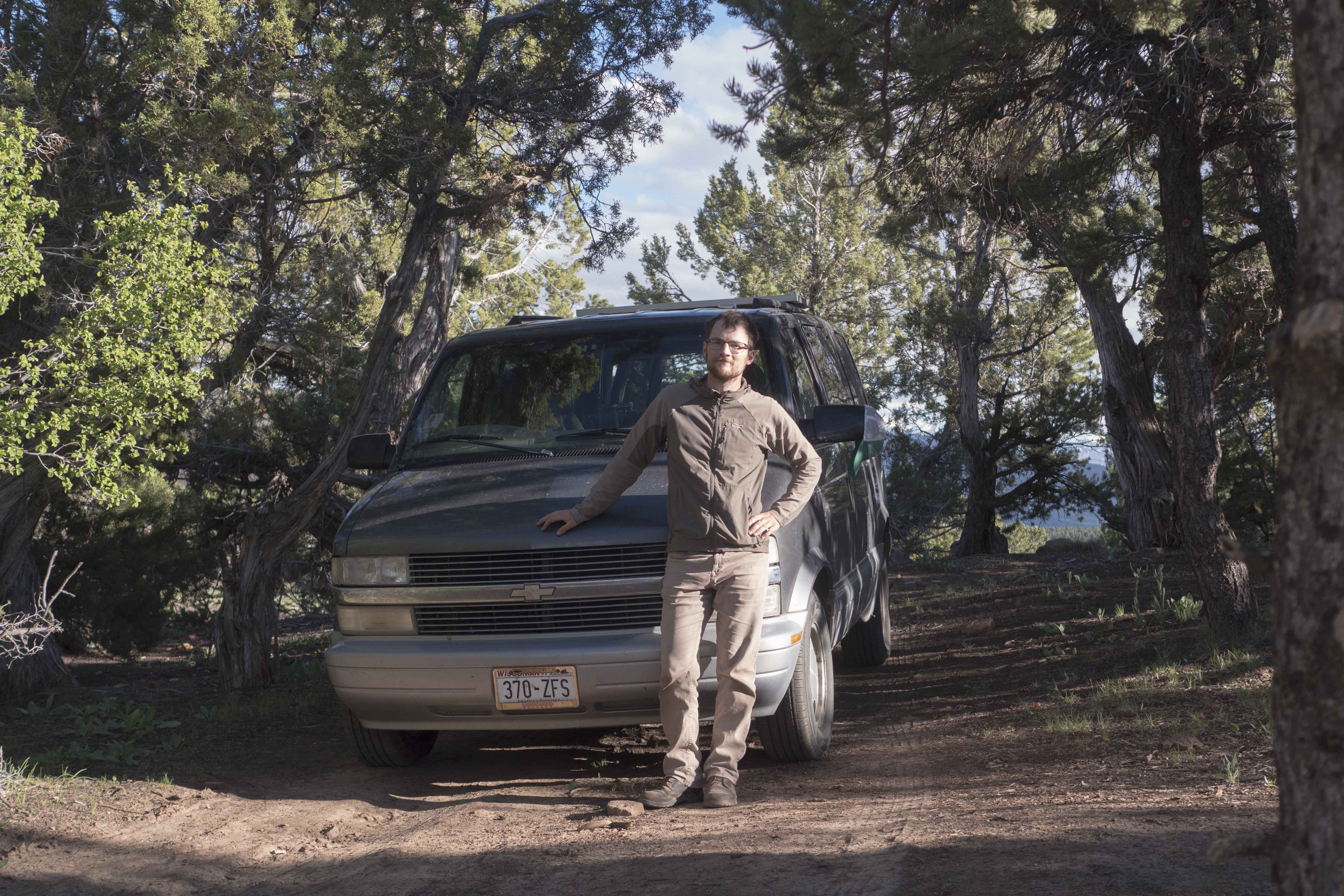
I spent the night on some public land just outside the park staring long into my last campfire. Black Canyon was so different in so many ways, but perhaps most importantly it was very empty and uncrowded. It felt right to end my journey surrounded by nothing but nature, my thoughts, and a cooler full of beer. It had been a good trip.
Comments
Paul Simmons
Great photos. . ;. . (and that’s one gneiss pun!) Your mom and dad are visiting us in Lotus tonight!
Leave a Comment
Your email address will not be published. Required fields are marked *