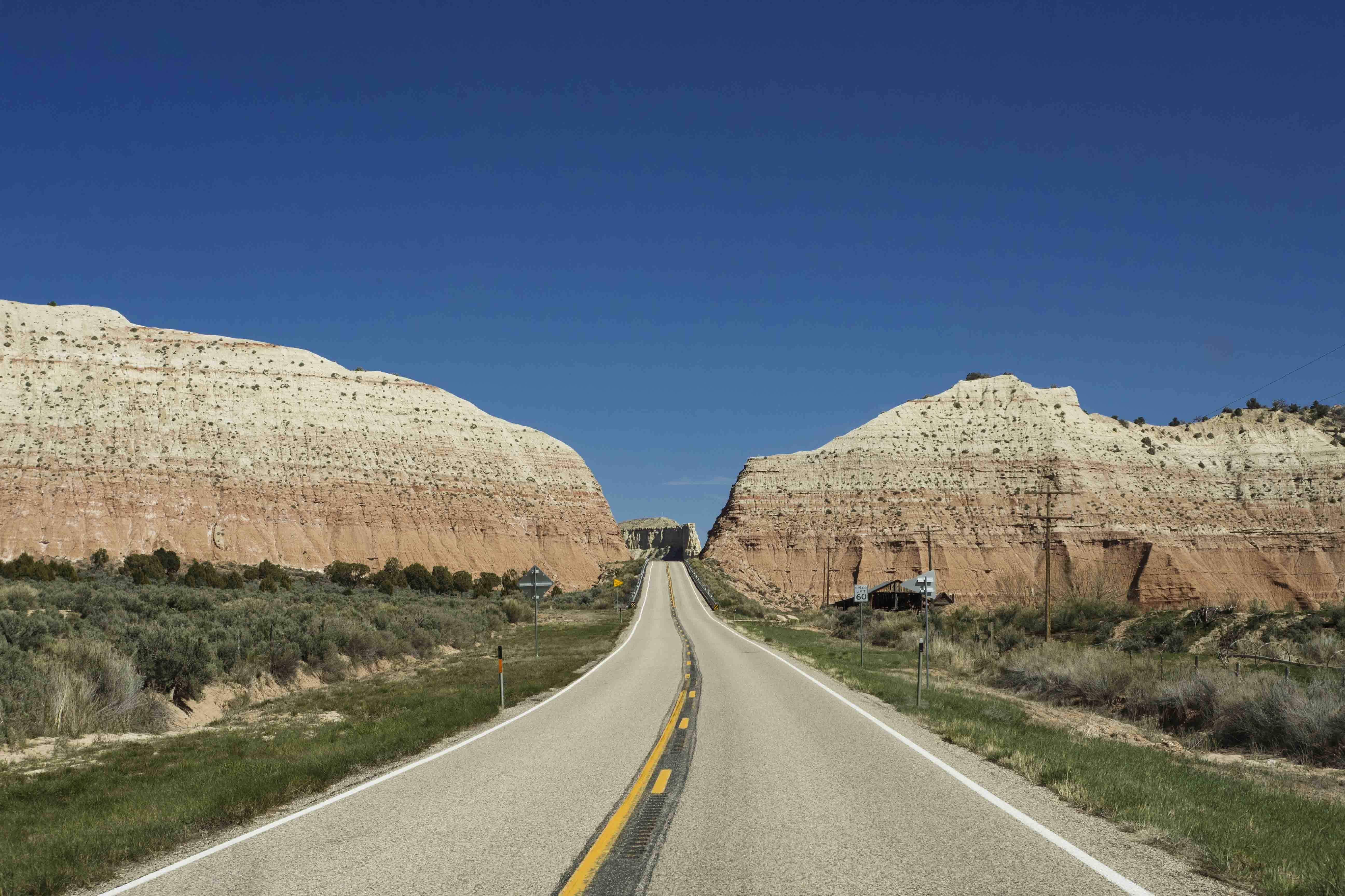
After leaving Bryce Canyon it was back on UT 12 east into the Grand Staircase/Escalante National Monument (GSENM). The GSENM is the largest National Monument in America and encompasses a huge amount of land and a wide variety of environments. For this trip I would focus on the eastern section: The Canyons of the Escalante. The road here is very good and passes by and through a never ending sequence of amazing views.
Slot Canyons
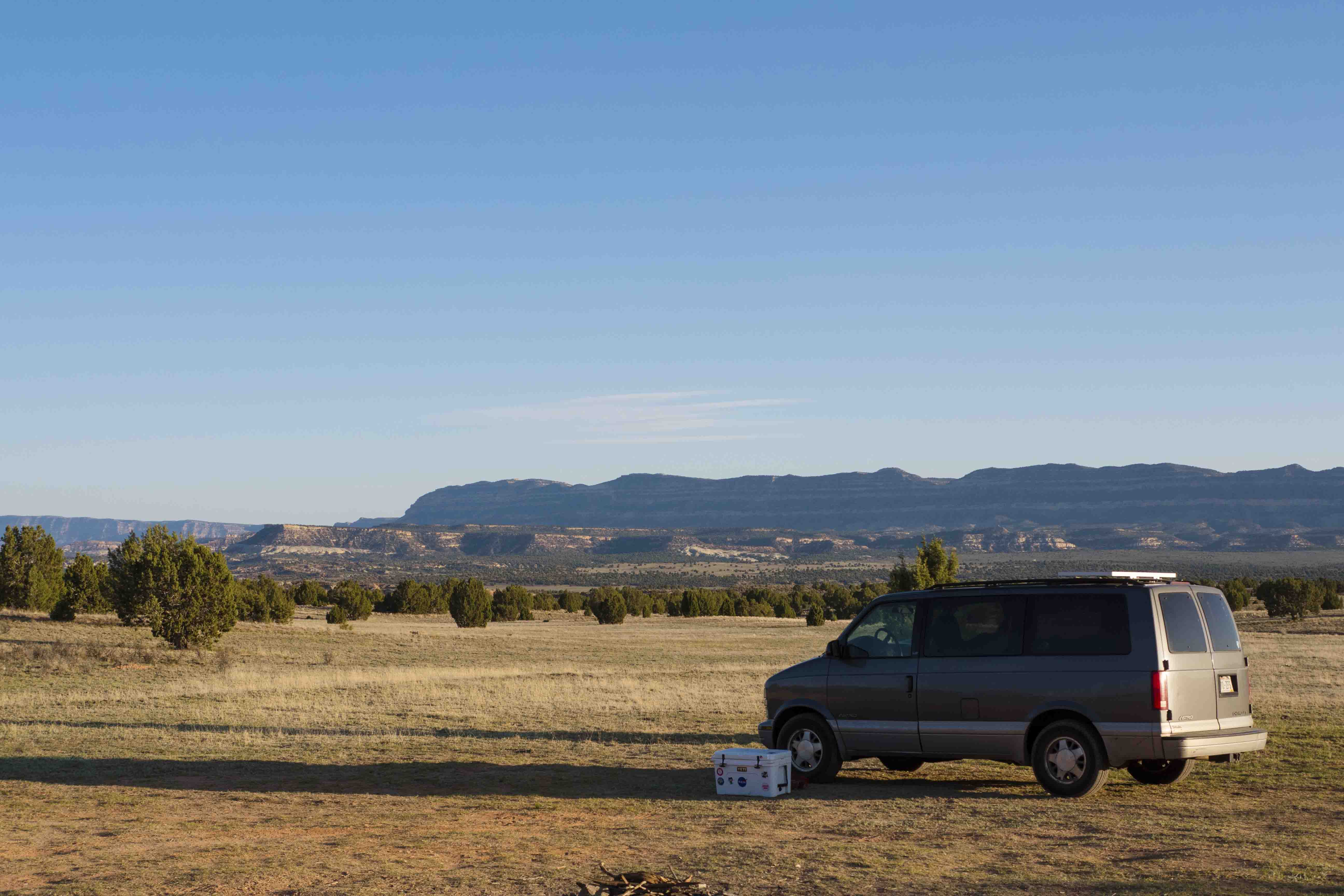
I stopped at a BLM office to get a (free) permit to camp in the GSENM and a better map of the area, as well as some information on the most popular hikes out in the monument. In the town of Escalante (pronounced “Eskalanee”, not “Escalahnte”) I got a little more beta at a local outfitters and learned that some of the slot canyons I had planned to visit were under about 4 feet of water. Good to know! and I crossed them off my list. The hour was getting late so I stopped to camp at a large dispersed camping area right at the top of Hole in the Rock road, which is the main artery for travel into the heart of the GSENM. From my camp I could see far across the plains of the monument and down along the sheer cliffs of the Kaiparowits Plateau. Tomorrow I would journey out into this wilderness.
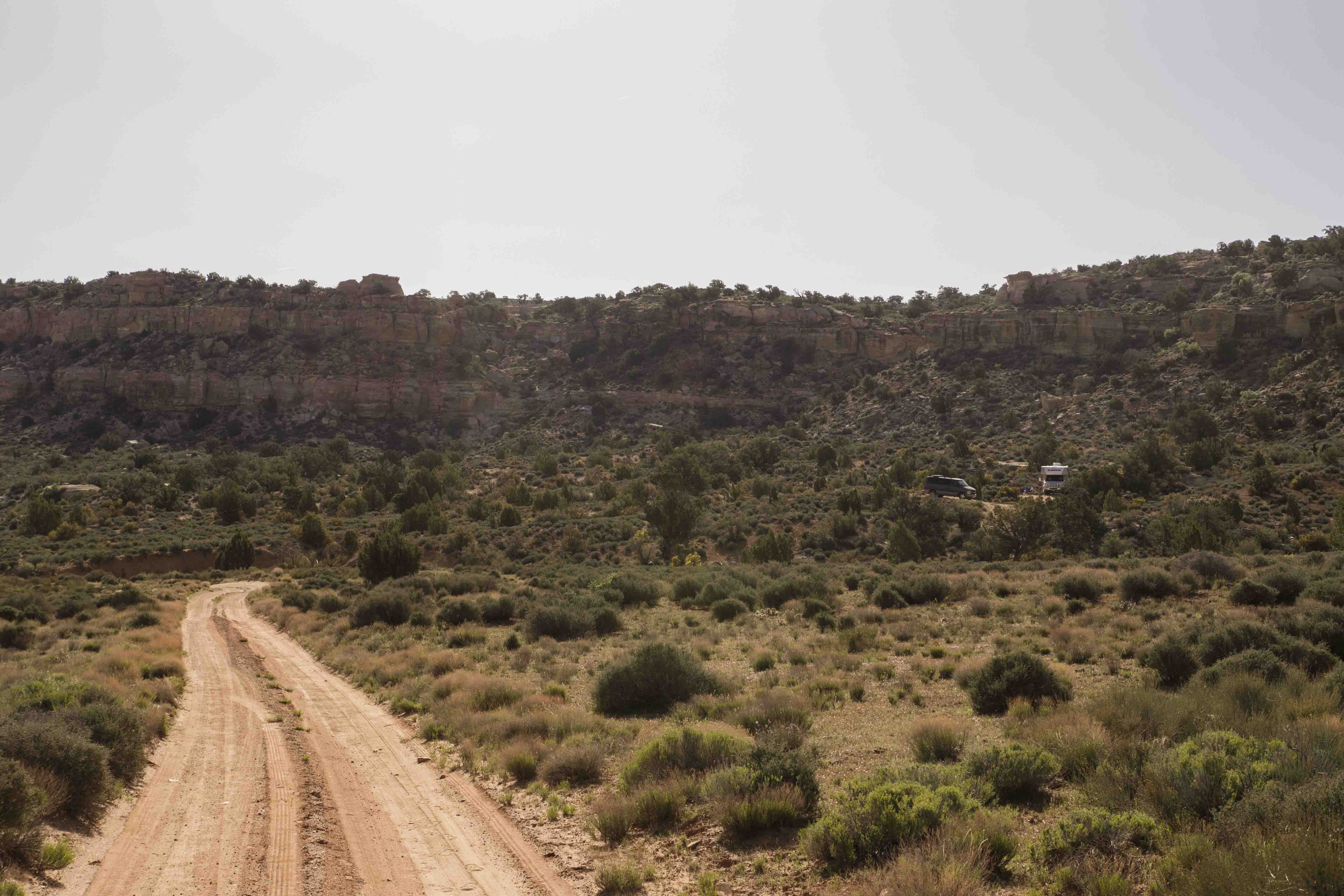
It felt wonderful to sleep in the next morning, but soon I was up and heading down Hole in the Rock (HITR) towards some trailheads and slot canyons. The road is well graded dirt and certainly better than some I had been on - I could go 30, 40, and even 50 mph in some places - but it was still very washboarded and often very brutal. My original plan to go all the way to 40 mile road and Dance Hall Rock was quickly abandoned; the thought of driving 80+ miles on a bumpy dirt road was not appealing and Van Halen deserves better.
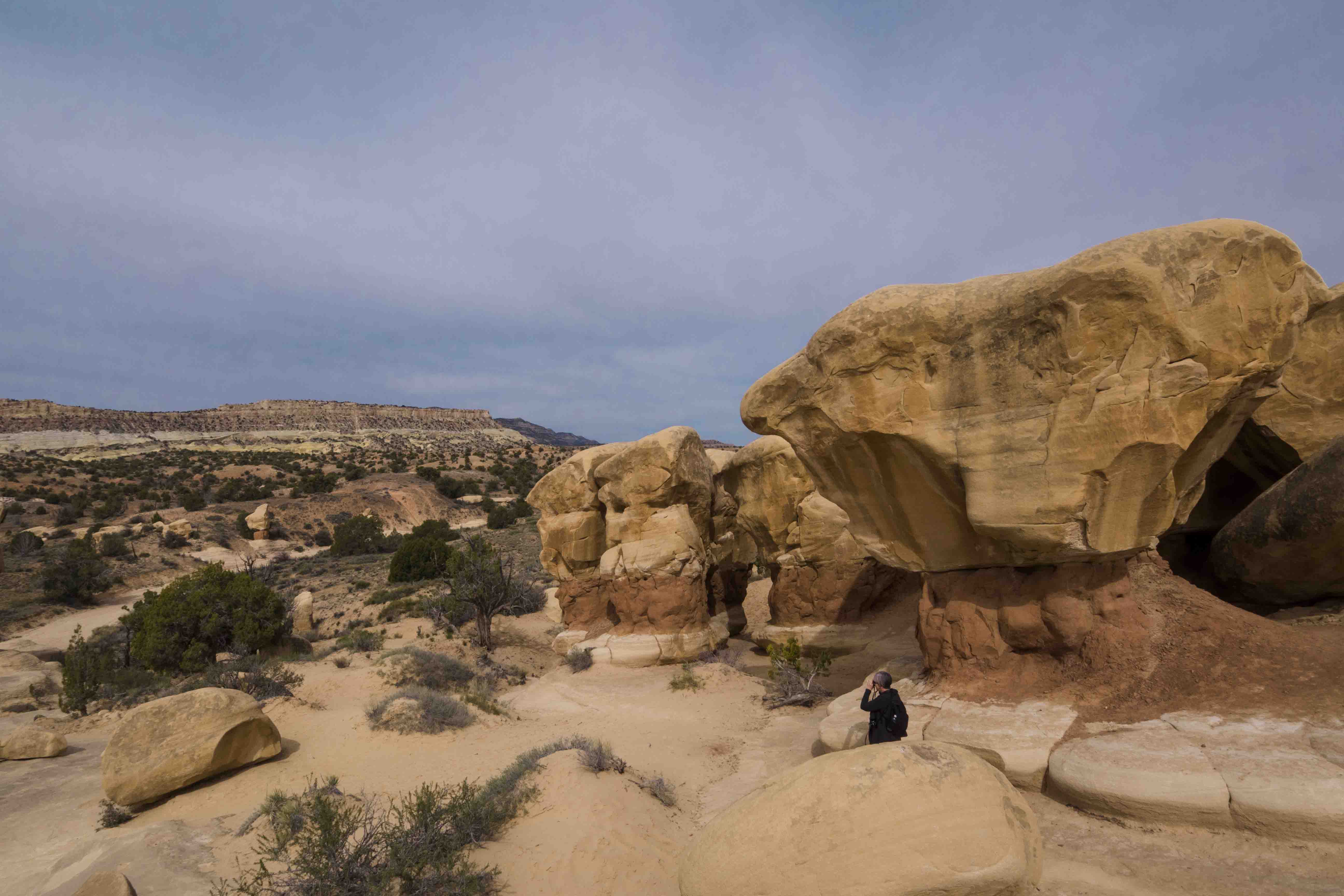
13 miles in I reached Devil’s Playground and stopped to asses the condition of Van Halen and to take in the surroundings. Van Halen was doing great and the Devil’s Playground provided an hour’s worth of fun as I explored the twists and turns of paths leading between the jumble of hoodooos. This would be a great place to bring kids or to be a kid a heart; it really is like a giant playground.
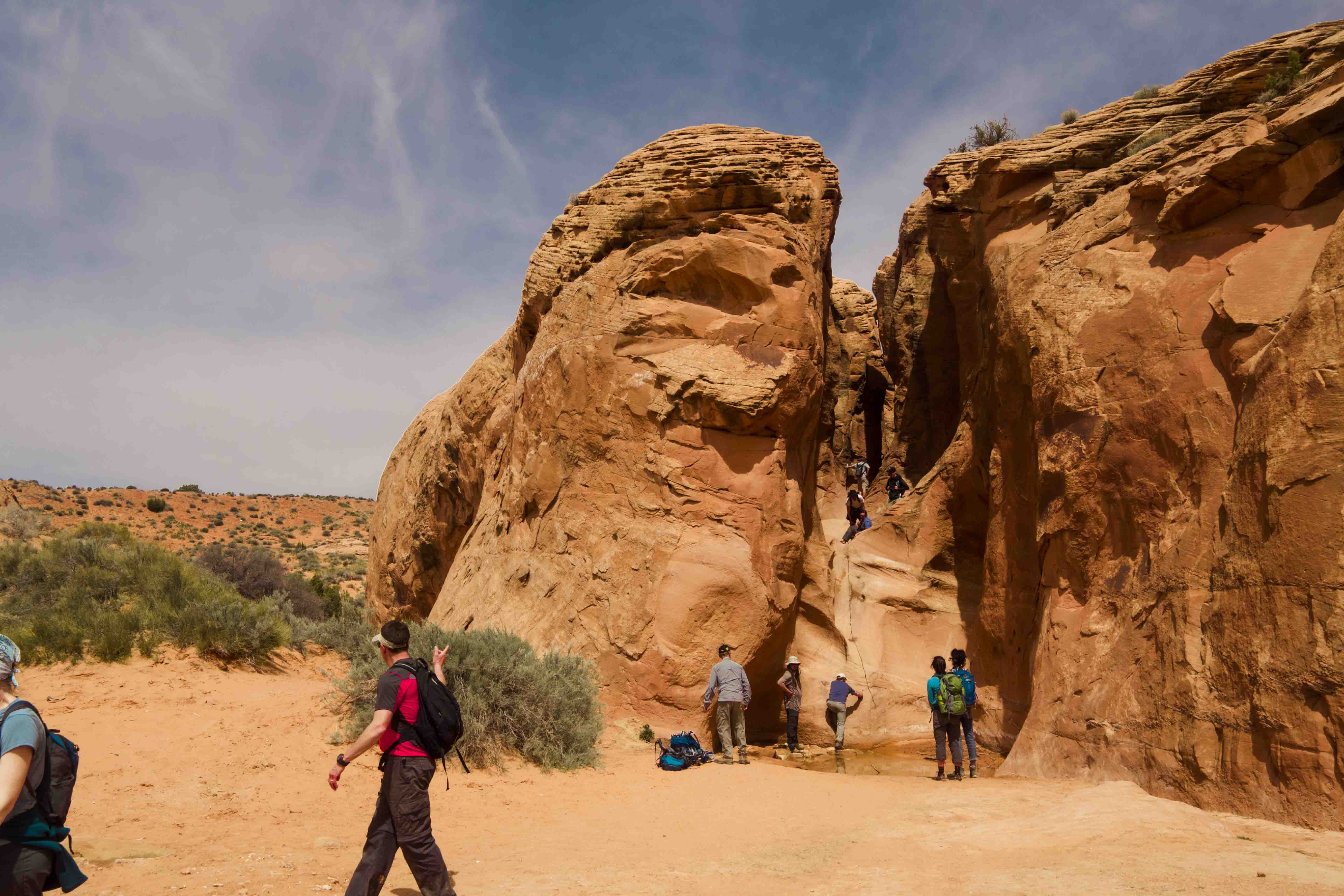
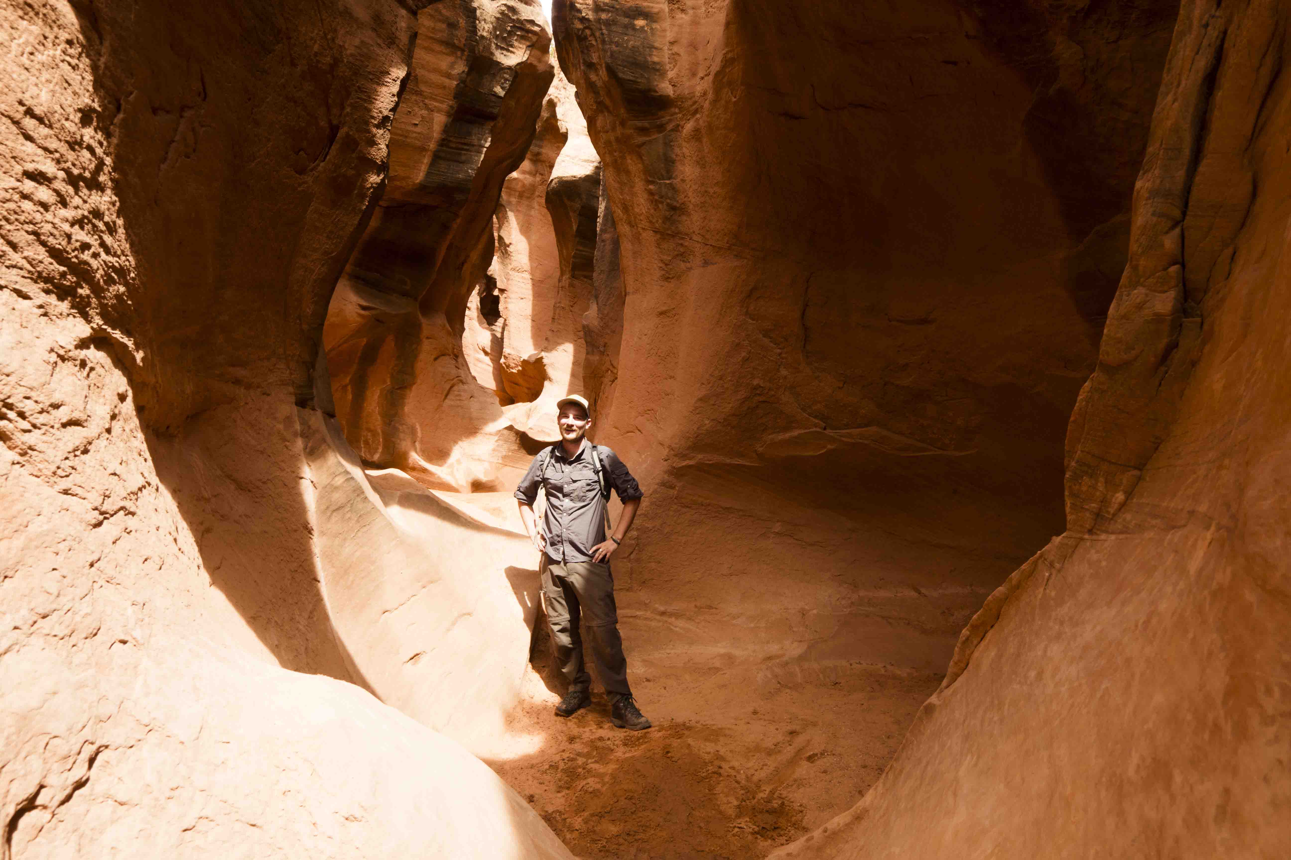
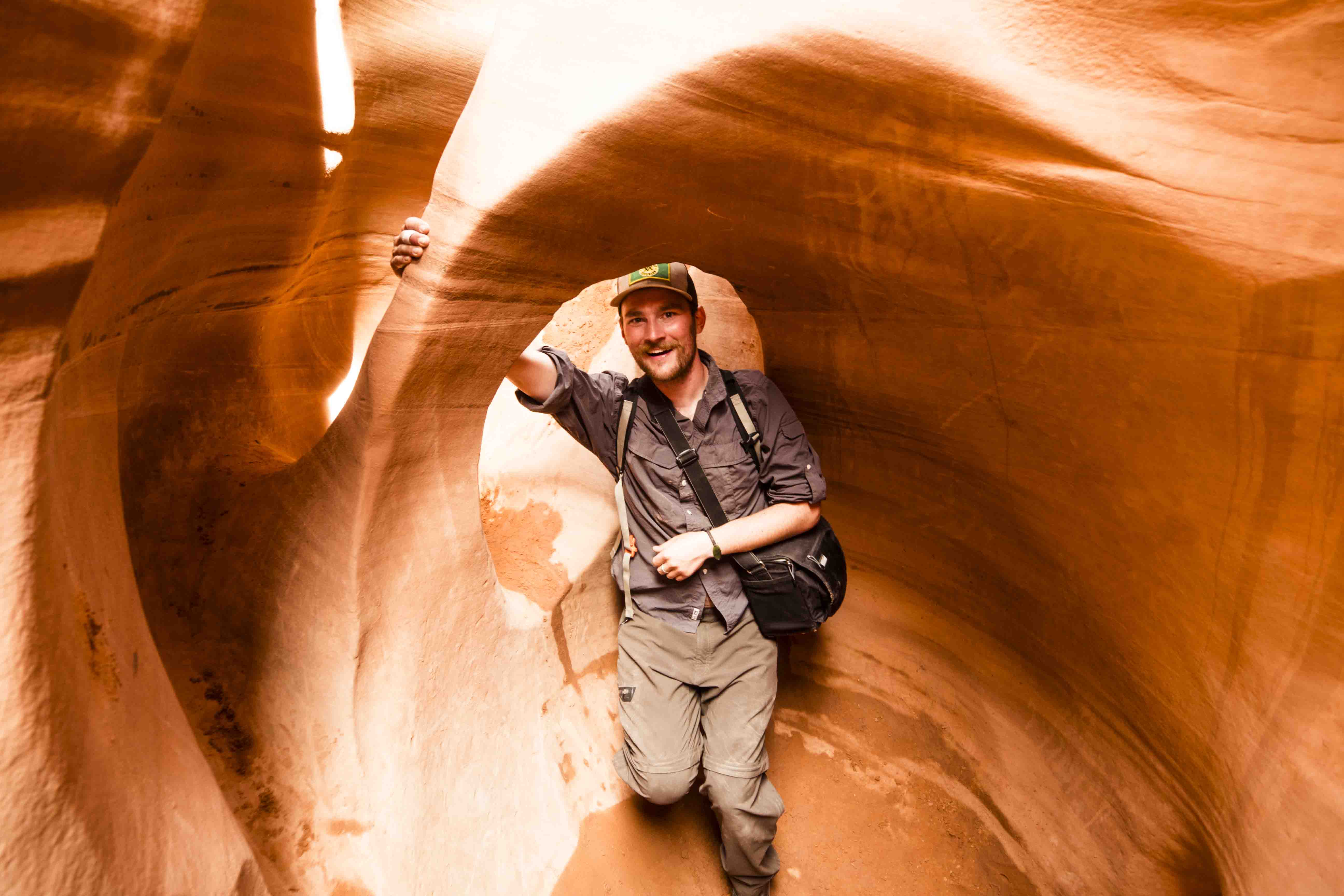
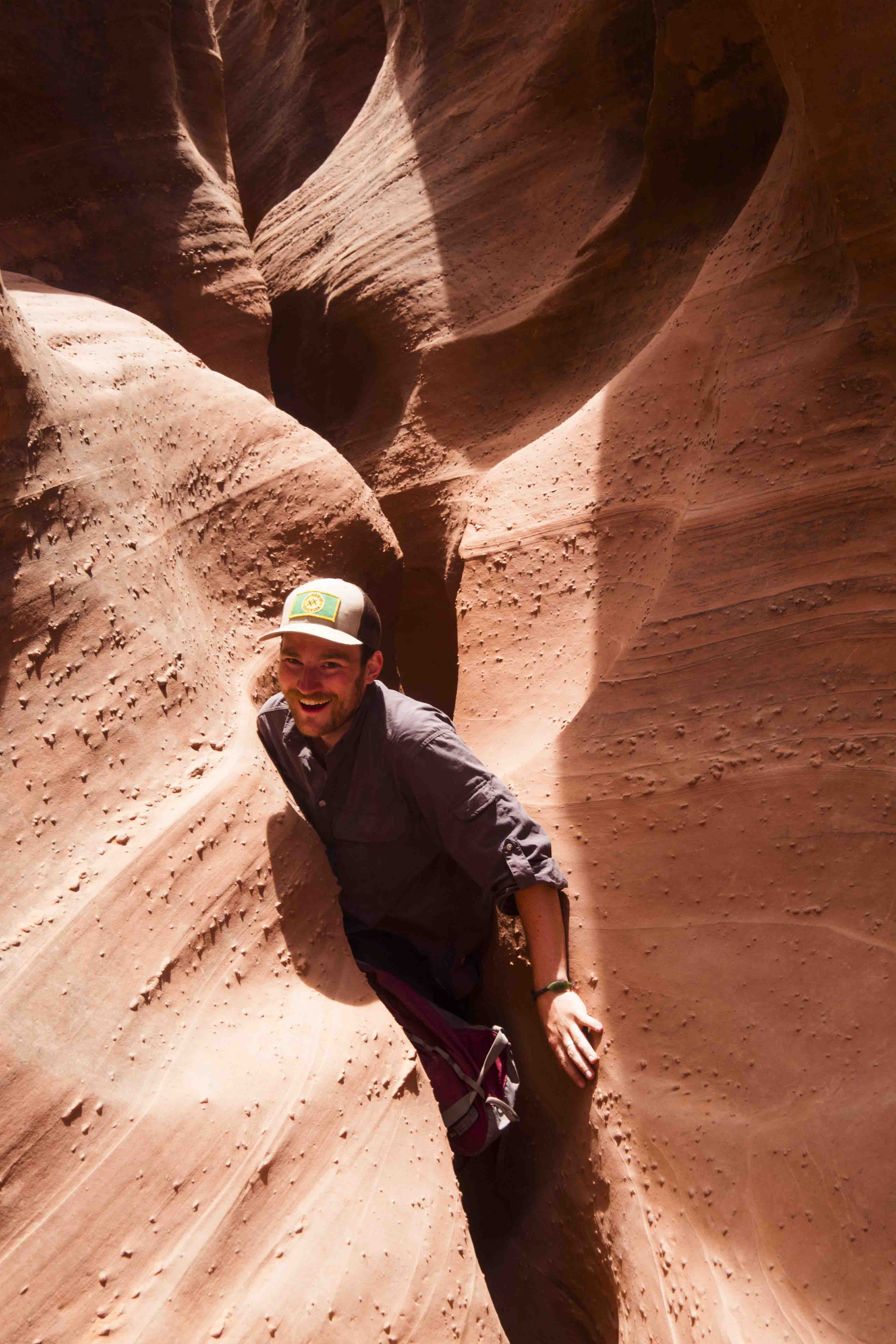
Another 13 miles farther into the wild I found the Dry Fork road and associated trailhead. This trail led to my goal for the day: the slot canyons of Peek-a-boo and Spooky gulches. Looking out across the slickrock from the parking lot you wouldn’t expect the area to be full of slot canyons, but I guess that’s kind of the point. A short trail led down to the bottom of Dry Fork wash where I found the entrance to Peek-a-boo gulch. Access to the gulch required climbing a 20 foot wall of sandstone, and a few groups ahead of me were having some trouble with this. In a boost to my self-confidence I found it quite easy to scramble up the wall and I even helped a nice family who were coming up behind me. The were very friendly and we spent the rest of the day together.
Once inside, Peek-a-boo was awesome. It is windy, crazy, narrow, and had a few holes full of water that required some creative climbing to get around. It was extremely fun to navigate the canyon and the experience was made better by the wonderful companionship of my new friends.
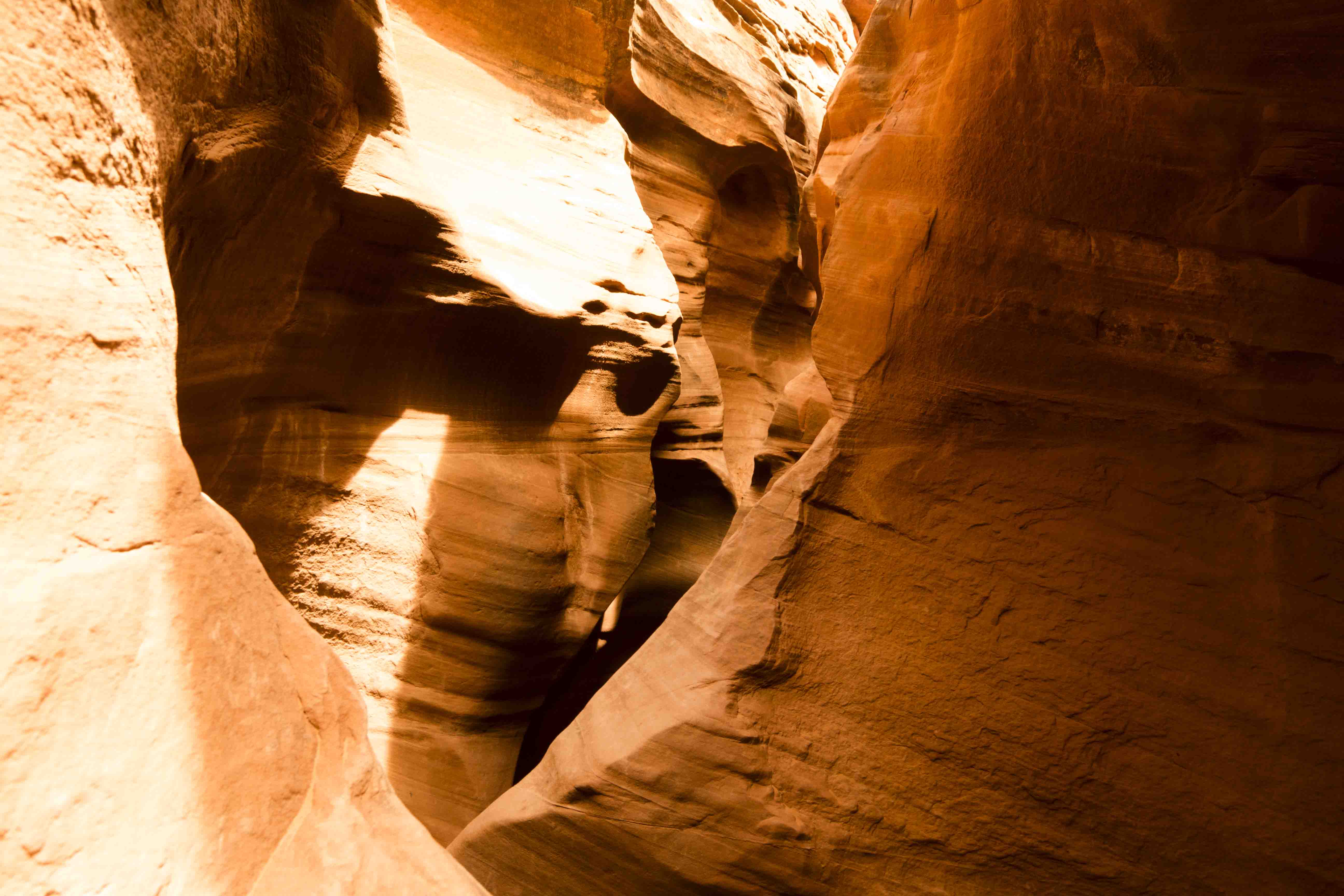
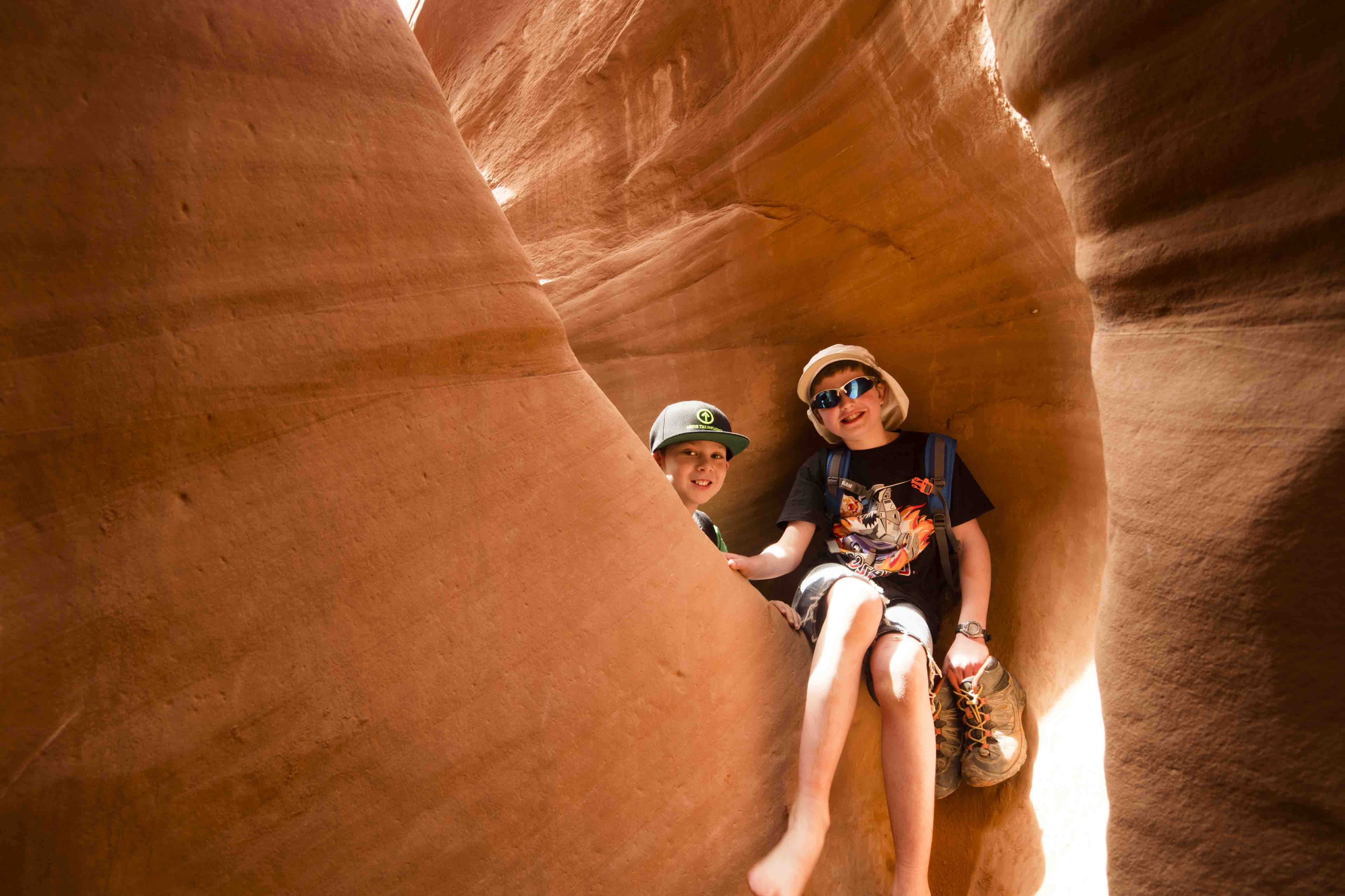
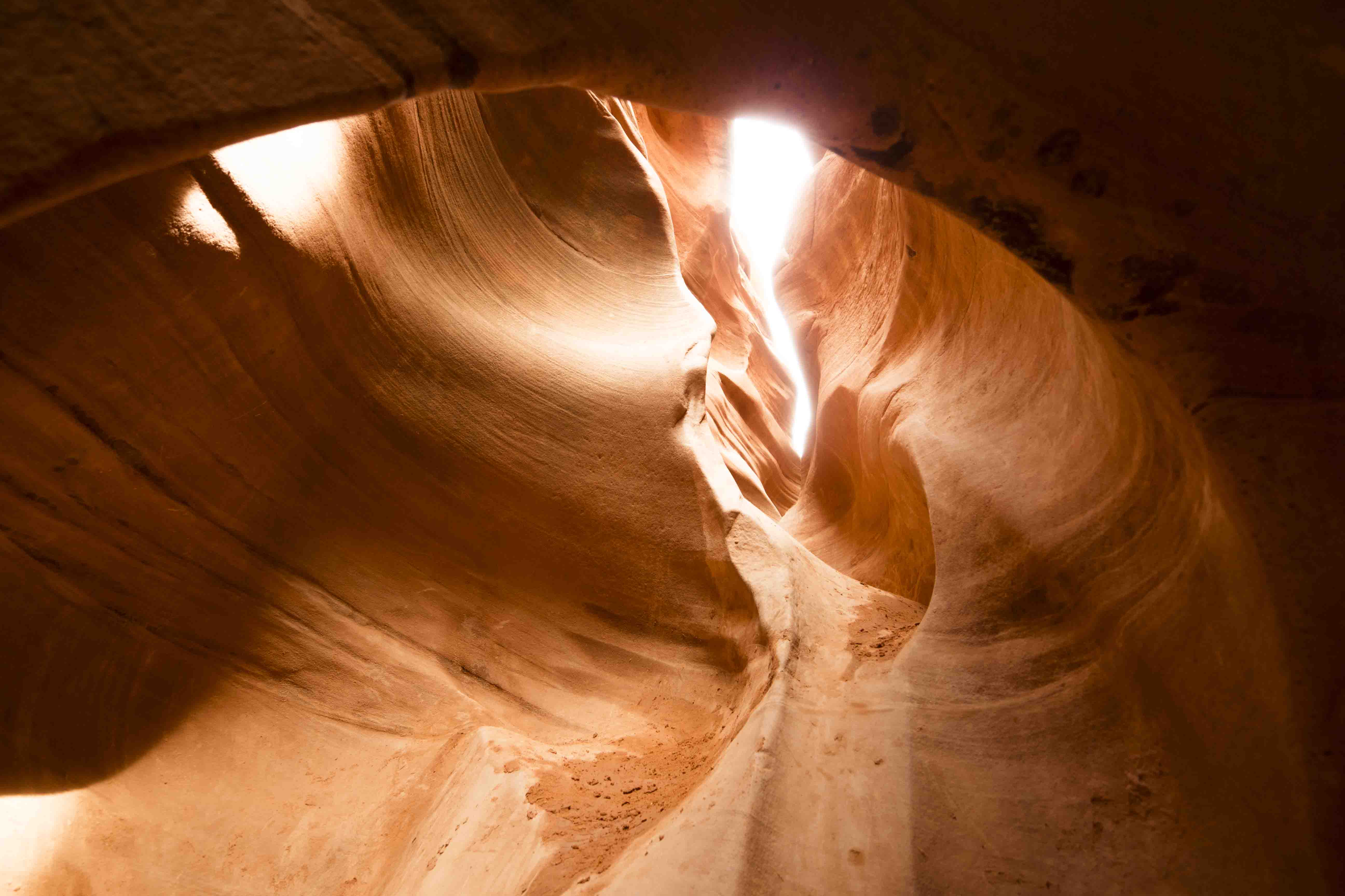
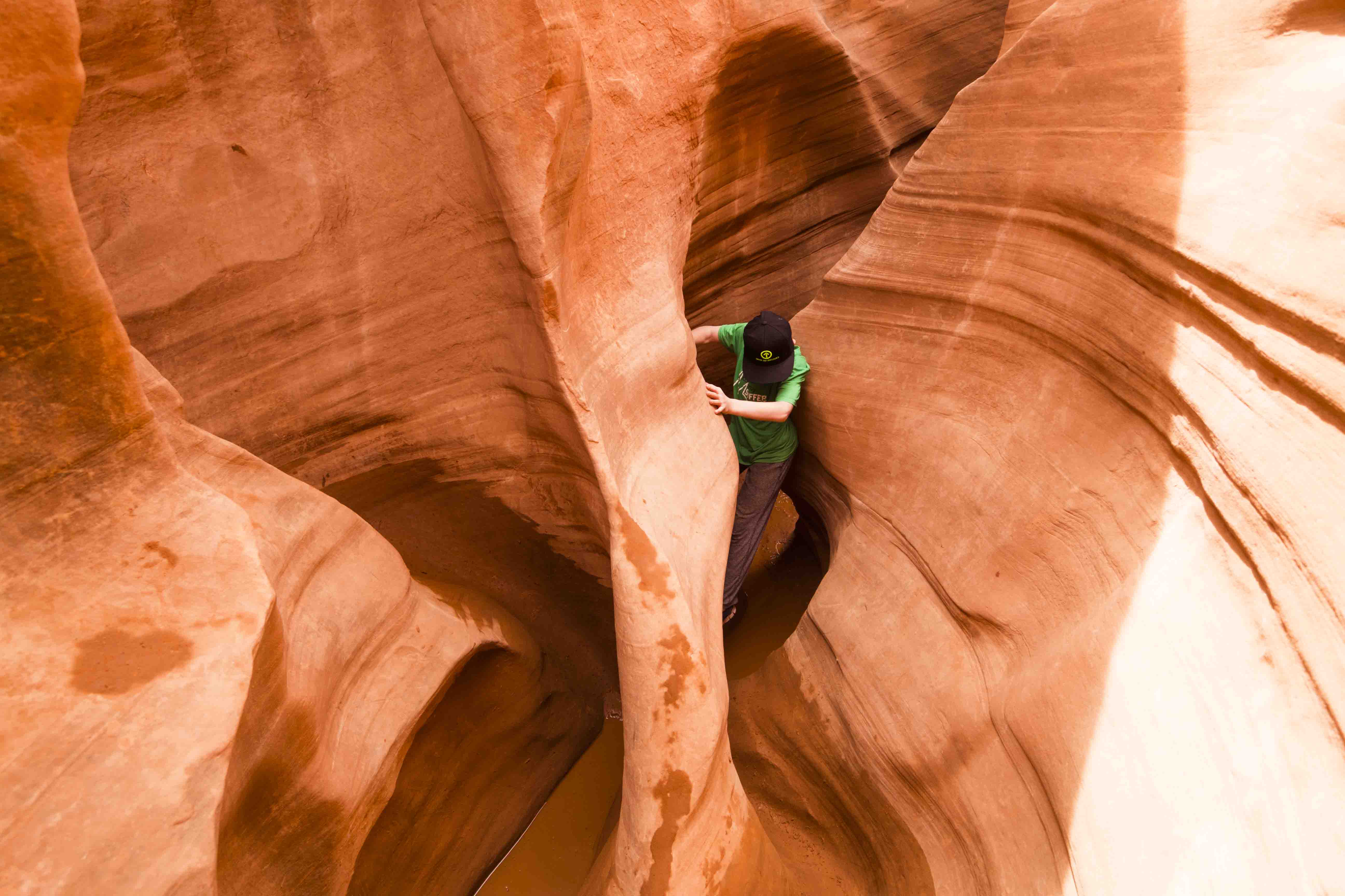
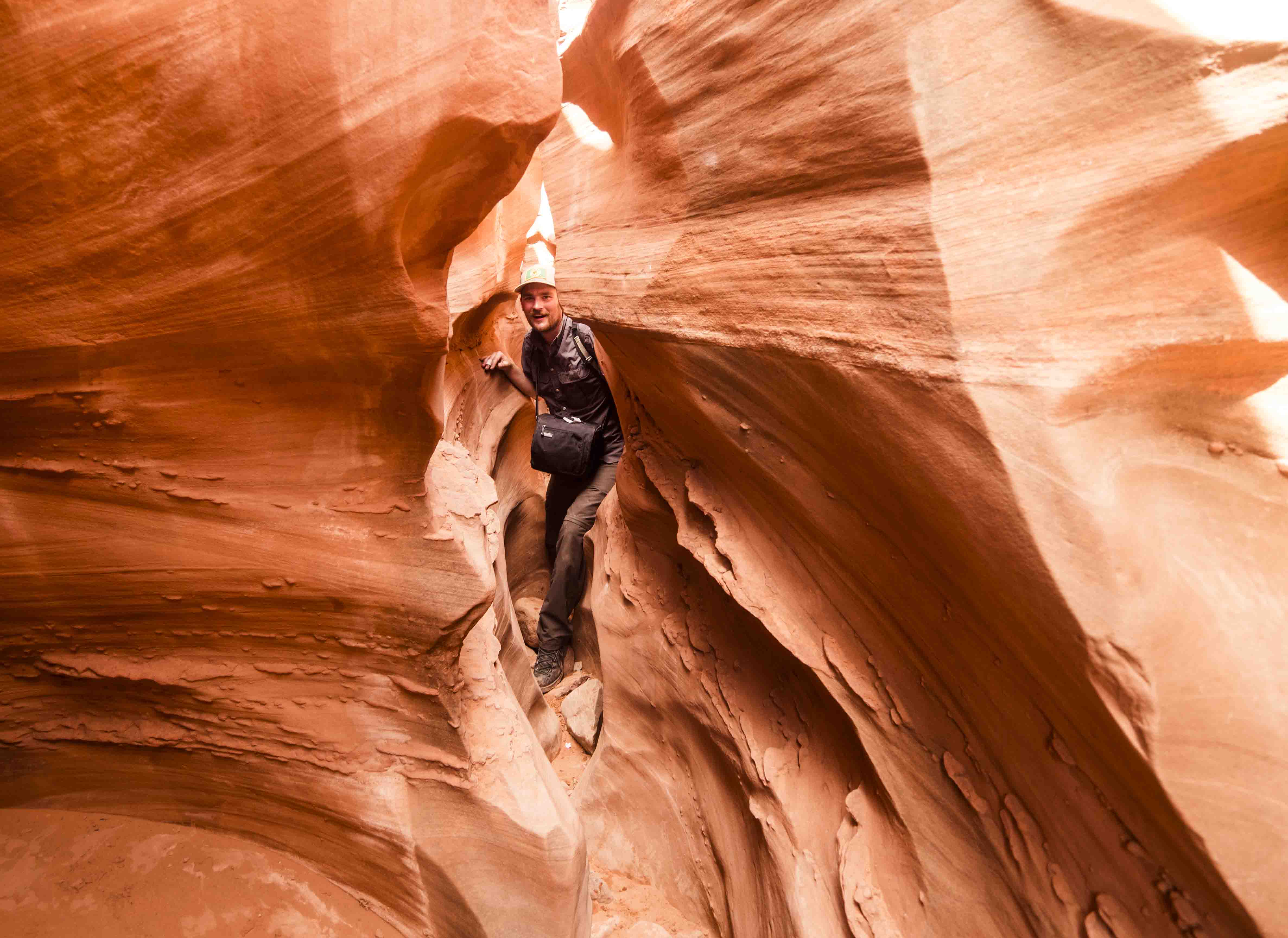
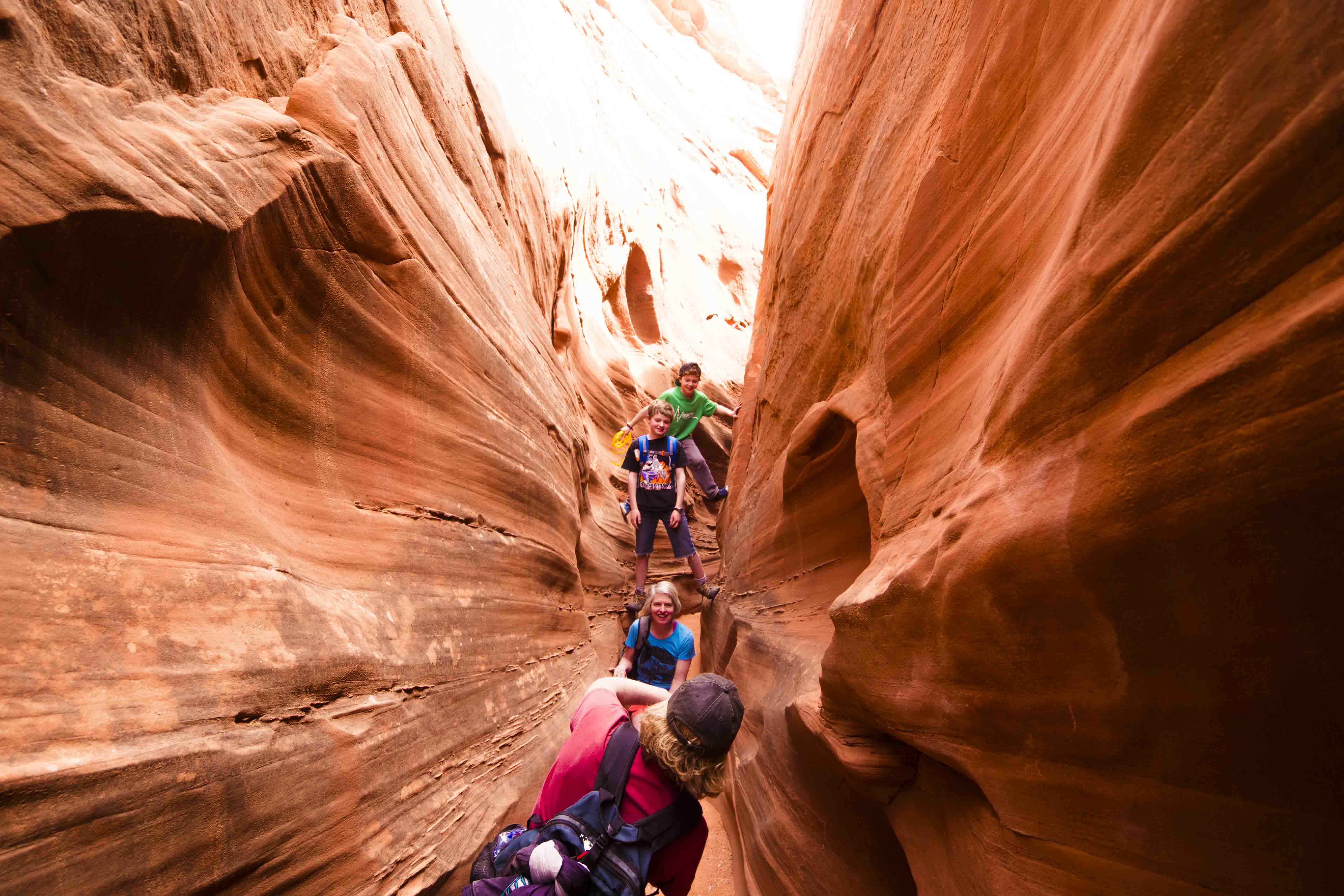
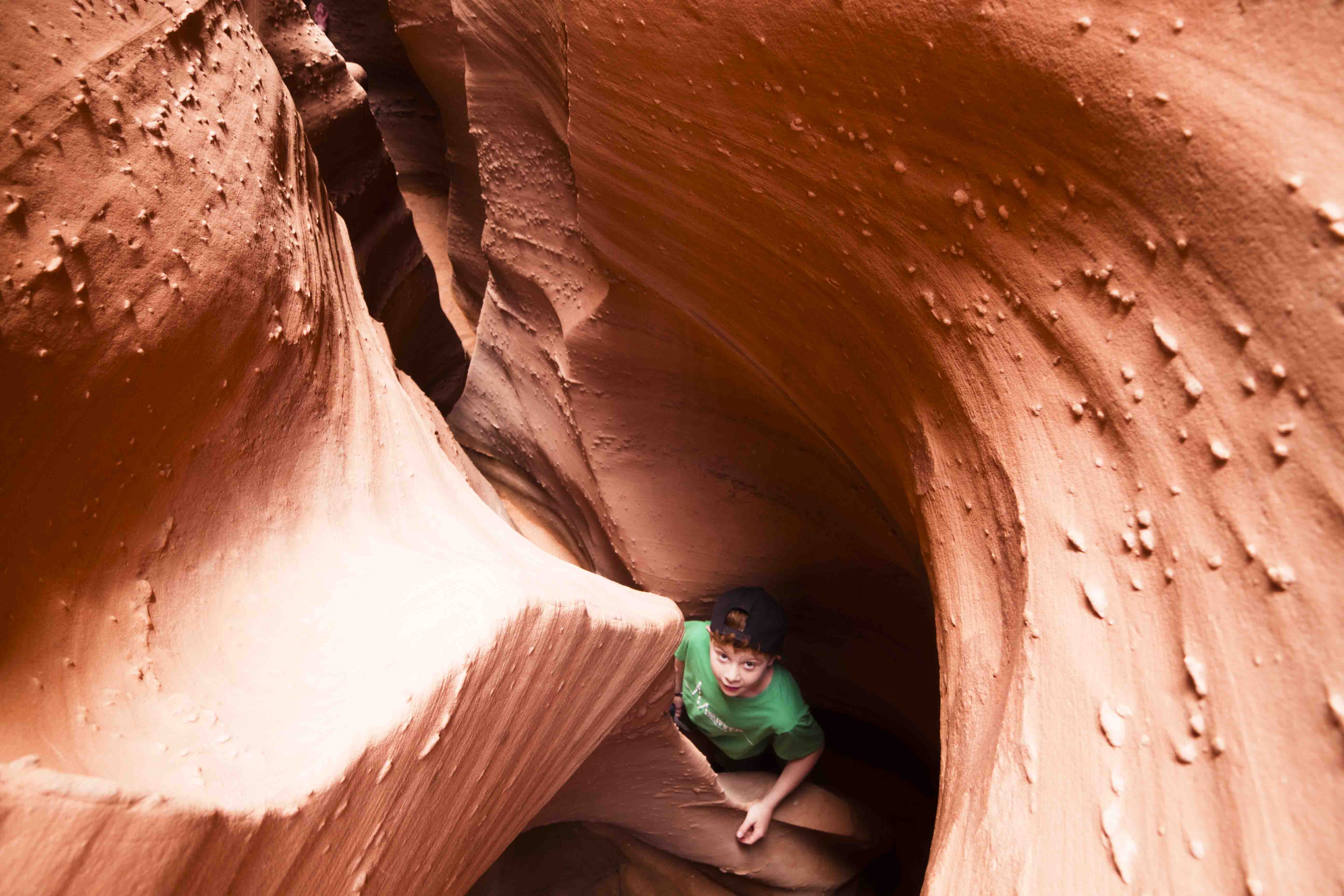
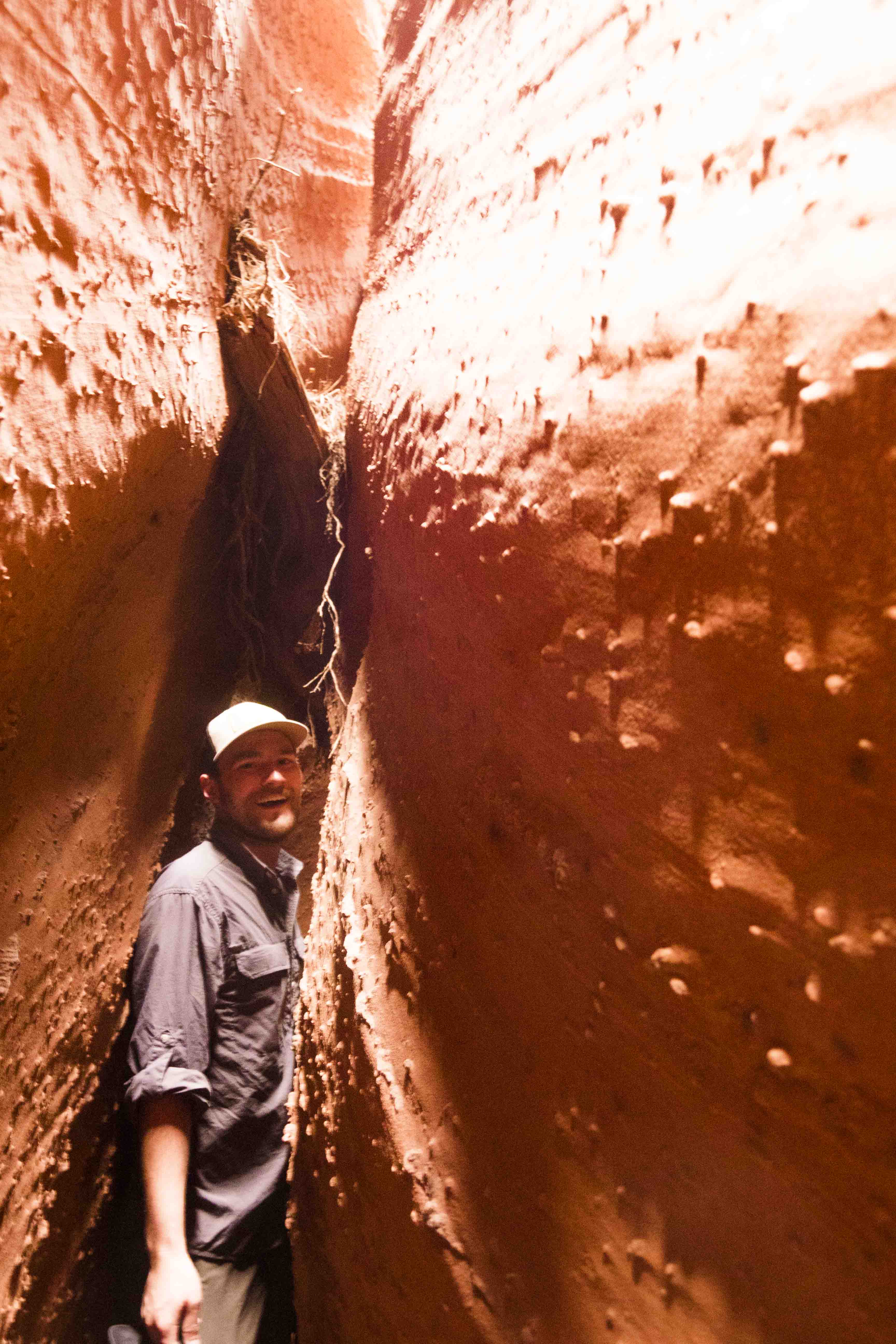
After emerging from Peek-a-boo we traversed some slickrock to the end of Spooky gulch for the return journey. Spooky is dry and straighter than Peek-a-boo, but made up for this by being extremely narrow. Like backpacks off, squeeze through narrow. As we shimmied down the gulch sandstone walls shot 50 feet above our heads to blot out all but a very narrow strip of sky. When passing people coming the other direction we either had to squeeze into tiny cracks or simply wedge ourselves up the walls to let them pass underneath. What a trip!
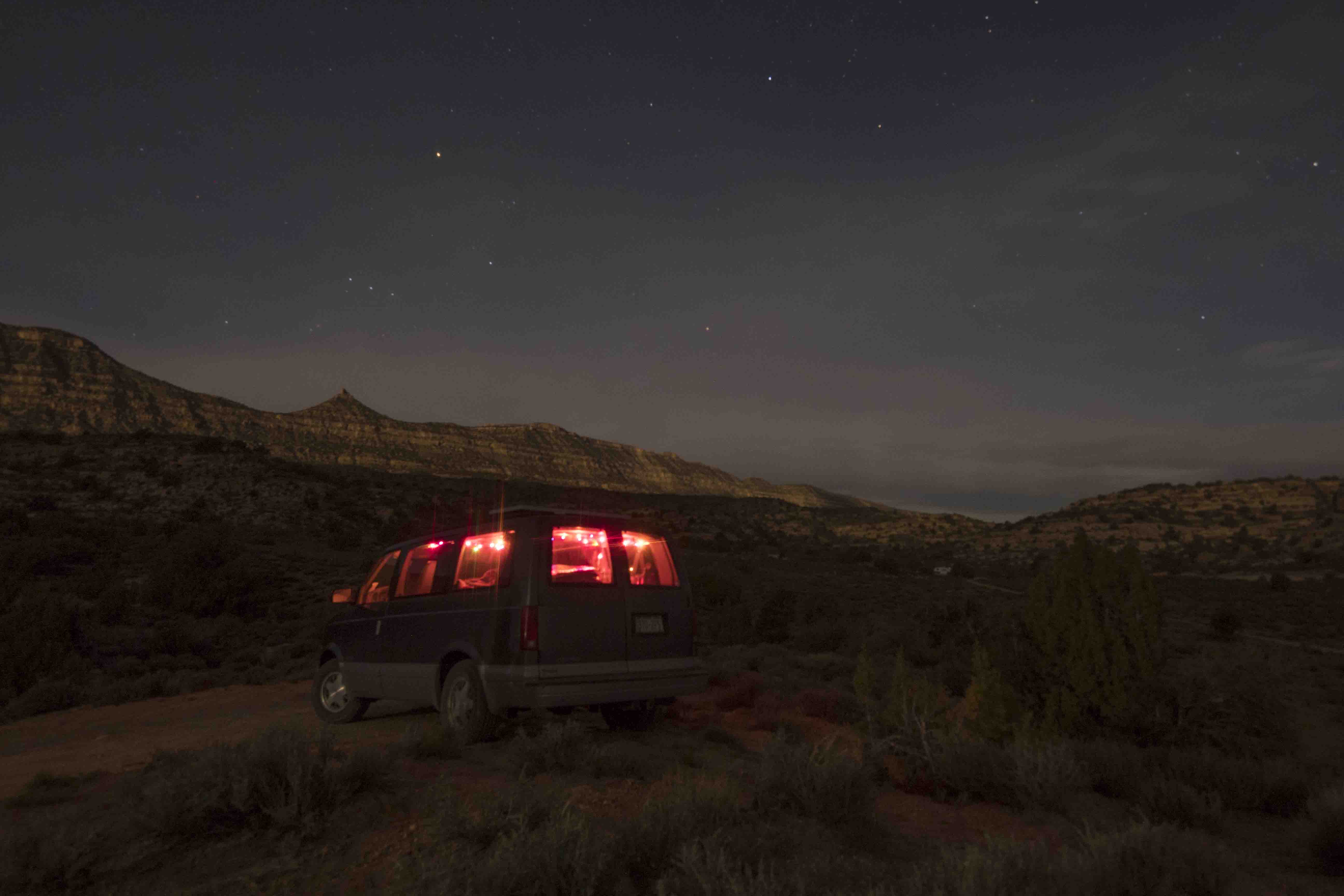
By the time we finished both canyons I had become fast friends with the two sisters and their sons and they very generously invited me back to their camp for the night (which was actually in the area I was planning to camp anyway). I met their father/grandfather who was very bravely driving a medium-sized RV across these rugged dirt roads. We crossed HITR road and made camp in the foothills of the Kaiparowits Plateau. They gave me drinks and even let me eat dinner with them. This meant a lot to me and I happily spent the rest of the night around their campfire enjoying the company and the view.
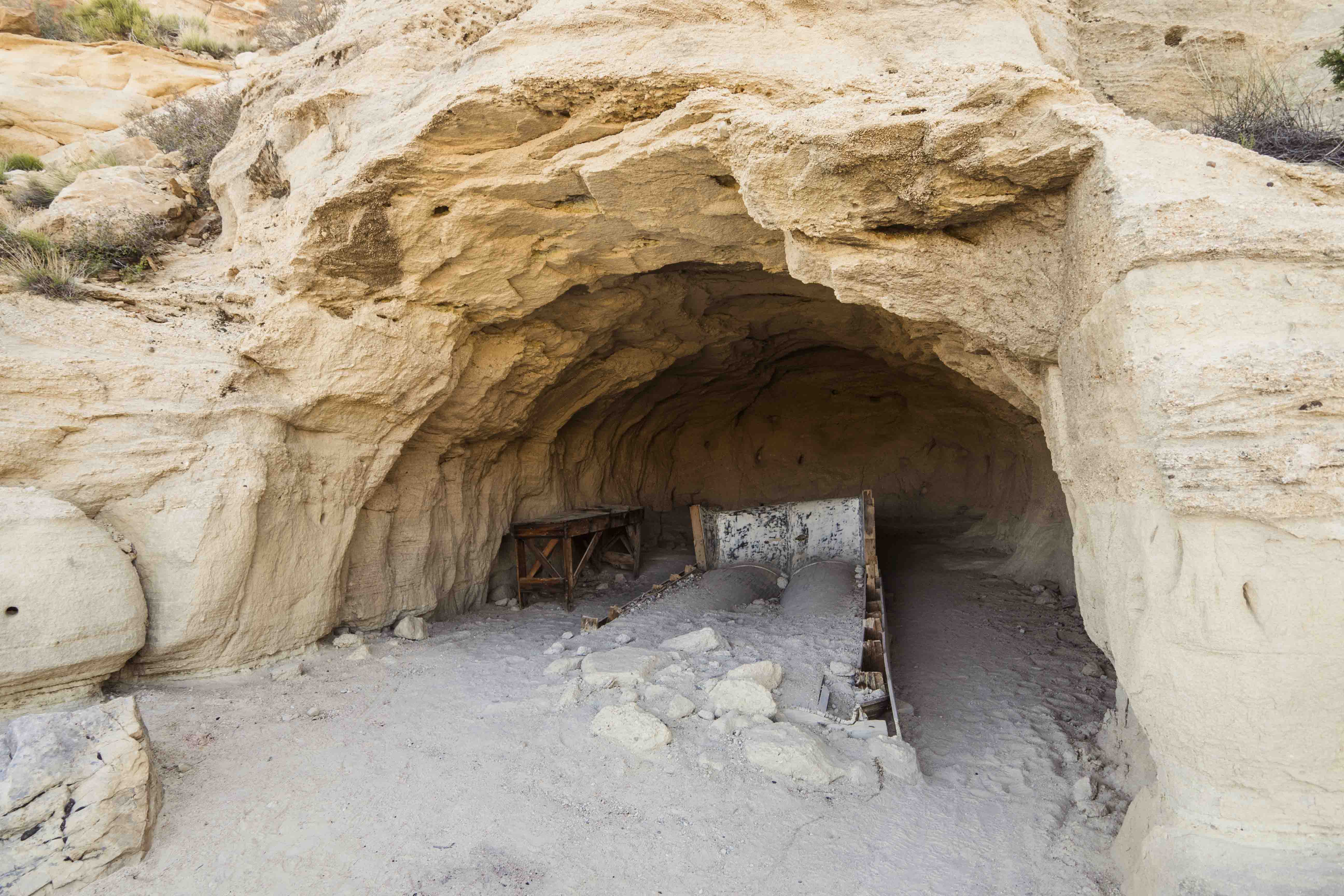
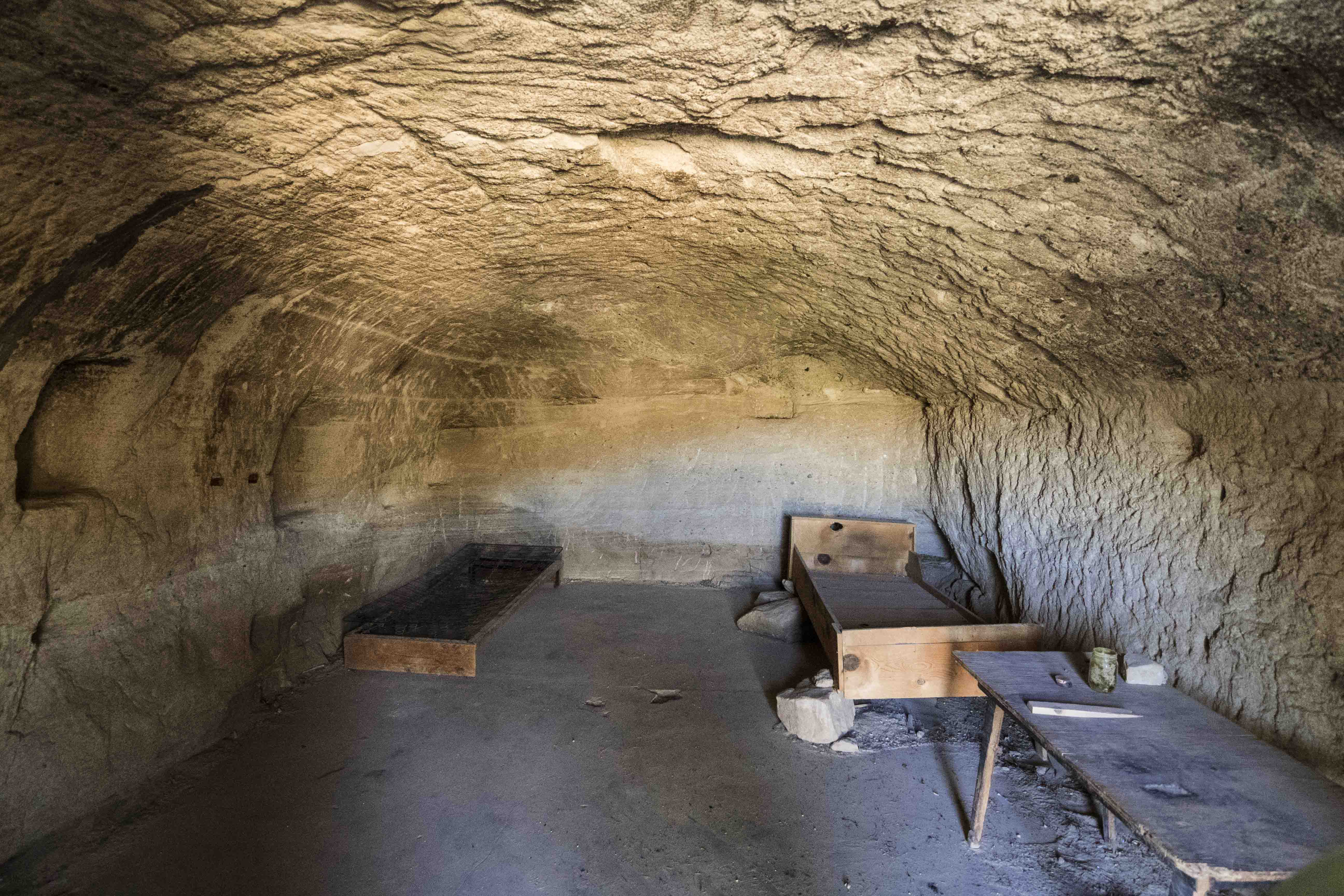
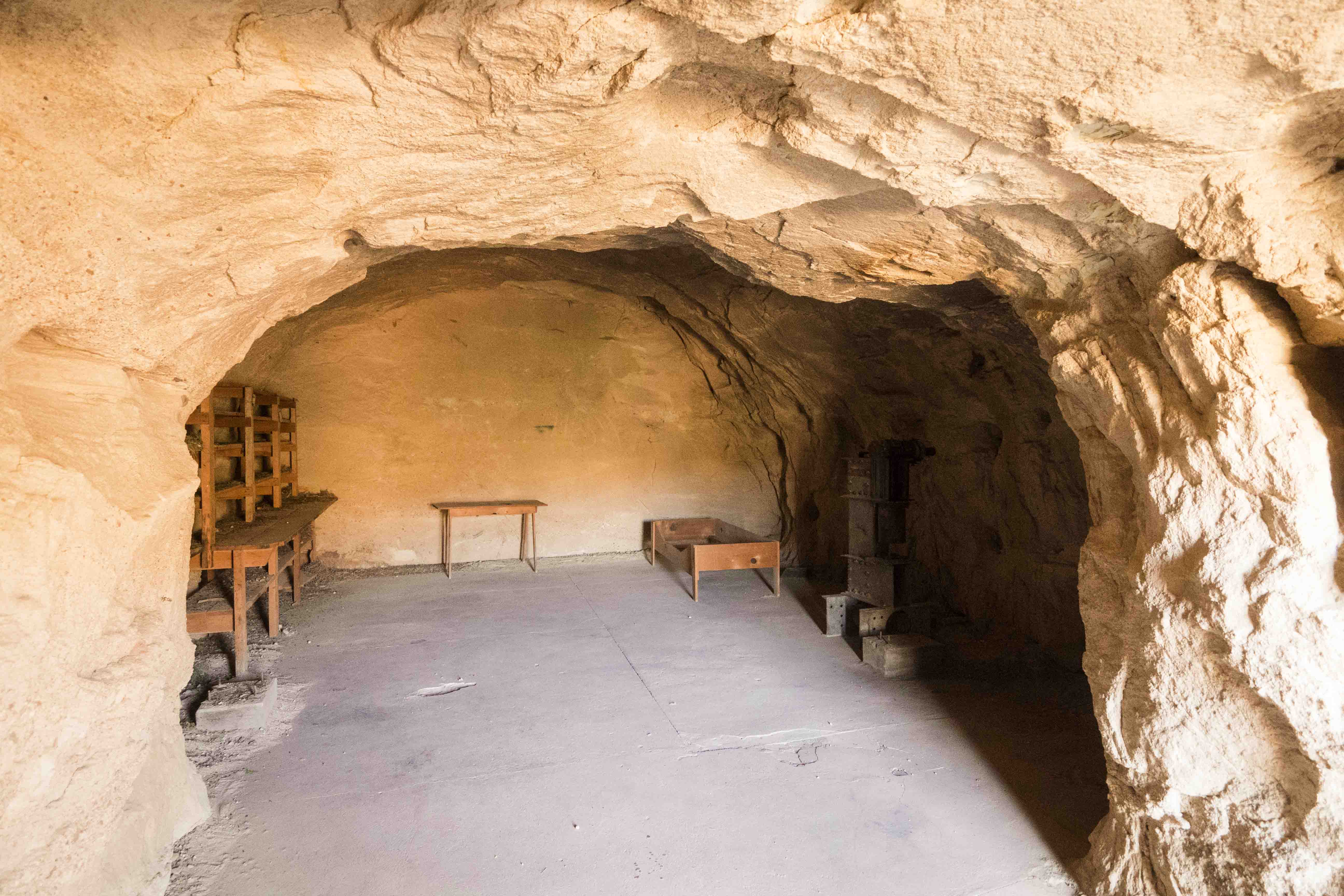
Batty Pass Caves
The next morning we all decided to take a very short hike up the road beyond our camp to a series of artificial caves that had been blasted out of the rock. Local history suggests that these caves were created in the 50’s by some German brothers who were seeking a new life on the edge of civilization.
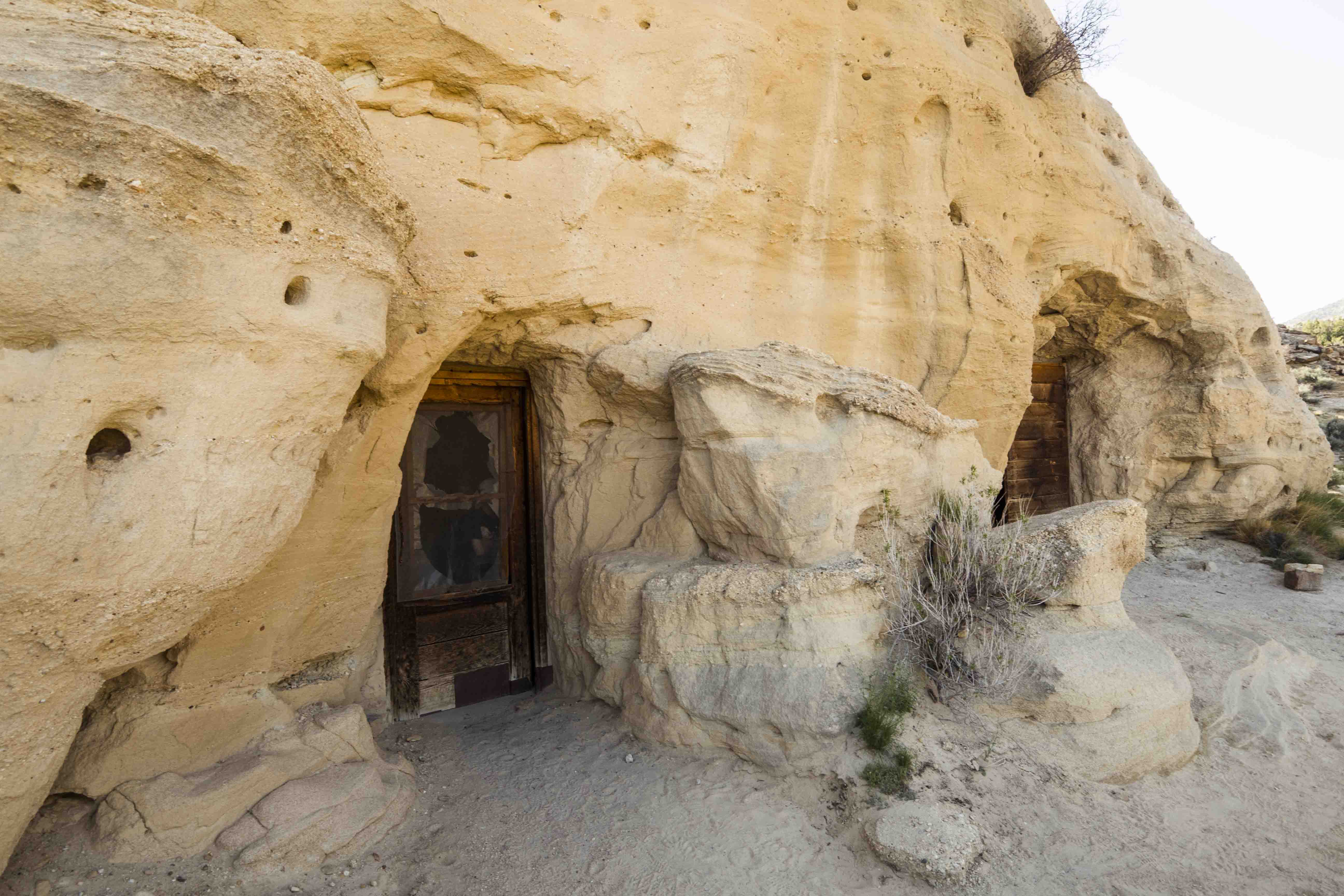
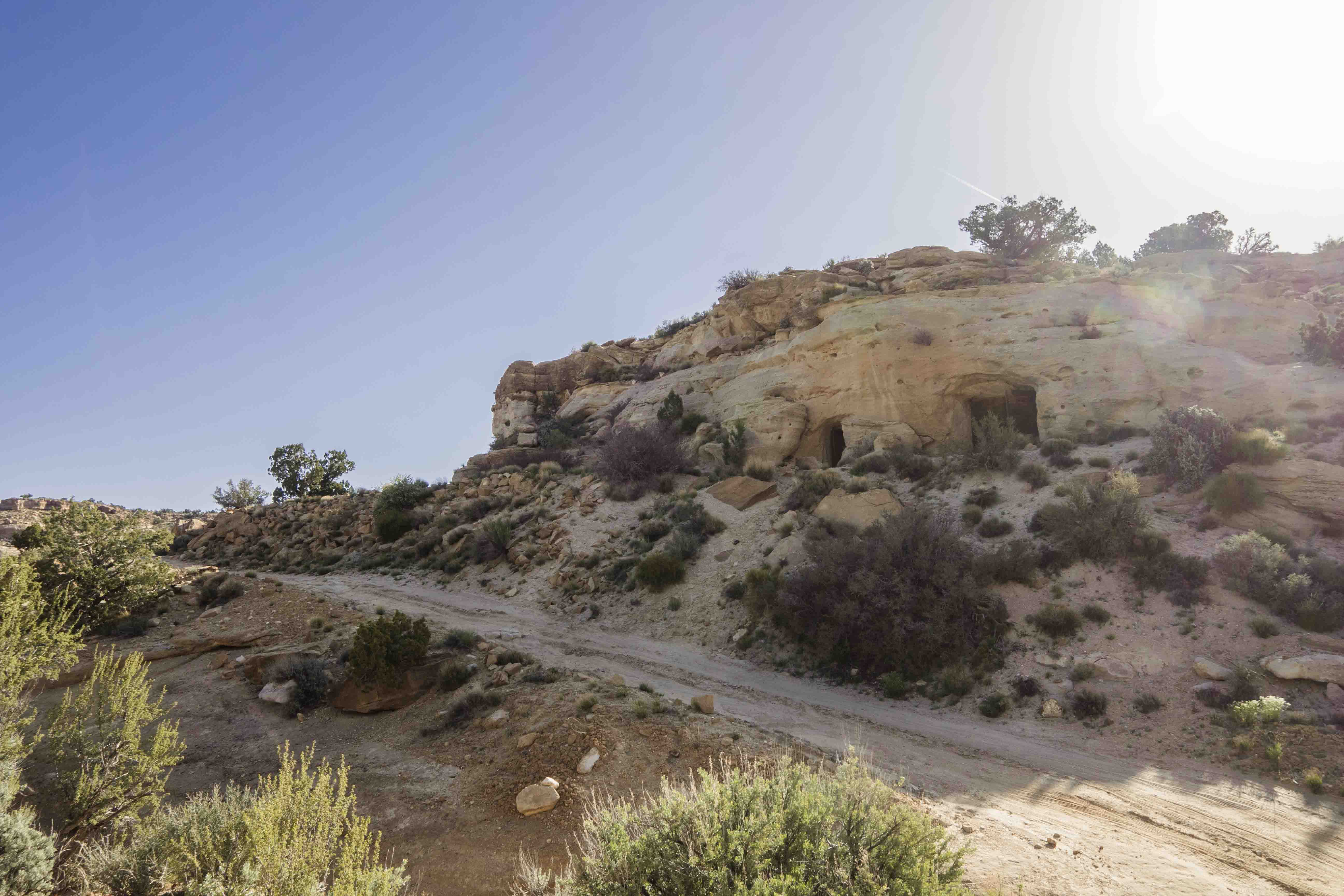
The three caves included a living quarters, a very large workshop, and something that looked like a boat-building area (apparently they were worried about the waters of Lake Powell reaching them way up here. Ha!) The first two had surprisingly sturdy doors and well-laid concrete floors. It all felt so old, but 1956 really wasn’t that long ago!
Calf Creek
After visiting the caves I said goodbye to the lovely family and headed back out HITR road. I’m not sure why, but the return journey seemed much harder than the drive in and by the time I had reached UT 12 my shelves had shaken themselves bare.
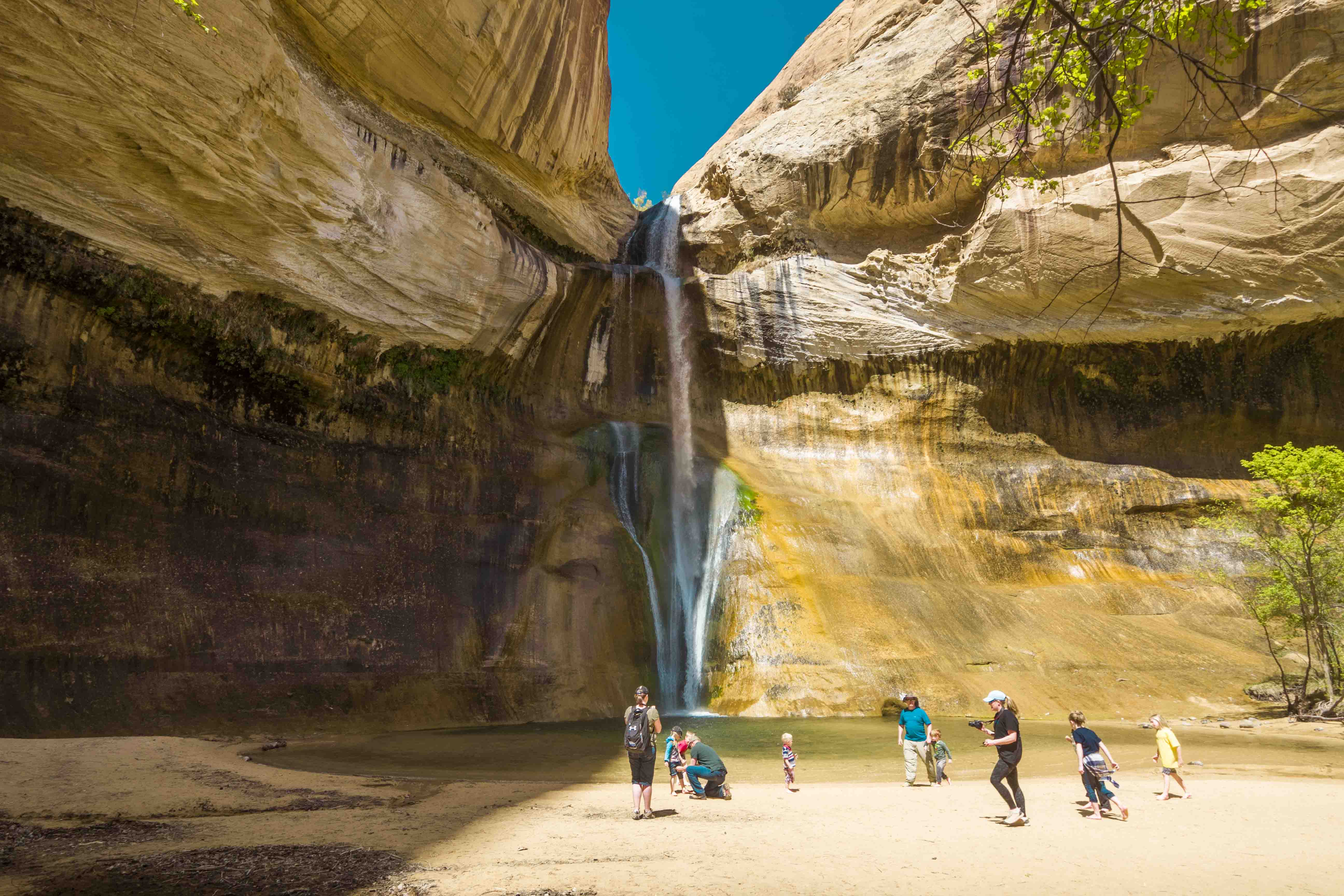
After putting my living room back in order I headed east on UT 12 to the Calf Creek recreation area (still in the GSENM). There is a small, nice campground here ($$) but most people come for the hike to Lower Calf Creek Falls. I was one of these people and was soon setting out up Calf Creek.
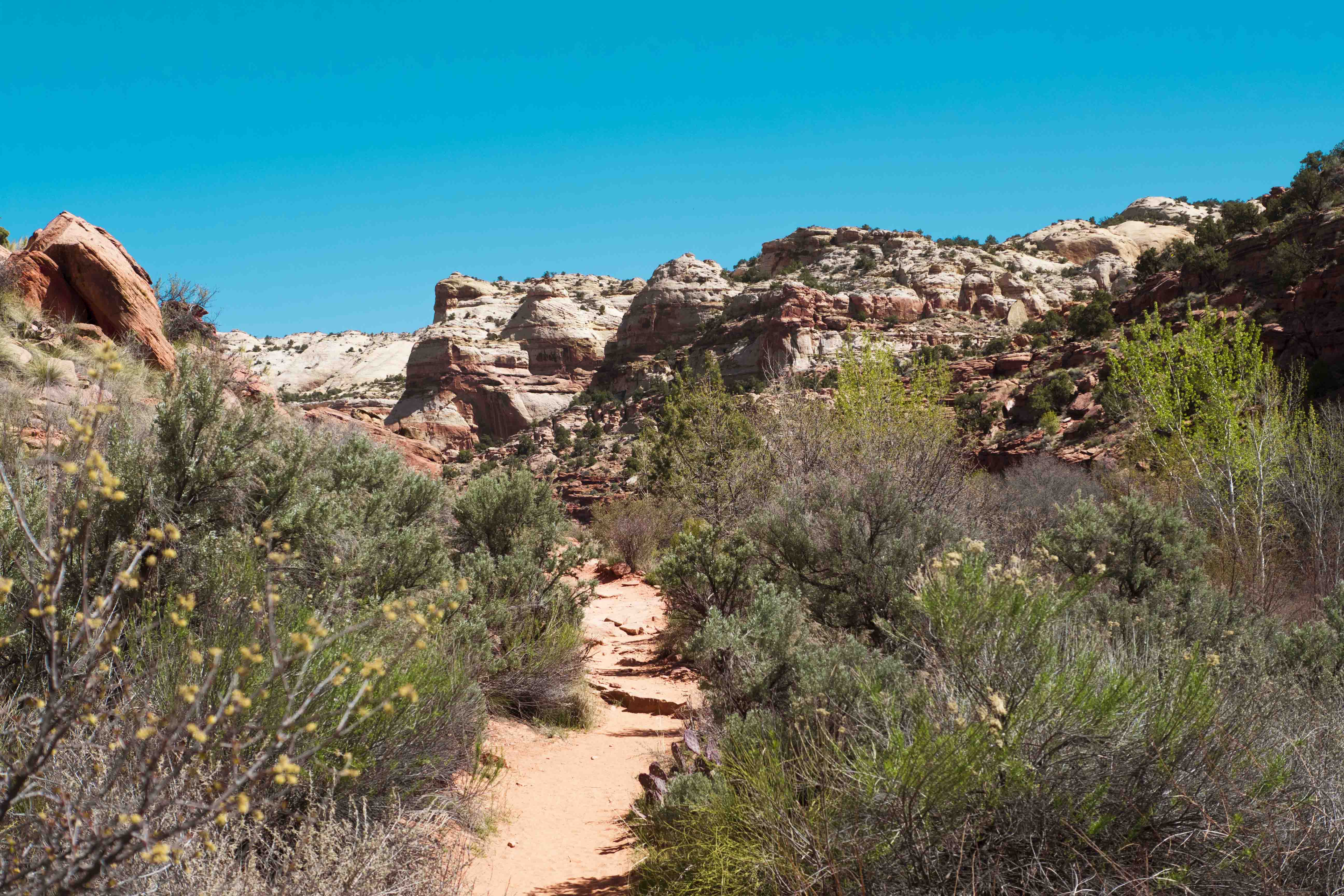
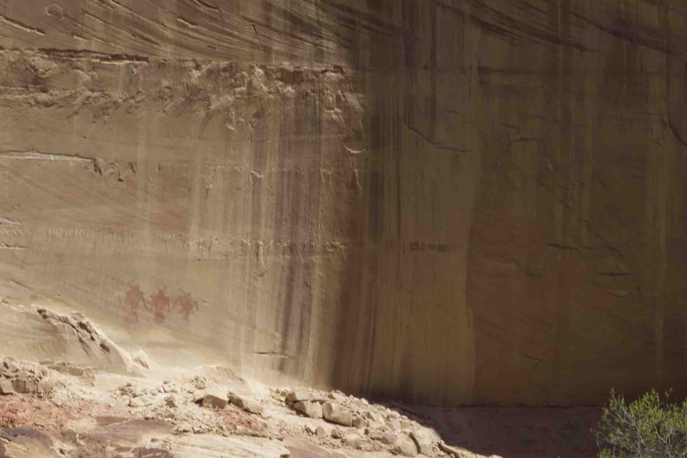
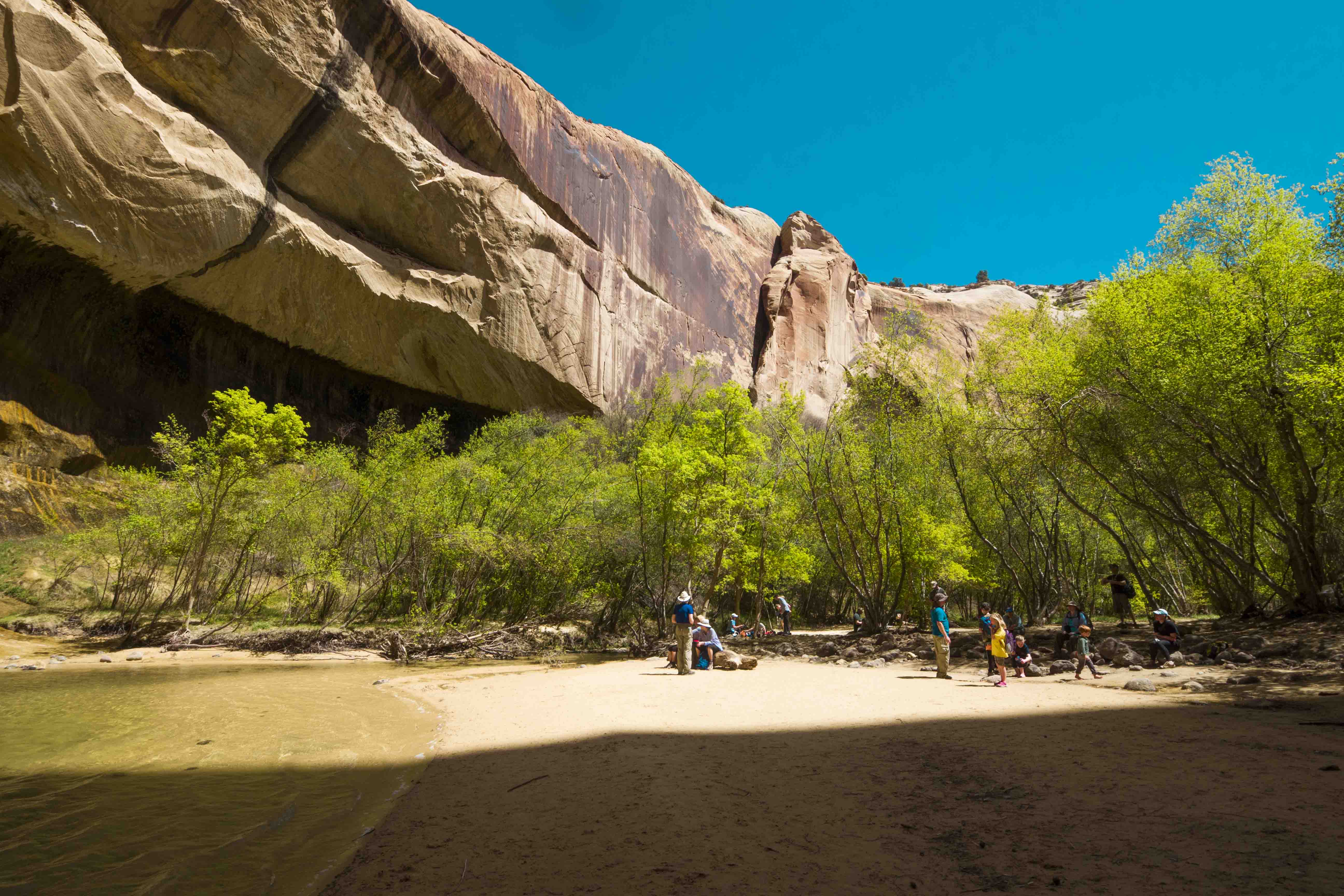
The trail was a well-maintained 3 miles of walking along sand through the lively riparian environment along the creek itself. Under the watchful presence of towering cliffs of Navajo Sandstone tall reeds and cottonwoods hung along the banks and the occasional beaver dam formed large ponds that teemed with life. The overall effect was very peaceful. Far across the creek, on one of the walls of stone, is perhaps the best set of pictographs I have seen to date. Very cool:
Eventually the trees became thicker and the air wetter as I reached the falls themselves. Here the water of Calf Creek drops over 100 feet into a large pool flanked by a sandy beach and a robust stand of trees. I soaked my feet and washed my face in the frigid water and was very much renewed after the hot hike. The hike back out was much nicer with a wet hat on my head!
After the hike I returned to Escalante town for some supplies and to do some work at a local cafe. I had dinner at the local-recommended Circle D eatery where I got a hamburger that was notable for the quality of the meat, but sadly not much else. Once again I camped at the top of HITR road and fell asleep as memories of the past few days put a smile on my lips.
Errata
The Dry Fork trailhead has two parking lots: one for high clearance vehicles and one for the rest of us. In this high clearance lot I saw a Rav4 that had a spare tire installed! If I had got a flat anywhere on HITR road I would have immediately turned around got the hell out of there!
The family I met at Peek-a-boo and Spooky had a CD player in their RV but no CD’s. I gave them copies of the two Begowatts albums I had. I hope they like ‘em because that’s all they have to listen to!
The skies in the GSENM were very dark, but while I was parked at the top of HITR road I was surprised how bright the tiny towns of Escalante and Boulder were on the horizon.
The girl running the Sinclair in Escalante was friendly and in a “very good mood”. She used to be a model for Budweiser and worked for a rapper out in San Diego, but recently moved to the middle of southern Utah to raise a kid. Weird.
The grocery store in Escalante was depressingly stocked. I literally took one of the last loaves of bread they had.
Leave a Comment
Your email address will not be published. Required fields are marked *