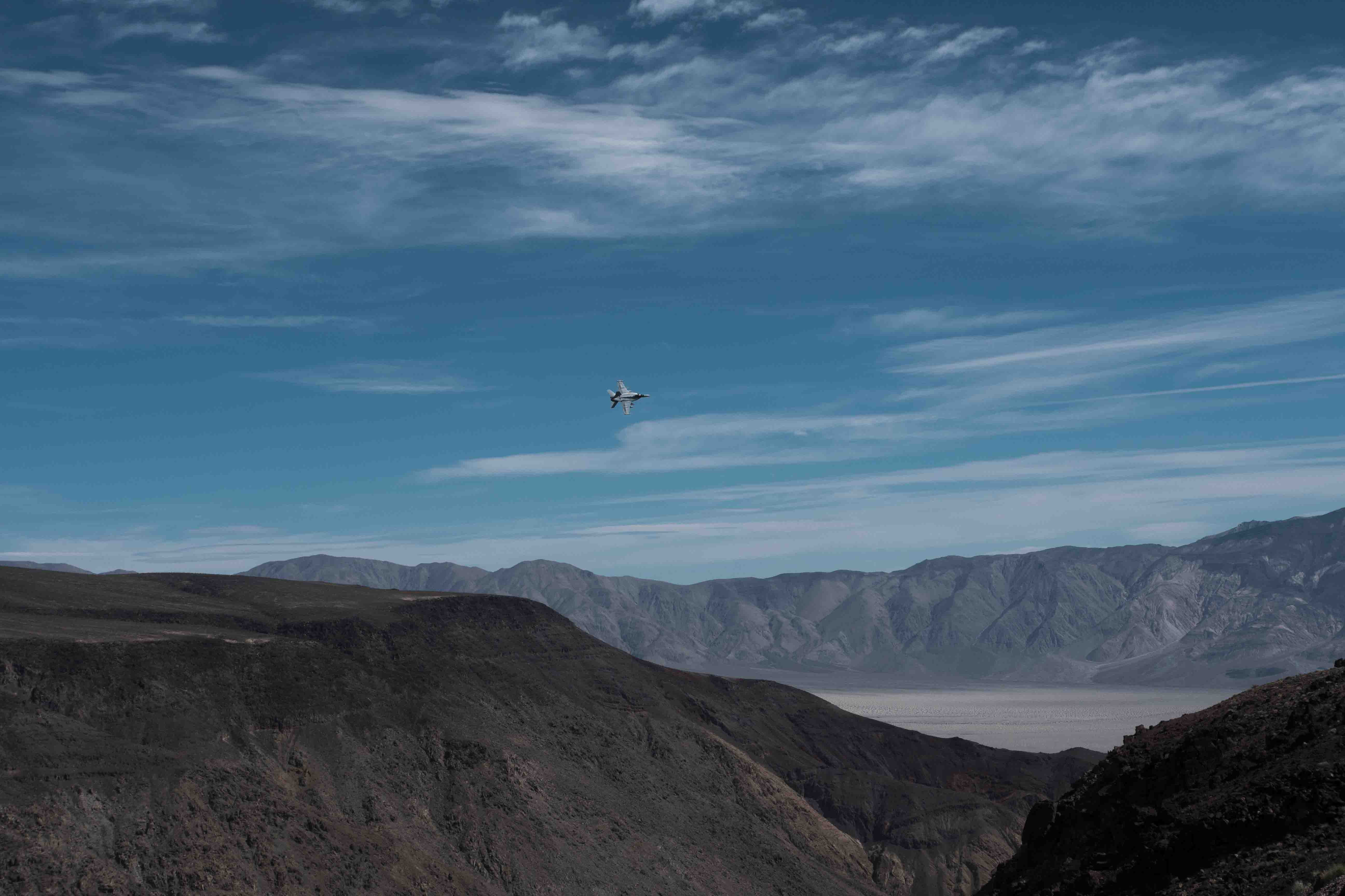
A trip to Death Valley has been one of my major to-do’s for over a decade so I was very excited when I woke up in Bishop with the intention of finally crossing it off the list. As I headed south, the familiar drive down US 395 became unfamiliar as I turned onto CA 136 east in Lone Pine. Soon after I was on CA 190 climbing into the Argus range, which is the first of two mountain ranges separating the Owens and Death valleys. Not long after entering the mountains I had the living bejeezus scared out of me by a fighter jet buzzing the road in what I can only assume was a display of admiration for my sweet ride. With the resulting adrenaline still pumping through my veins I pulled into a nearby viewpoint to watch a pair of jets make repeated runs down a narrow canyon right in front of me. Every time they flew past a few car alarms in the parking lot went off, and at least once they flew directly overhead no more than 100 feet away. Must be fun!
Once the adrenaline had worn off I got back on the road and was soon driving down into the Panamint Valley. There is a small “town” here that seems to be little more than an overpriced gas station ($4.44/gal!) but I was quite surprised at how big the valley itself is. I had imagined the drive to Death Valley as mostly flat but instead it involved going up, over, and down two very impressive mountain ranges. The second of these ranges is the Panamint range and before I knew it I was up at 5,000 feet as I crossed them at Towne Pass. After that it was over 5,000 feet down to Stovepipe wells where I found a visitor center and gas for sane people.
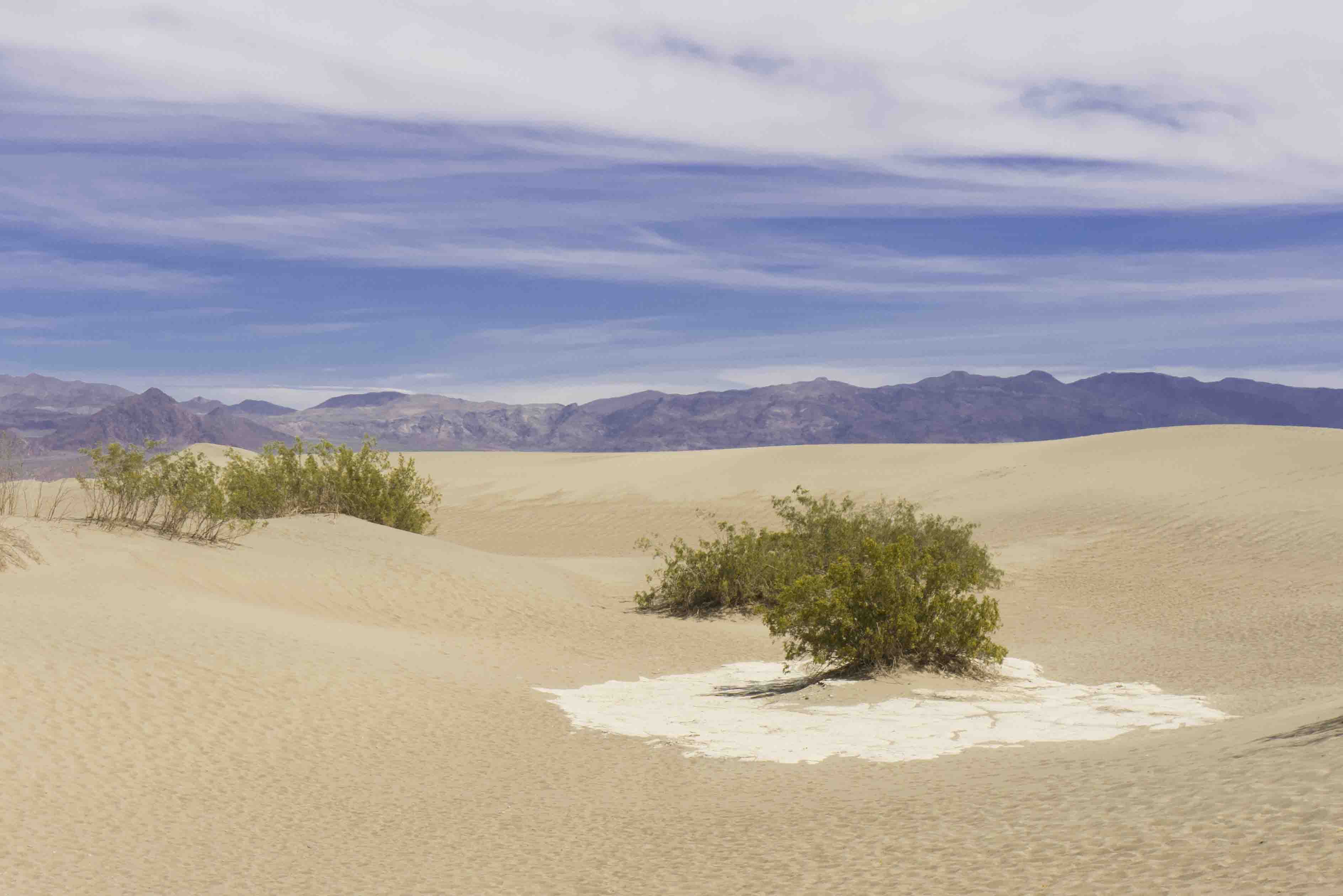
I got some decent beta from the ranger (including a few spots to camp for free) and it wasn’t too long before I was just down the road at the Mesquite Flat dune field. For most of my journey I have experienced weather on the colder side of pleasant and was thus quite unprepared for the searing noon time heat of Death Valley. Van Halen’s thermometer registered about 98 F, but what really got me was how dry it was down there. After sliding around the dunes a bit I sought some shelter from the sun beneath a low shrub but the dryness was more than I could bear and by the time I returned to Van Halen I felt an almost primal urge to get somewhere I could cool down. That place ended up being the Furnace Creek visitor center, where I learned a bunch of cool shit and drank a bunch of cool water. Soon I felt my old self again.
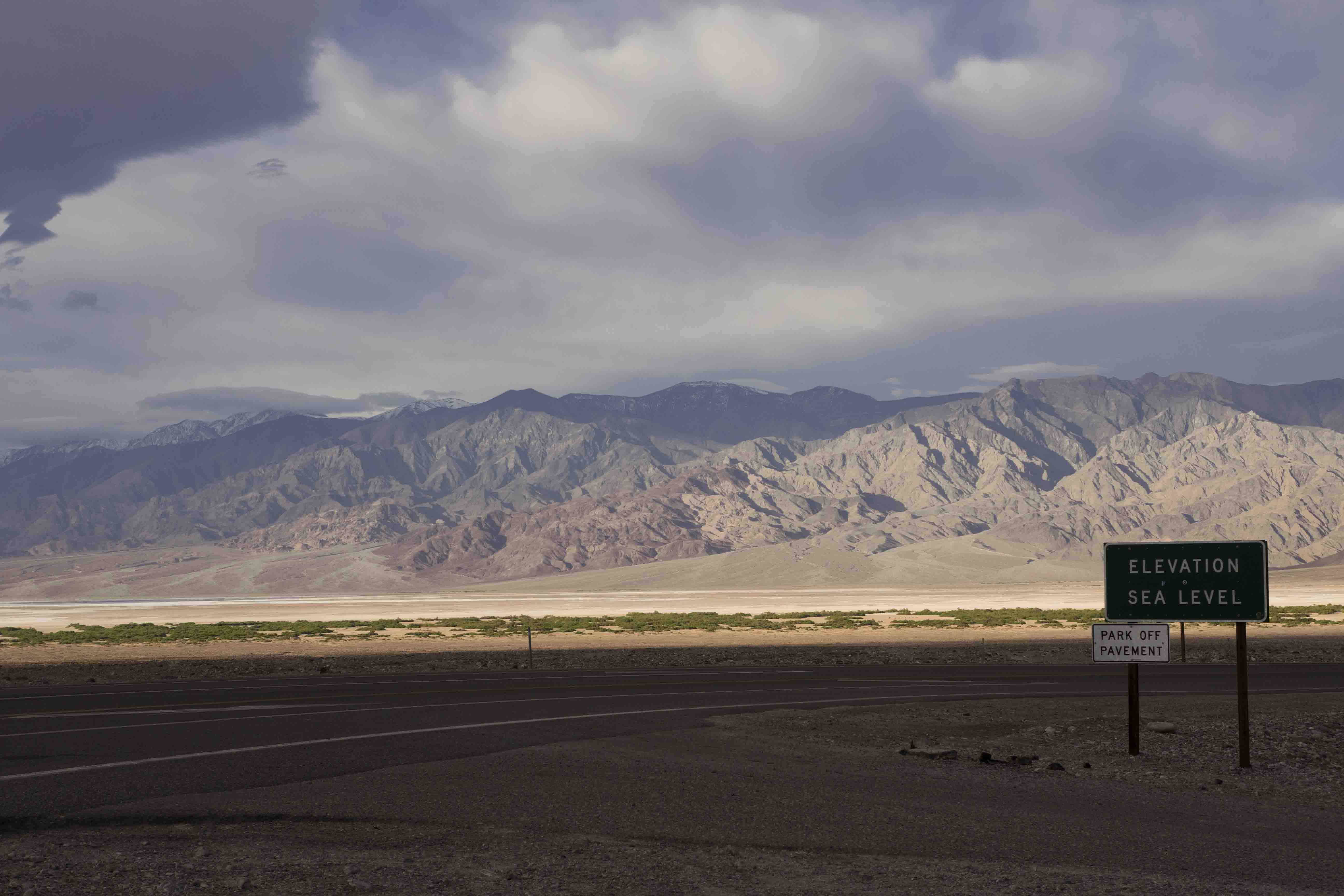
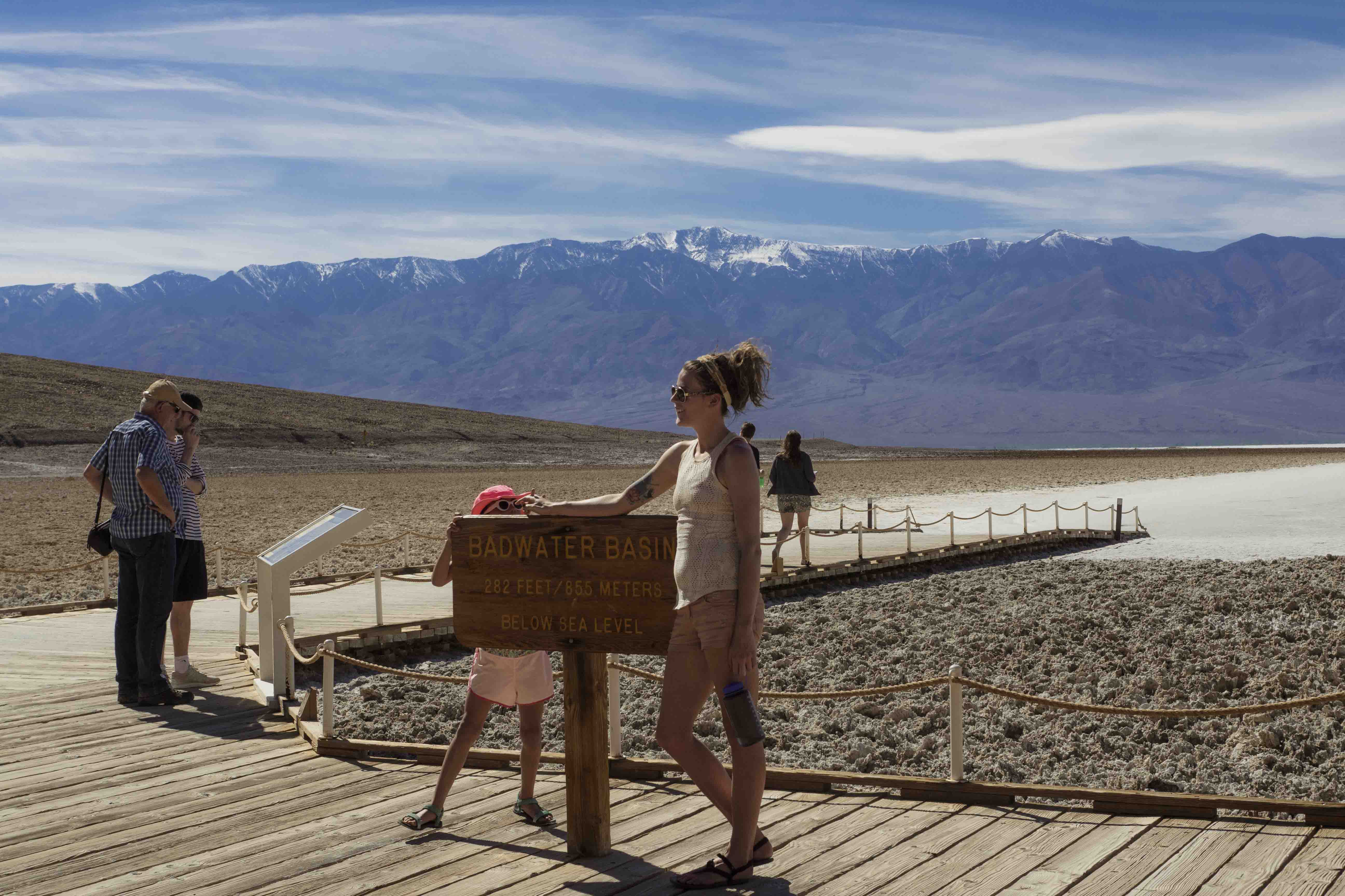
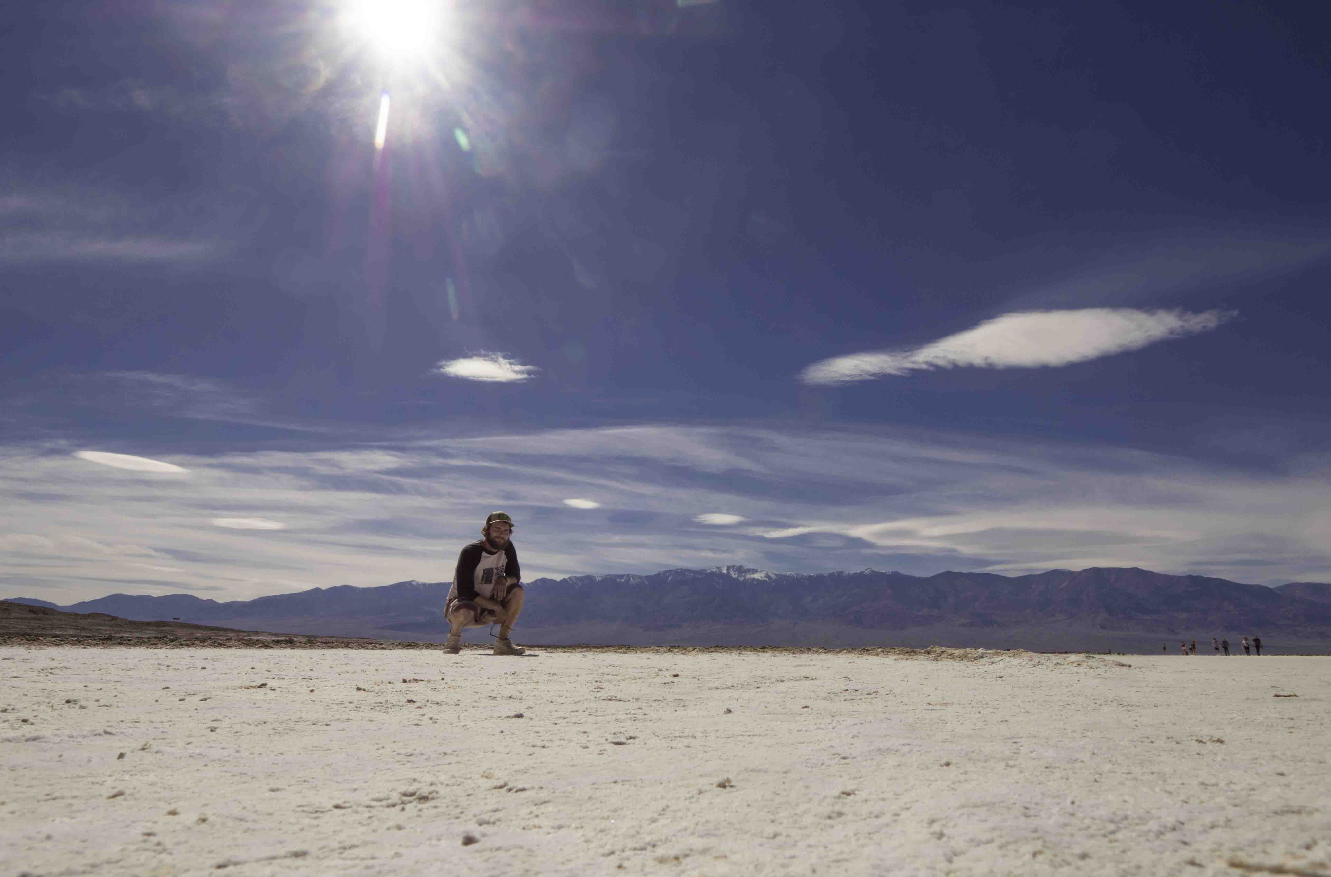
No trip to Death Valley would be complete without a visit to Badwater, which, at -282 feet, is the lowest piece of dry land in the United States. There was a sign advertising this fact and we were also afforded the opportunity to walk out on salt flats towards the other side of the valley (McTeague style). Standing out on this frying pan salt plane I though about the Lowest-to-Highest route (another life goal of mine) - all of the (big) mountains between where I stood and Mt. Whitney; the desolation of the land between them; and the strength-draining heat present at lower elevations - suddenly it seemed like a very hard hike. On my way back to the car I made sure to lean down and get a breath from the bottom of the Badwater sign; the gluttony of oxygen was almost too much to handle.
Exposure to midday heat had once again heated me up and rather than return to the Furnace Creek visitor center I headed over to the Furnace Creek Inn. After some snooping around I discovered an unlocked and unguarded (but still occupied) pool surrounded by palm trees in the heart of Death Valley! I almost couldn’t get in fast enough and I spent over an hour immersed in the cooling waters of this testament to man’s desire to laugh in the face of nature’s harshest aggressions.
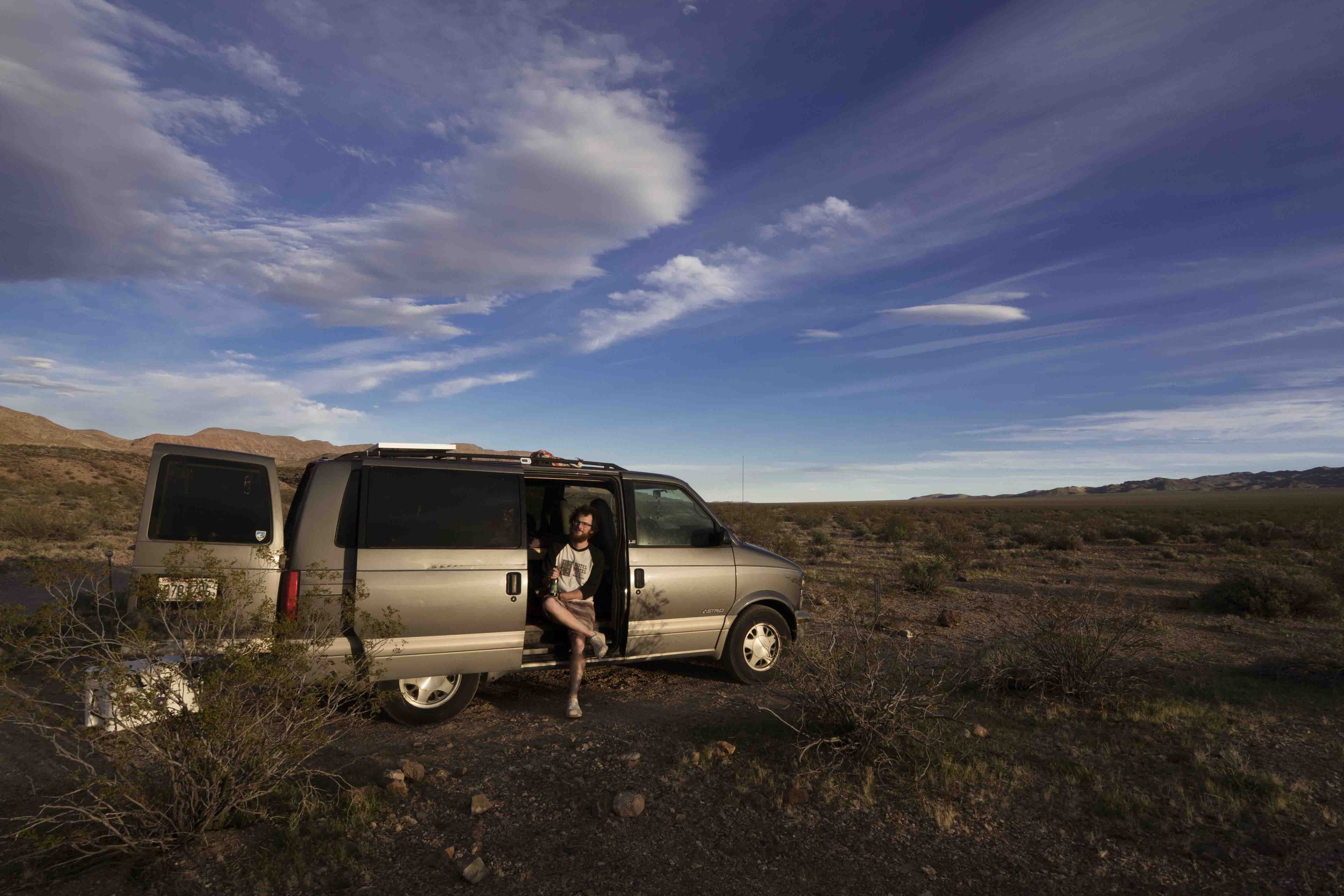
After my swim it was time to make camp so I took the ranger’s suggestion and found a dirt road just off the road to Dante’s View. A mile down was a nice little spot to park and I ate dinner and cleaned my living room a bit while blasting some tunes into the desert air. Up where I was, at 3,000 ft, the air was a completely pleasant 75 F and that night it stayed around 60. My first day in Death Valley was a good one; I saw a lot of cool stuff and learned what real heat can do.
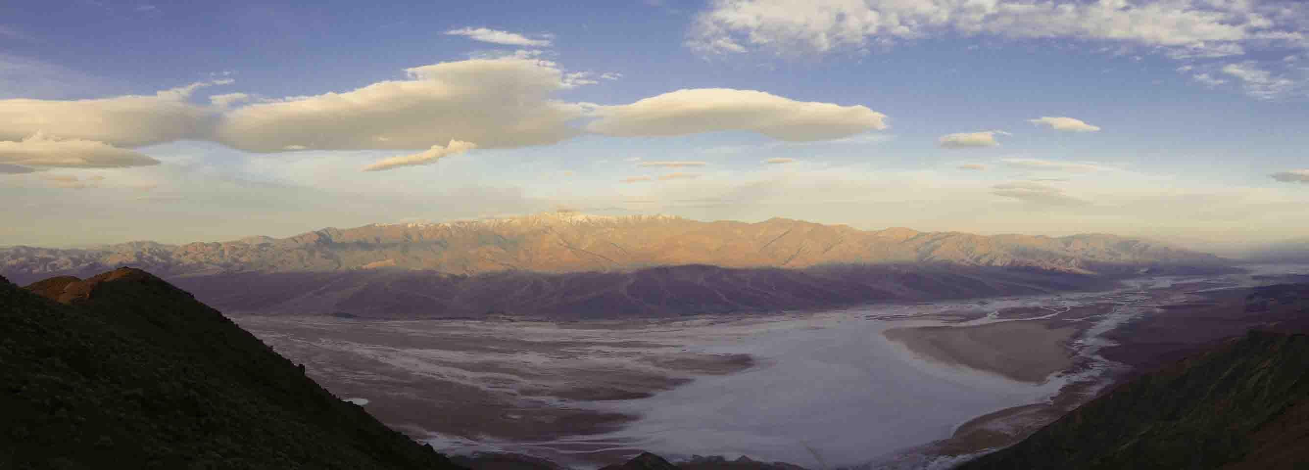
The next morning I was up before dawn so that I could get to Dante’s view in time for sunrise. From over 3,000 feet directly above Badwater this ridge provides commanding views of the valley and the Panamint range. Apart from some snow on Telescope peak the landscape was nothing but rock and sand and salt as far as the eye could see. Some clouds provided a little more drama and they continued to build up as the morning progressed.
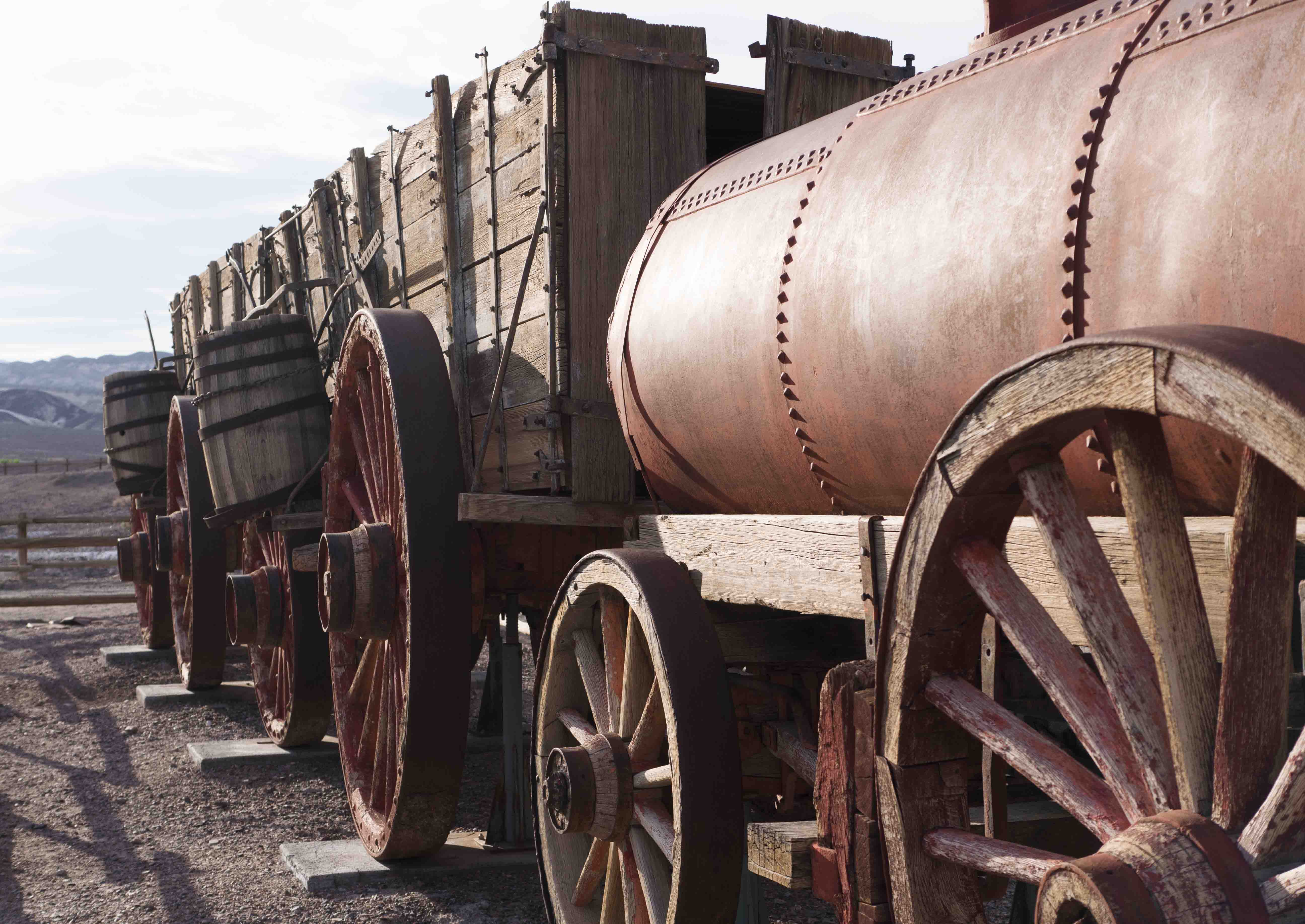
Traveling down from Dante’s View the temperature steadily increased as I put more and more air above me. Before the day got totally unbearable I stopped at the abandon Harmony Borax mine. Back in the day Borax was the only way to pry a profit from this barren landscape and Harmony was the first of many Borax mines in the valley. Despite the heat they actually had to refine the Borax right here at the source because it was so goddamn awful to transport stuff out of the valley. I believe it!
The next stop was Salt Creek, which actually had quite a bit of water in it. In addition to water the creek is home to the Salt Creek Pupfish, a fish that, through isolation in the aforementioned creek, evolved into a completely unique species. There were a lot of them playing in the water but apparently in the summer most of them die when the creek dries up. Life sucks like that sometimes.
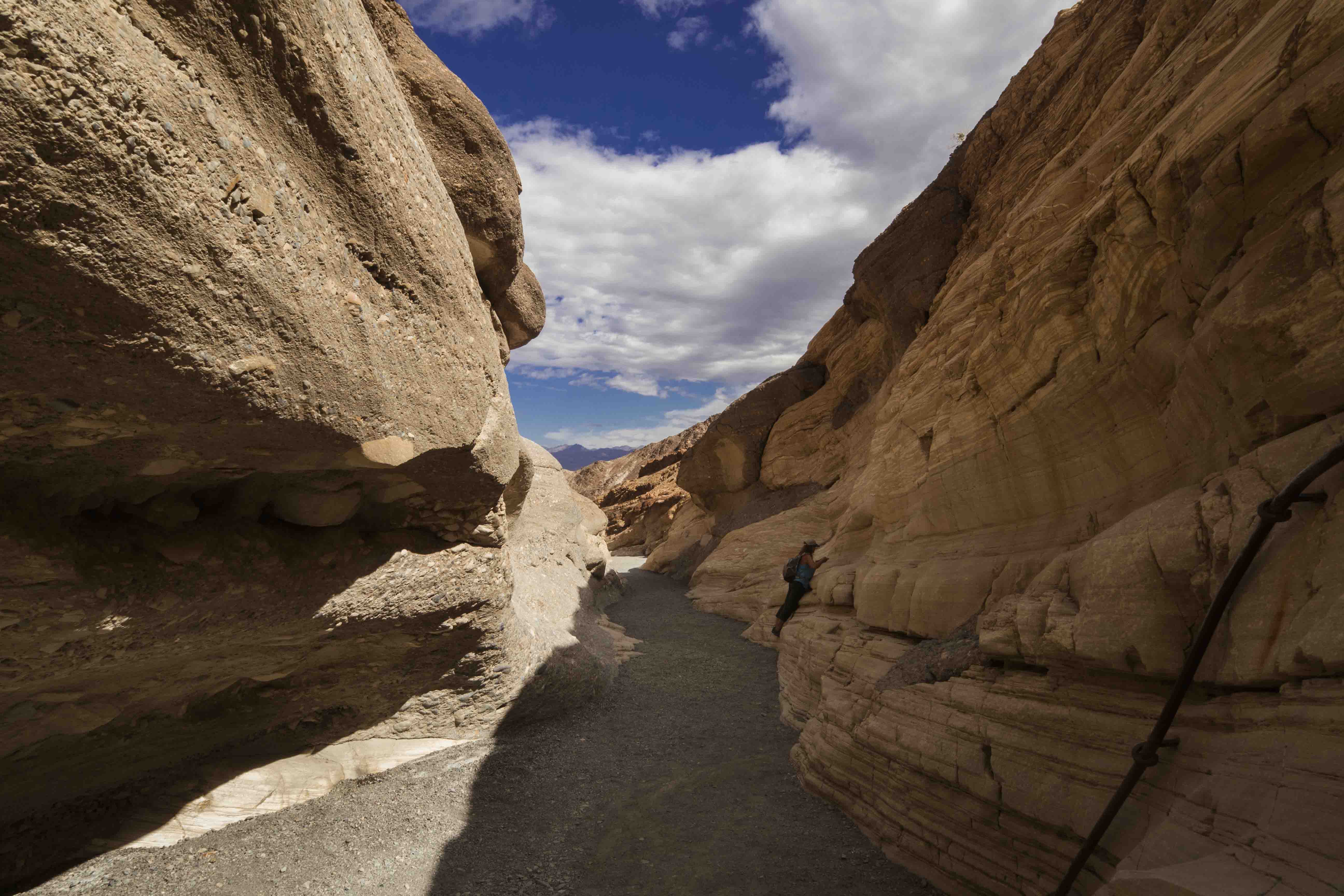
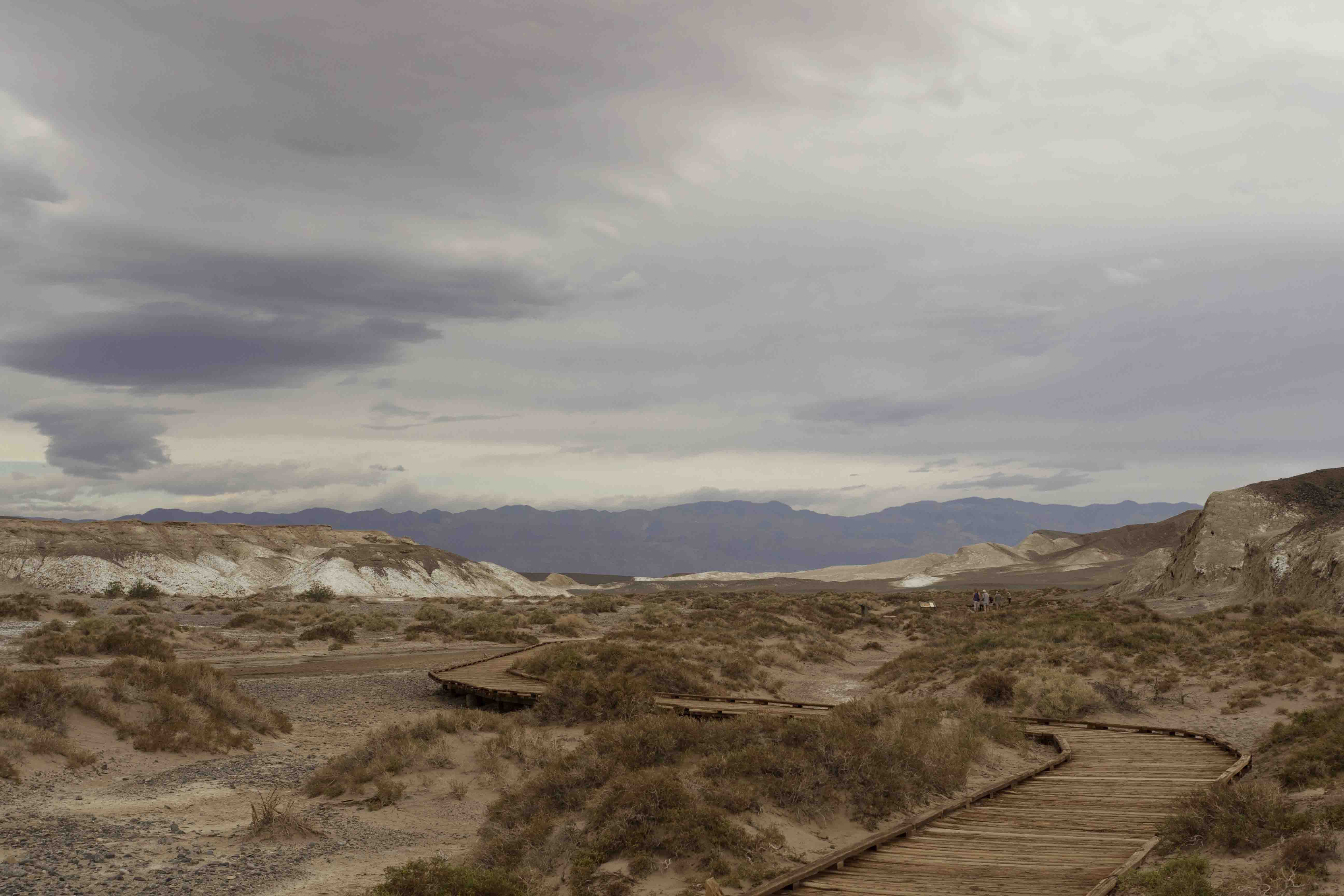
At this point the sky was completely covered with clouds so for my last stop in Death Valley I decided to go on a hike up Mosaic Canyon. Right away the canyon was very interesting; its walls were made of slick marble(!) and they formed something kind of like a slot canyon. Soon, however, it opened up and became just sort of a smallish canyon with a gravel bottom and not really that inspiring. I turned around before I reached the end because the Sun was starting to break through the clouds and I needed to make tracks to Mojave to meet my brother.
Once outside the park, on the other side of the Panamint range, I turned south into the Panamint Valley on the appropriately named Panamint Valley Road, which eventually became the Trona Wildrose Rd, then the Trona Rd, and finally CA 178 into Ridgecrest. The drive down the length of the Panamint Valley was awesome in the literal sense of the word. The valley is dominated by the flanking ranges of the Argus and Panamint while the floor was covered in a soft shade of green from fields of sagebrush. This empty valley was also the last known whereabouts of the Manson family. Would I make that grim connection?
After rejoining US 395 for a few miles before turning onto Garlock Rd to CA 14 I ended up in Mojave where there was just enough time for one more small adventure. While I was getting ice at a gas station I was approached by a man who needed money to catch a bus to California City, just a few miles up the road. I didn’t have any cash, but I offered him a ride. His name was too complicated to remember but he said he had just got out of jail and was heading back to work in Ca City. He had a lot of good things to say about the city itself and they contrasted starkly with the state of affairs when we finally arrived. If someone ever tells you to go to California City they are probably trying to trick you. Still, it was home for my passenger so I let him off with a smile and a handshake and headed back down the road to Mojave.
Errata
- Driving south of the Panamint Valley you eventually pass through the town of Trona, CA. Trona sucks. No matter where you live or how much you hate it, at least you don’t live in Trona.
Leave a Comment
Your email address will not be published. Required fields are marked *