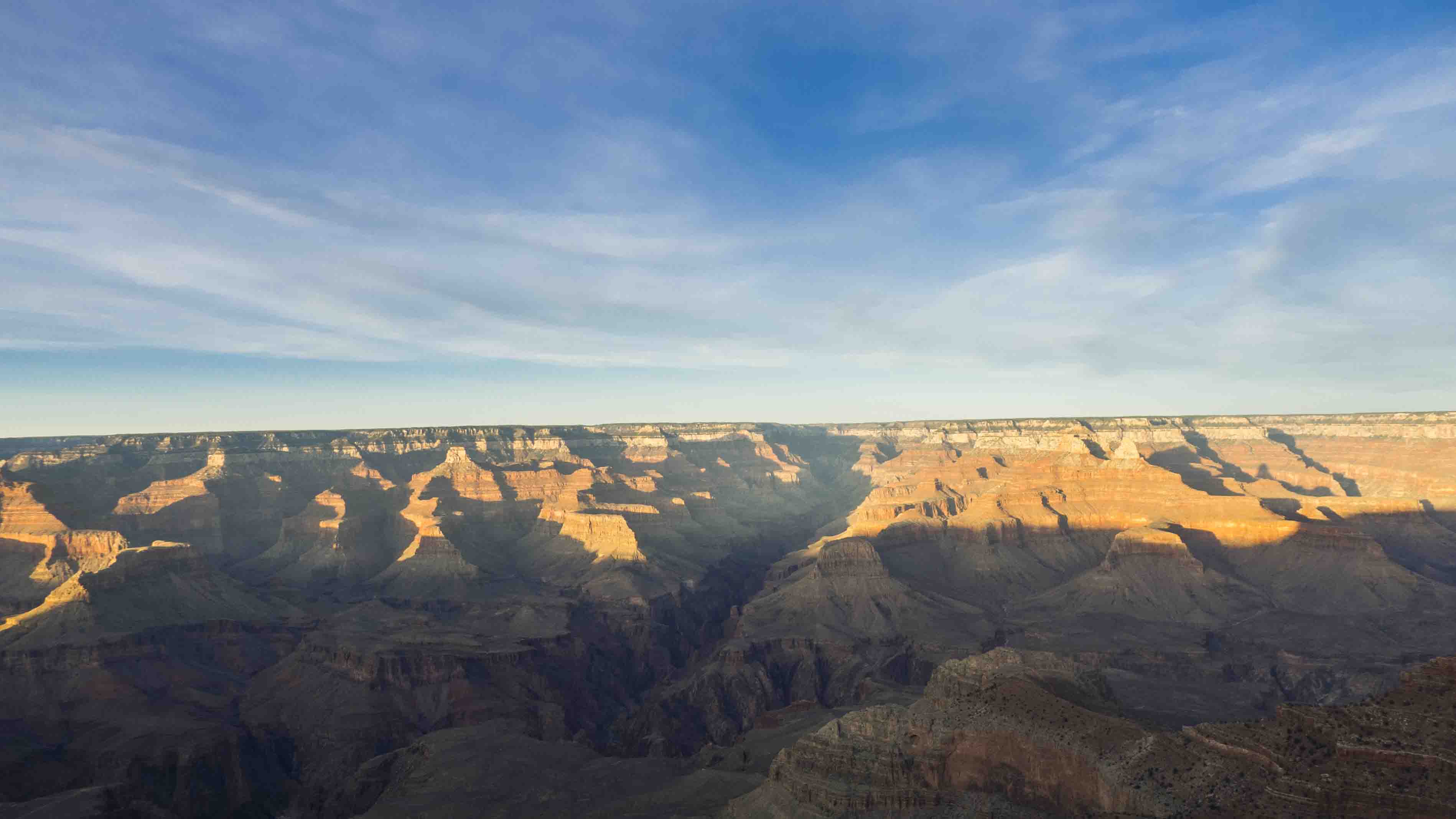
After some great disappointment at the Prescott Costco I was soon on AZ 89 north headed to the Grand Canyon. After a little jog down I-40 through Williams (see rant below) and a turn onto AZ 64 I soon found myself at the entrance of the second most popular National Park in this great nation (bonus points if you know which one is the first). I arrived just before sunset and barely had a chance to sneak a peak a the cañon itself. The viewpoint was packed with tourists, but incessant selfie-taking did little to diminish the grandeur of the, well, Grand Canyon. With the setting sun the Northern Rim glowed a fierce orange and the whole view seemed like a painting. After mulling things over I resolved to break through the third dimension and hike into the canyon. The main goal was to get down to the river (Springsteen style).
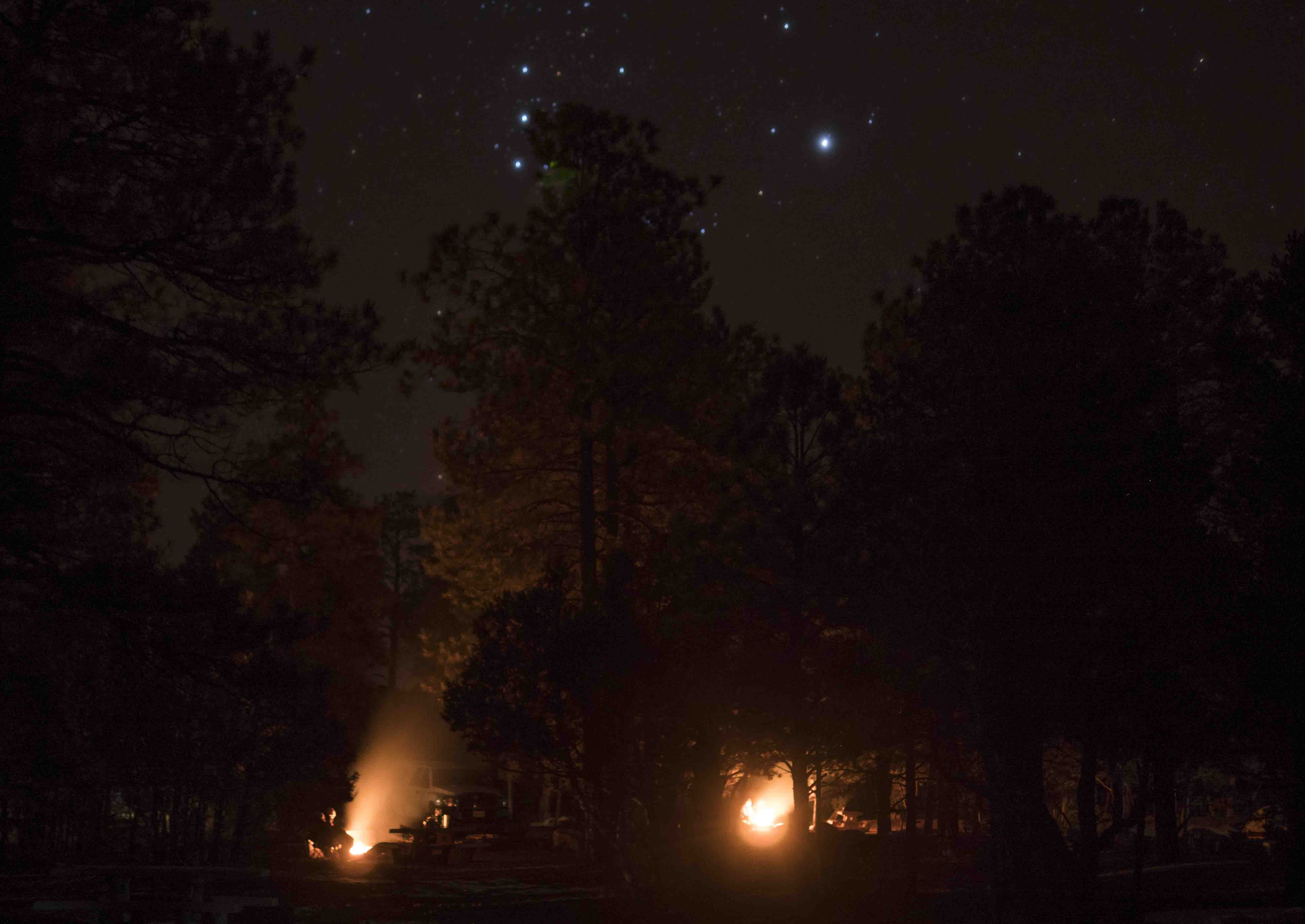
That night I stayed in the Mather campground’s only open loop. It was pretty cold up at 7000 feet, but it the sky was clear and the surrounding woods filled with the comforting glow of campfires.
The next morning I was up really early and eating breakfast outside the Backcountry Permit Office in hopes of being first to get the paperwork necessary to spend a night in the canyon. My aggressive scheduling proved unnecessary but I was still happy to easily get a permit for 1 night at the Bright Angel campground, right along the Colorado River 5000 feet below me. There are two main trails from the South Rim to Bright Angel camp; South Kaibab and the eponymous Bright Angel trail. The ranger at the backcountry office suggested a hike down South Kaibab with a return up Bright Angel because South Kaibab has no water along its entire length while Bright Angel has a few refill opportunities and thus requires less water on your back as you hike out of the canyon. This advice seemed sound and after hastily packing up my gear and two days of food I was on a hiker shuttle bus heading towards the South Kaibab trail head.
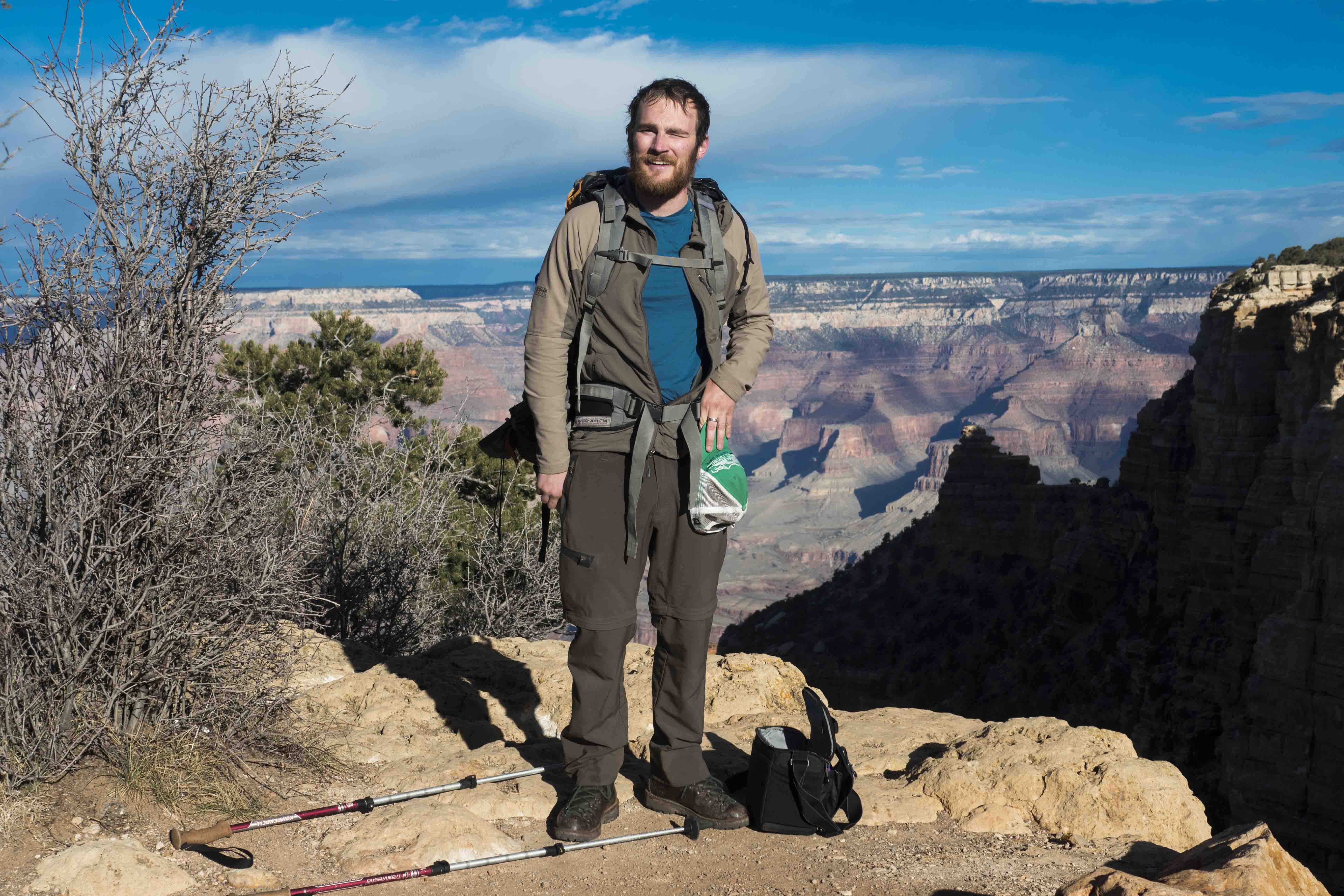
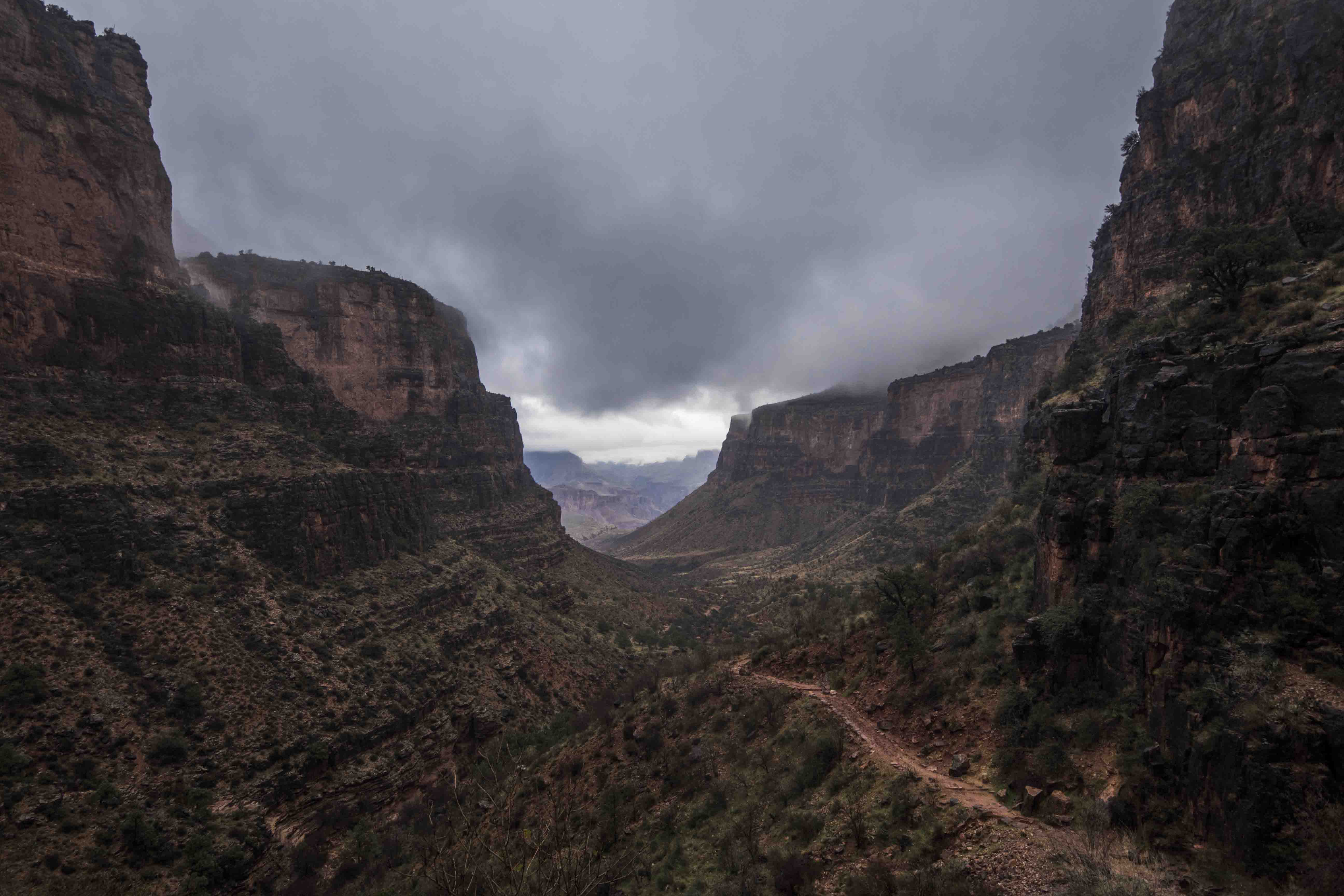
The bus was full of enthusiastic hikers and the air rippled with the infectious optimism of people excited to experience something deep (haha!). By around 9:30 in the cool, sunny morning I was poised at the top of the South Kaibab trail and ready to seek lower elevations. The trail wasted no time heading down via some switchbacks and soon I was far below the rim, farther yet above the river, and soaking up the warming radiation from the sun bouncing off the walls of the canyon. The scenery was understandably stunning and as I went farther down into the canyon not only did I gain a new literal perspective, but I also began to realize just how freaking huge this place is. Of course, from the rim you can see that the canyon is big (Grand even), but you can actually be deceived because the lack of trees makes judging distance difficult. Once you start actually moving into the canyon you realize that everything is bigger and farther away than you originally thought. Very impressive.
The trail was relentless in its descent and after a few hours of nothing but walking downhill I reached a sign that said I was only half way there. My mind reeled at the idea that, even after such extreme declination, I was only half way to the bottom. Phew! My legs were a’wobblin!
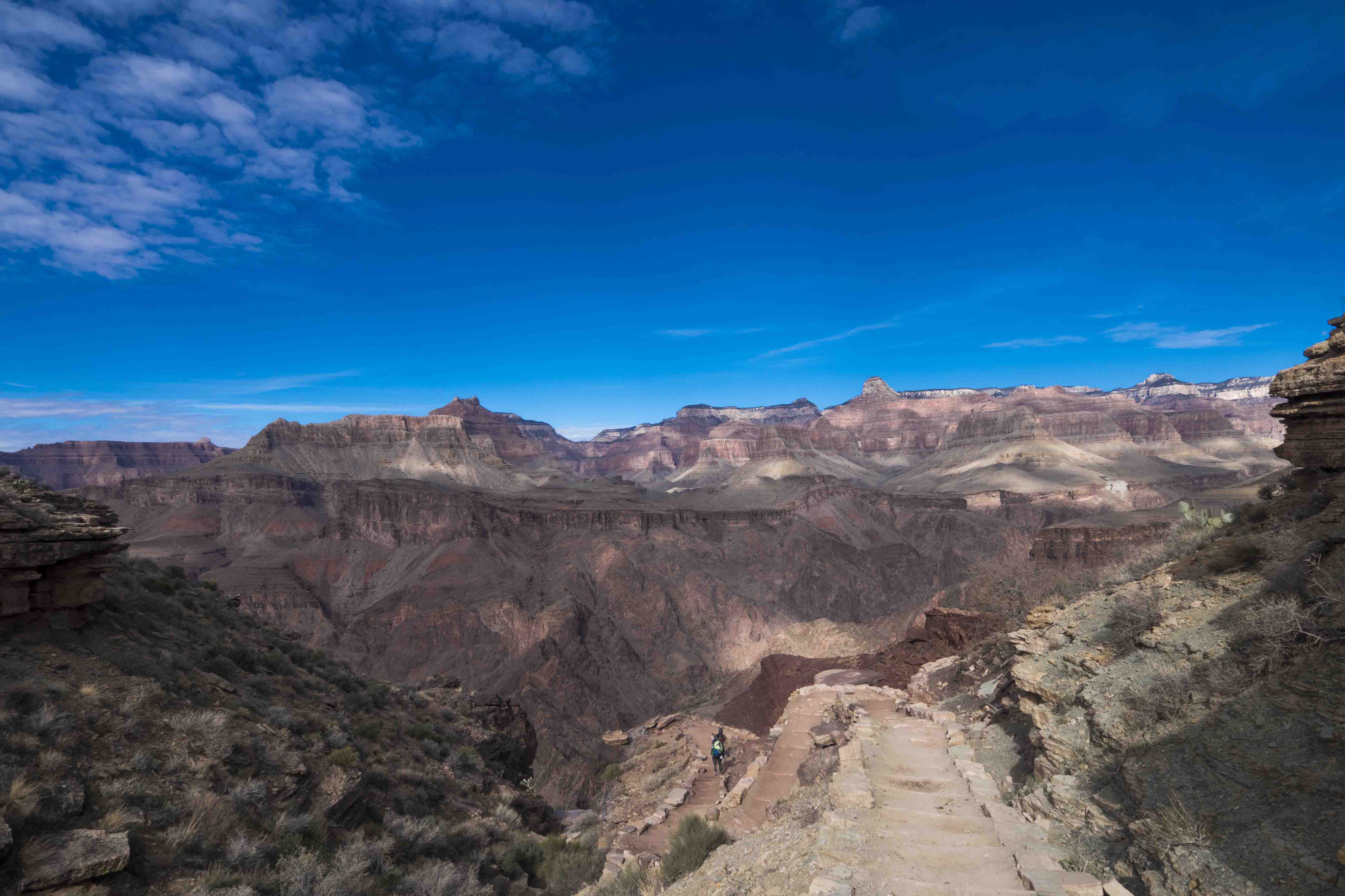
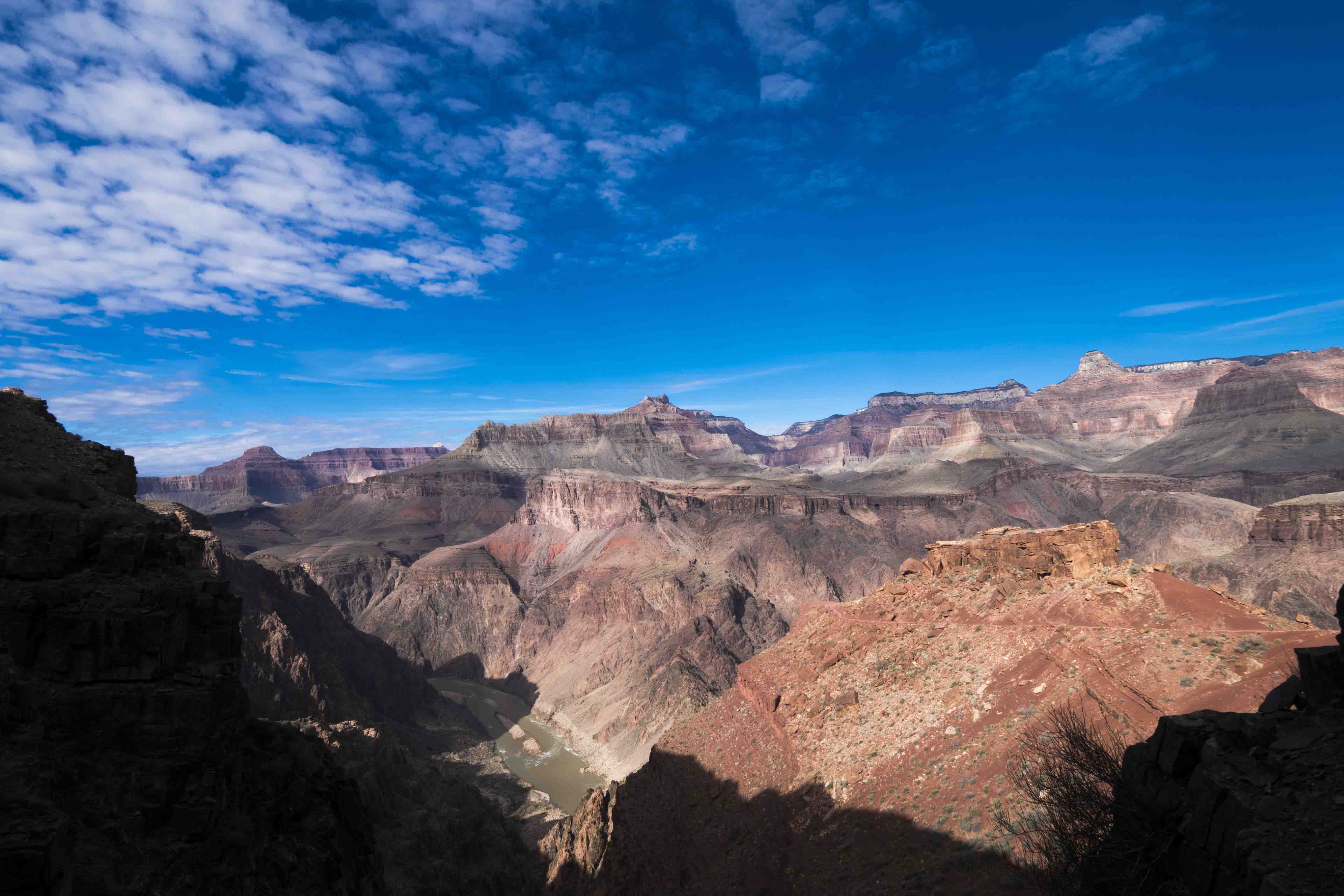
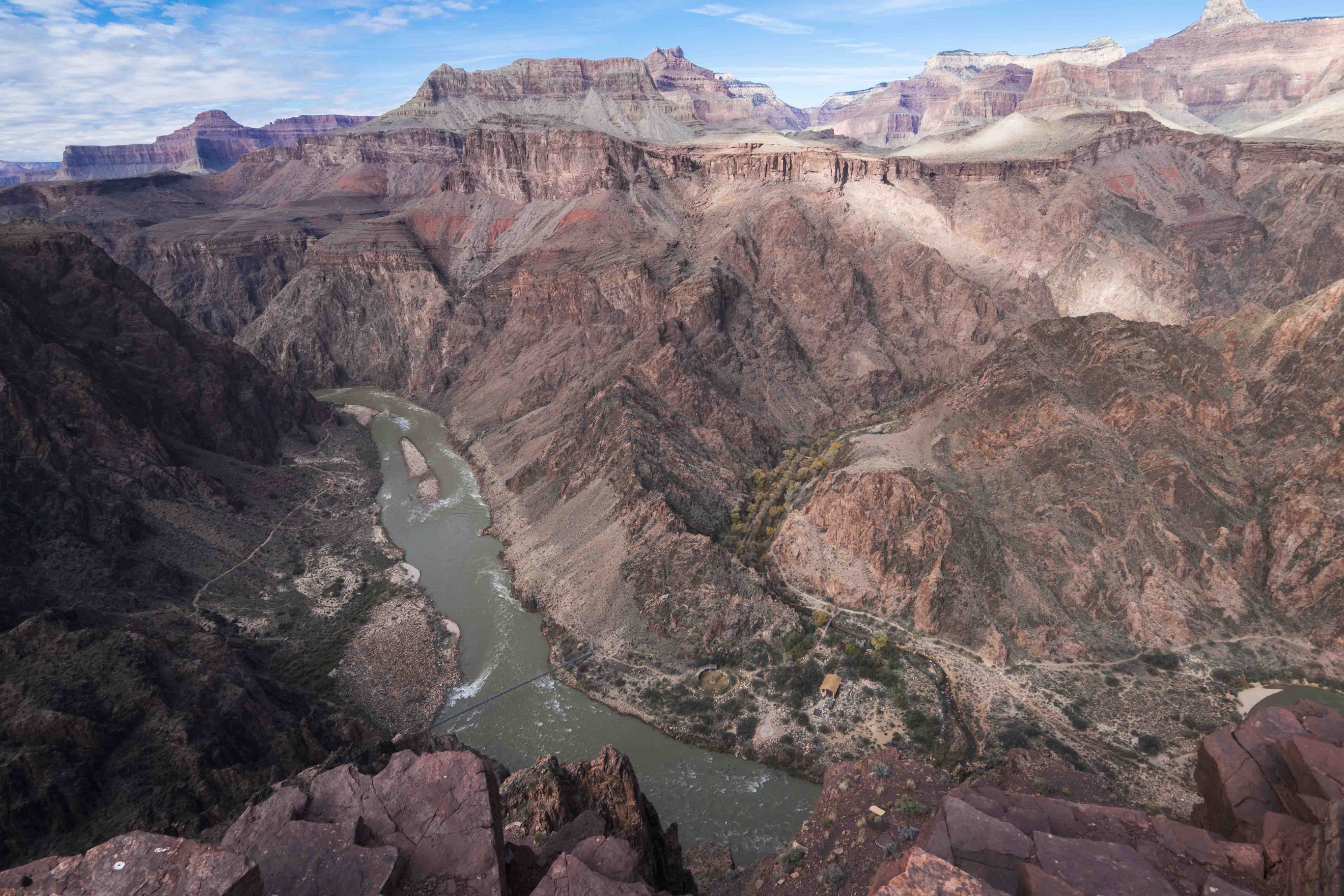
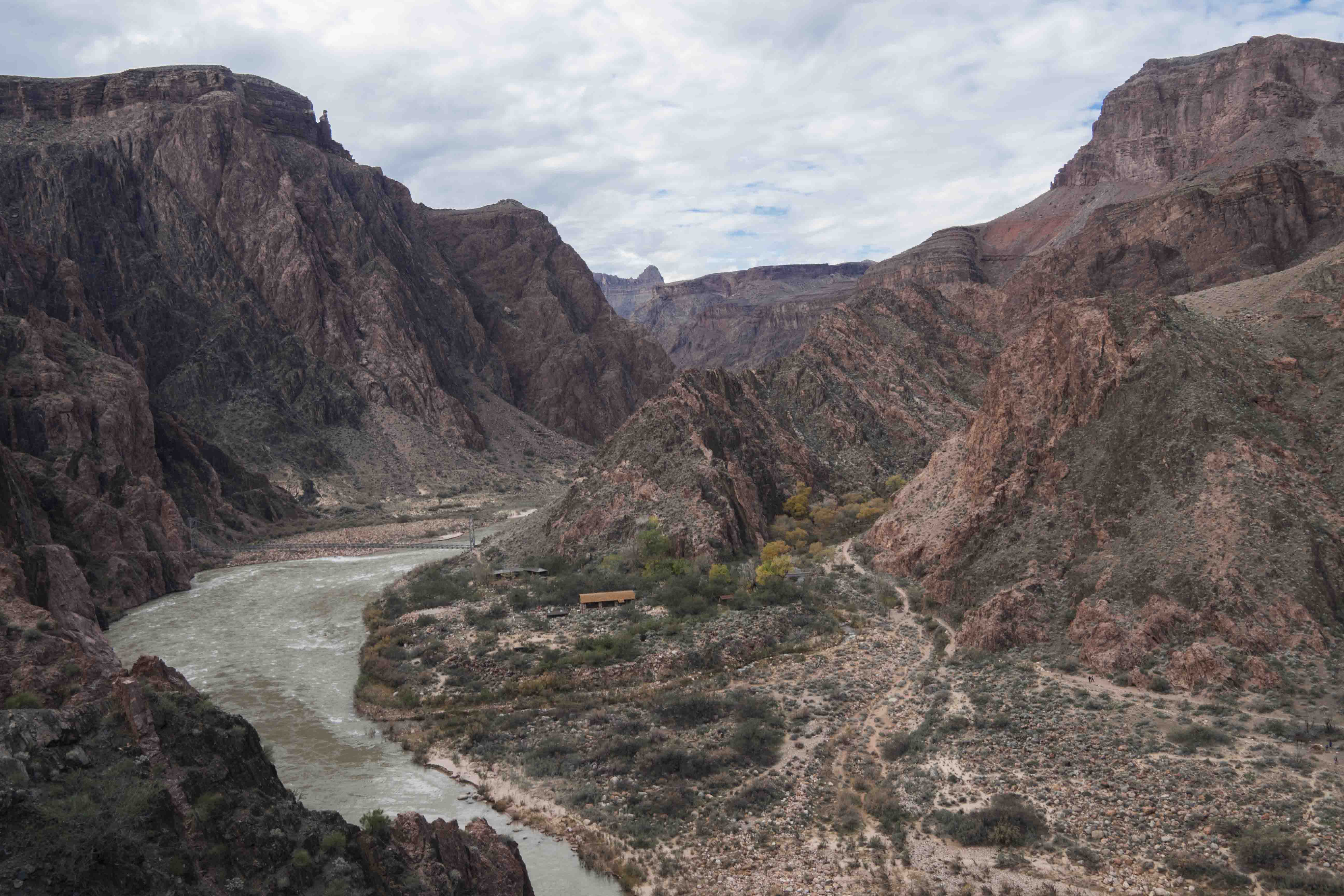
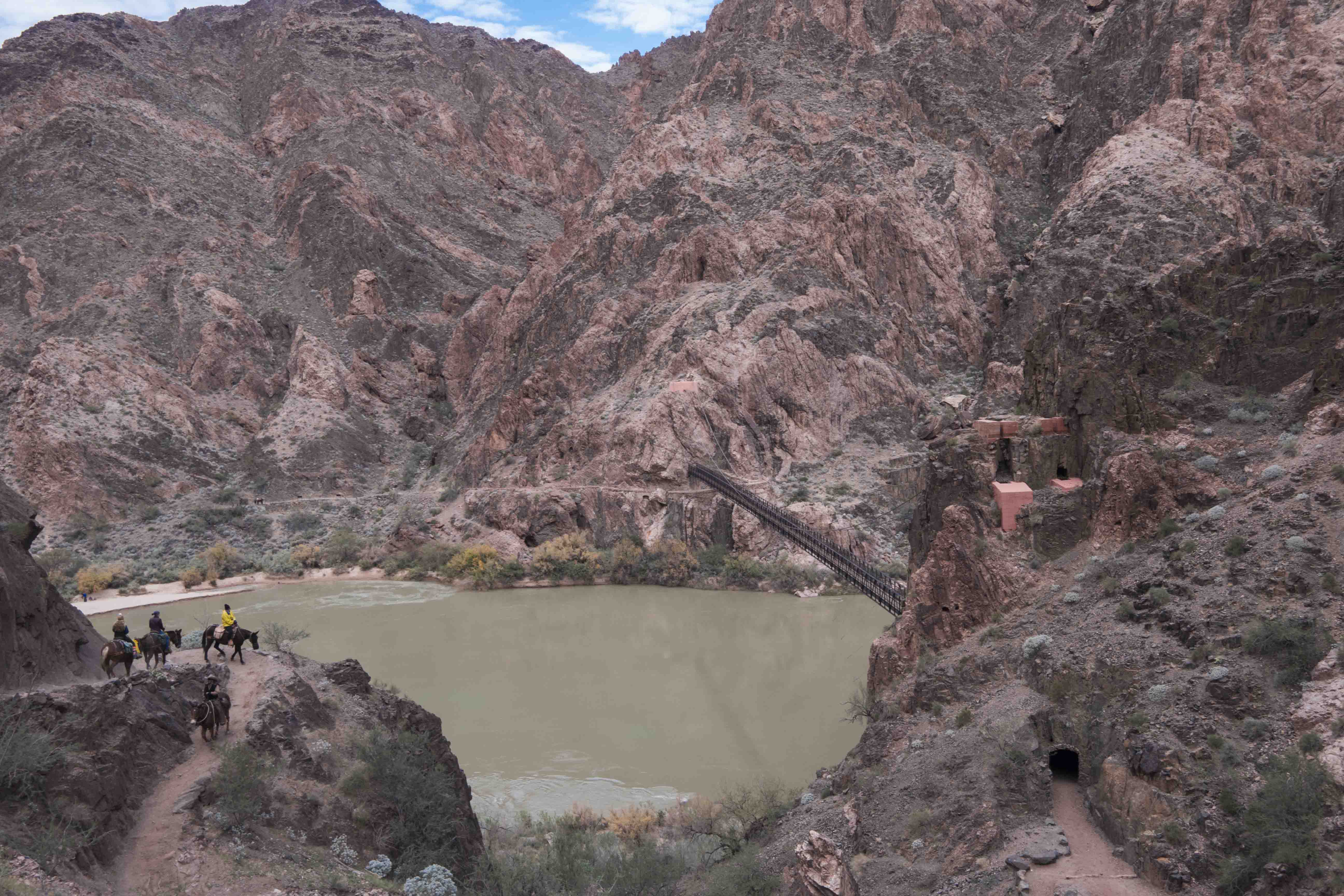
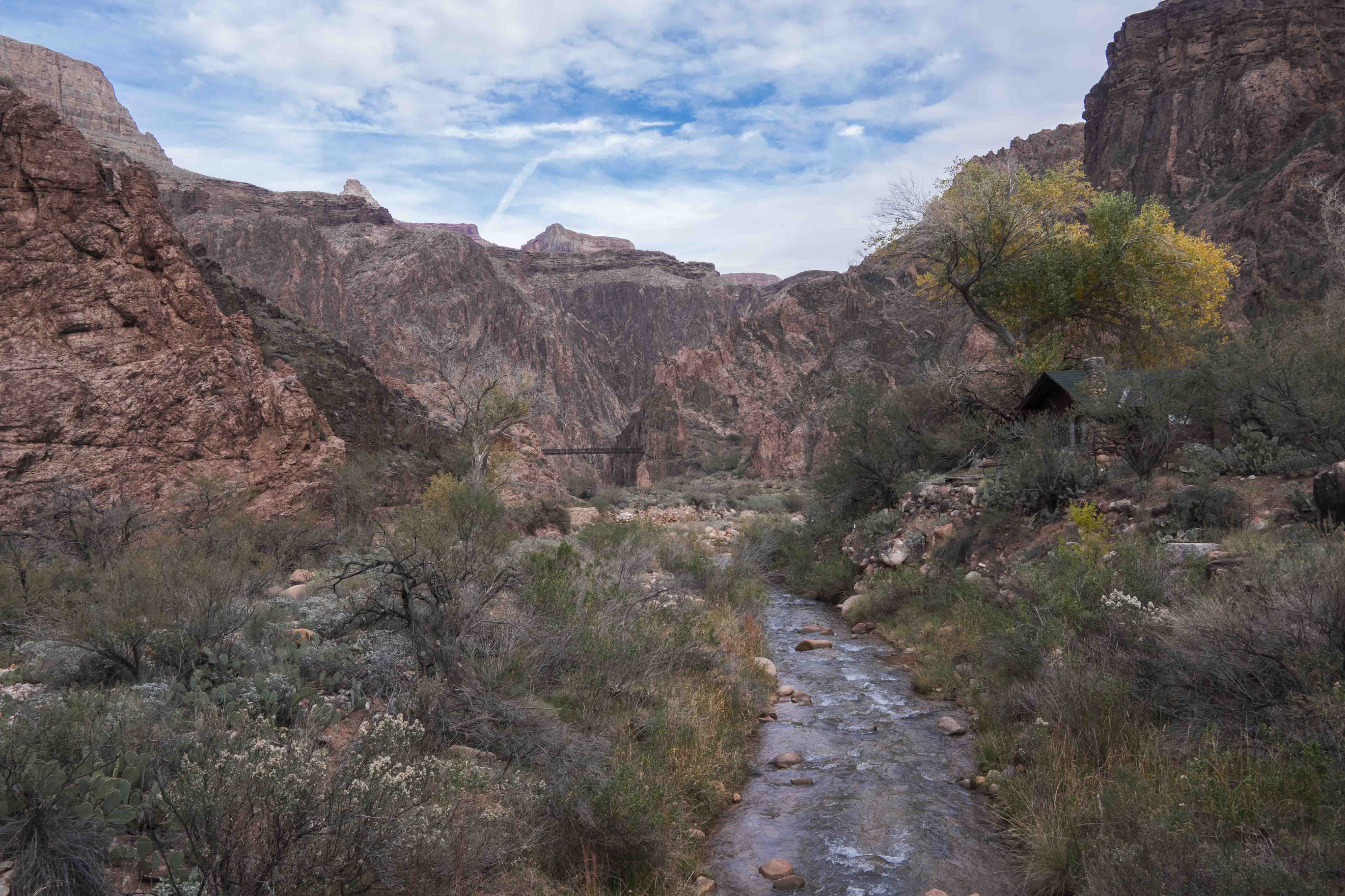
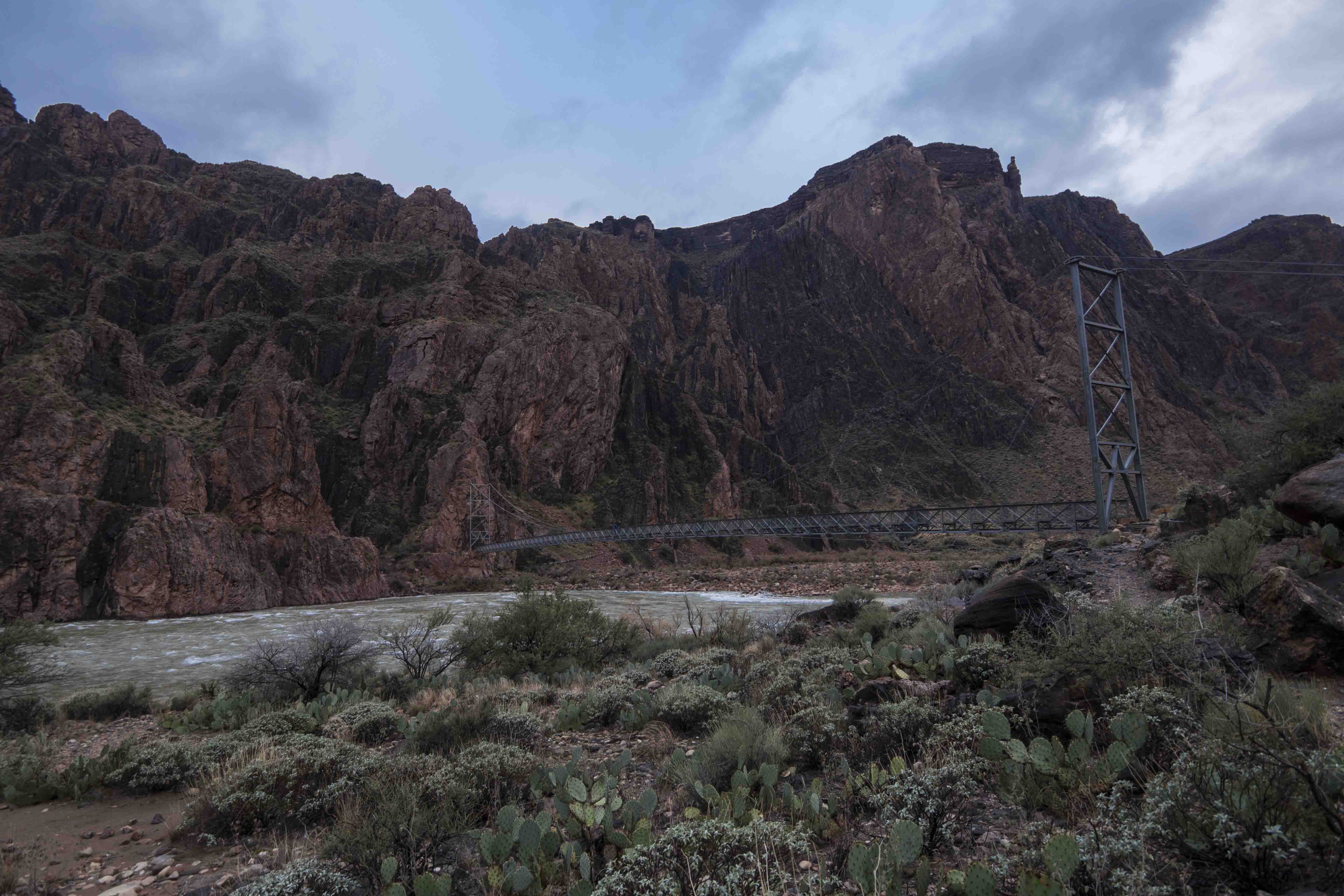
As I plumbed farther and farther into the depths the geologic history of the canyon revealed itself. After passing the sheer cliffs of the Kaibab and Coconino formations, sliding down the sloping terraces of the Hermit and Supai layers, and strolling across the relative flatness of the Tonto group I passed into the Inner Canyon, who’s secrets are unavailable to views from the rim. Down here the stone was an almost green color and certainly of a different type of rock (maybe granite?). The walls are also extremely steep as they rush towards their embrace of the mighty Colorado. Eventually I reached the level of the river and to my great surprise was greeted by a huge suspension bridge immediately preceded by a tunnel cut through the solid rock. Very cool. A nearby plaque said that the cables for the bridge were too unwieldy to be carried down by mule and instead were placed on the shoulders of over 200 men as they trudged down the Kaibab trail. That sure was a crazy image to imagine.
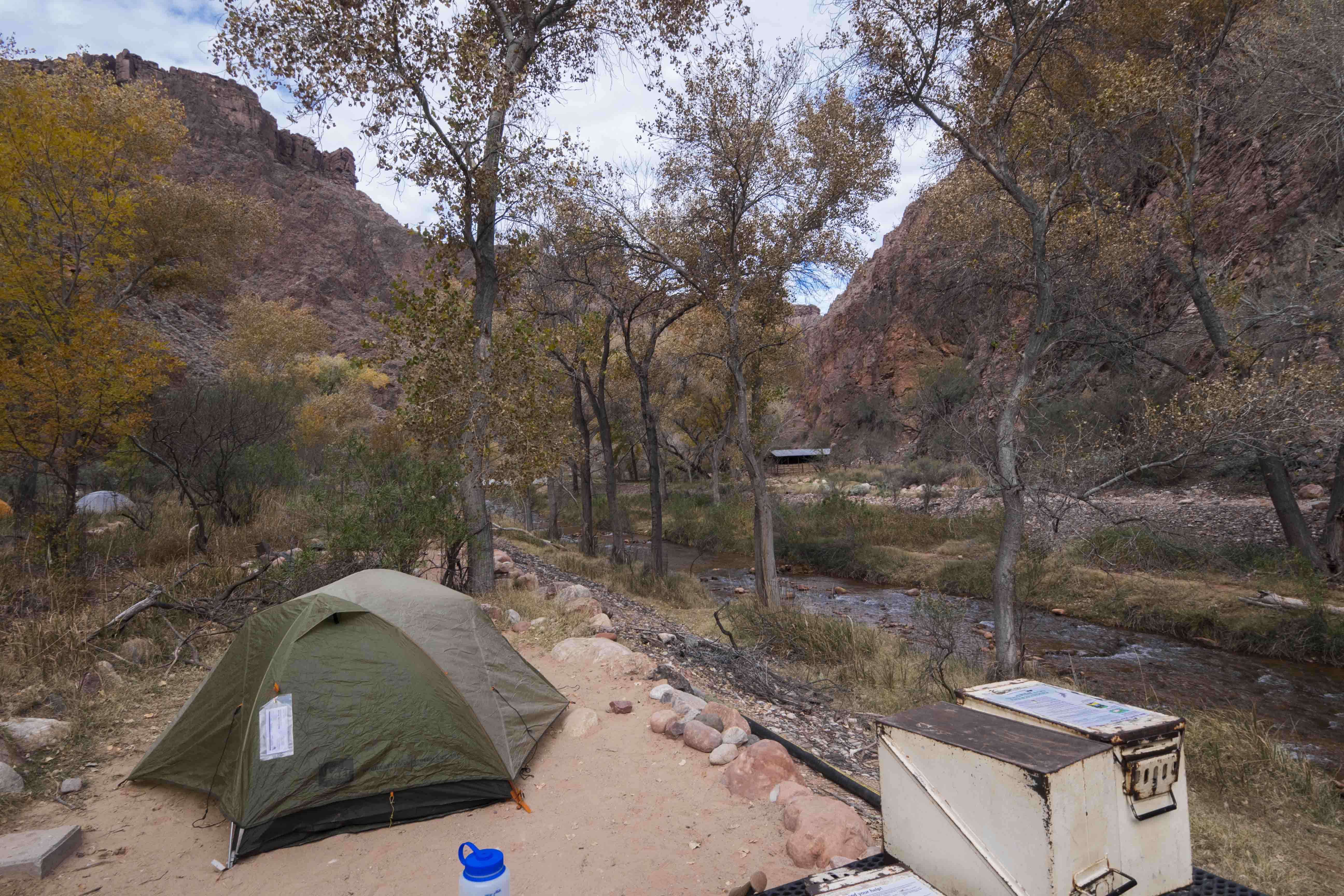
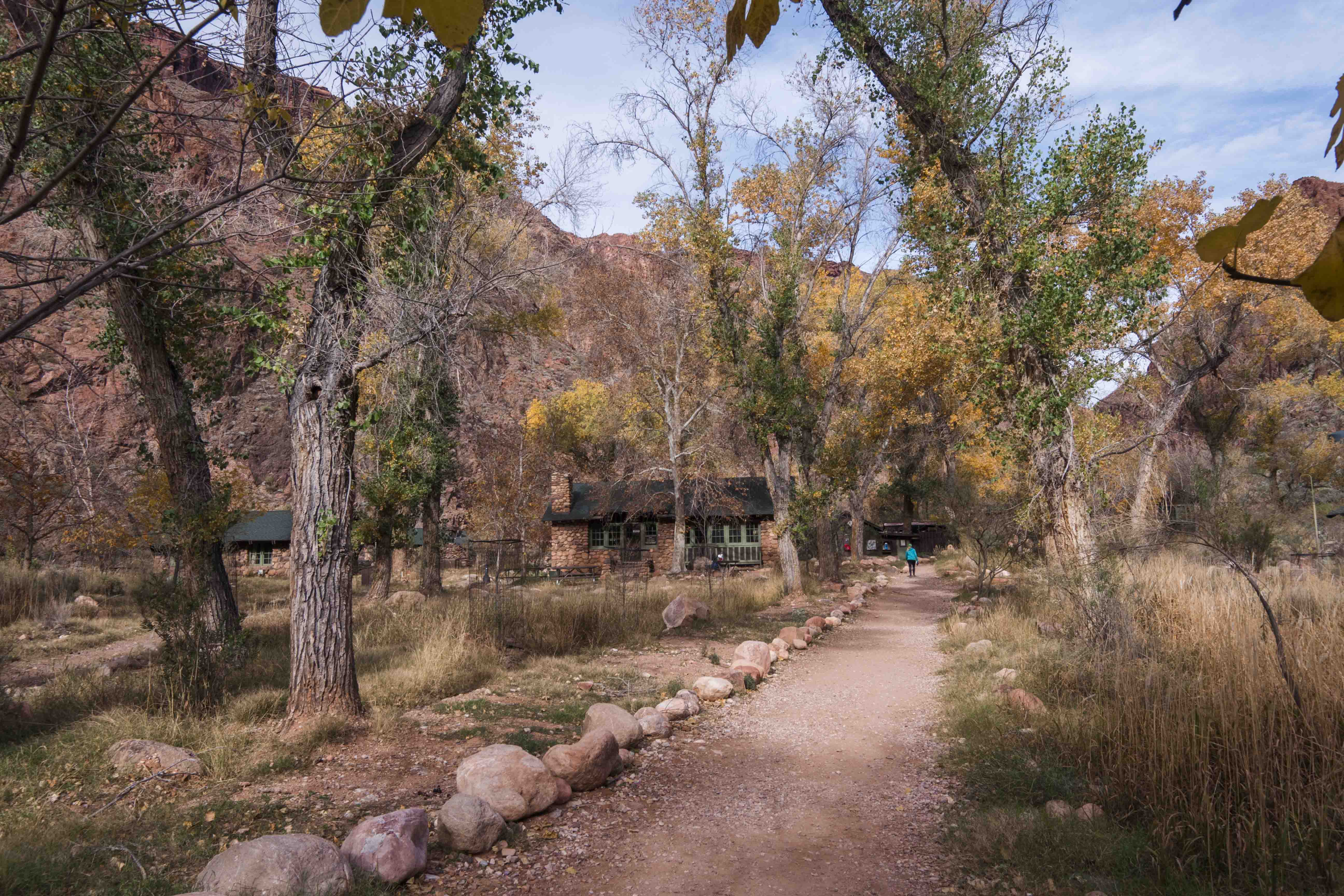
Once over the bridge I was at the Bright Angel Campground, very nicely nestled along Bright Angel Creek. Rain was in the forecast for the night, so I set up my tent quickly, had a nice lunch of premade PB&J (see below), and went exploring. Just up the creek from the campground is Phantom Ranch, a collection of cabins and bunkhouses that are available to rent for those who want a little more luxurious experience at the bottom of the canyon. Man, this place was niiiice; the creek itself is like an oasis with tall trees providing shade and sheltering the small cabins beneath their broad branches. Rooms were pretty cheap (~$50 for a bunk in the dorm), but apparently you had to book them about a year in advance. Woof.
Around 8pm, after some cold but delicious dinner and a bit of reading, I was back at Phantom Ranch to hang out in the cafeteria with the rest of my down-canyon colleagues. I drank some reasonably priced beer (considering the location) and played Euchre and Major General with a very lovely Welsh couple and two guys from central Illinois. The room was packed and the air thick with new friendships. Too soon it was 10pm and time to close down and go to bed.
Rain fell all night, but was gracious enough to stop exactly when I had decided “fuck it, I’ll just pack up in the rain”. Nice! I was on the trail around 8 with an apple for breakfast. In retrospect my hope that a single apple would sustain me all the way to the rim was foolishly optimistic, but at the time I felt fine and happy that I didn’t have to hike in my rain gear.
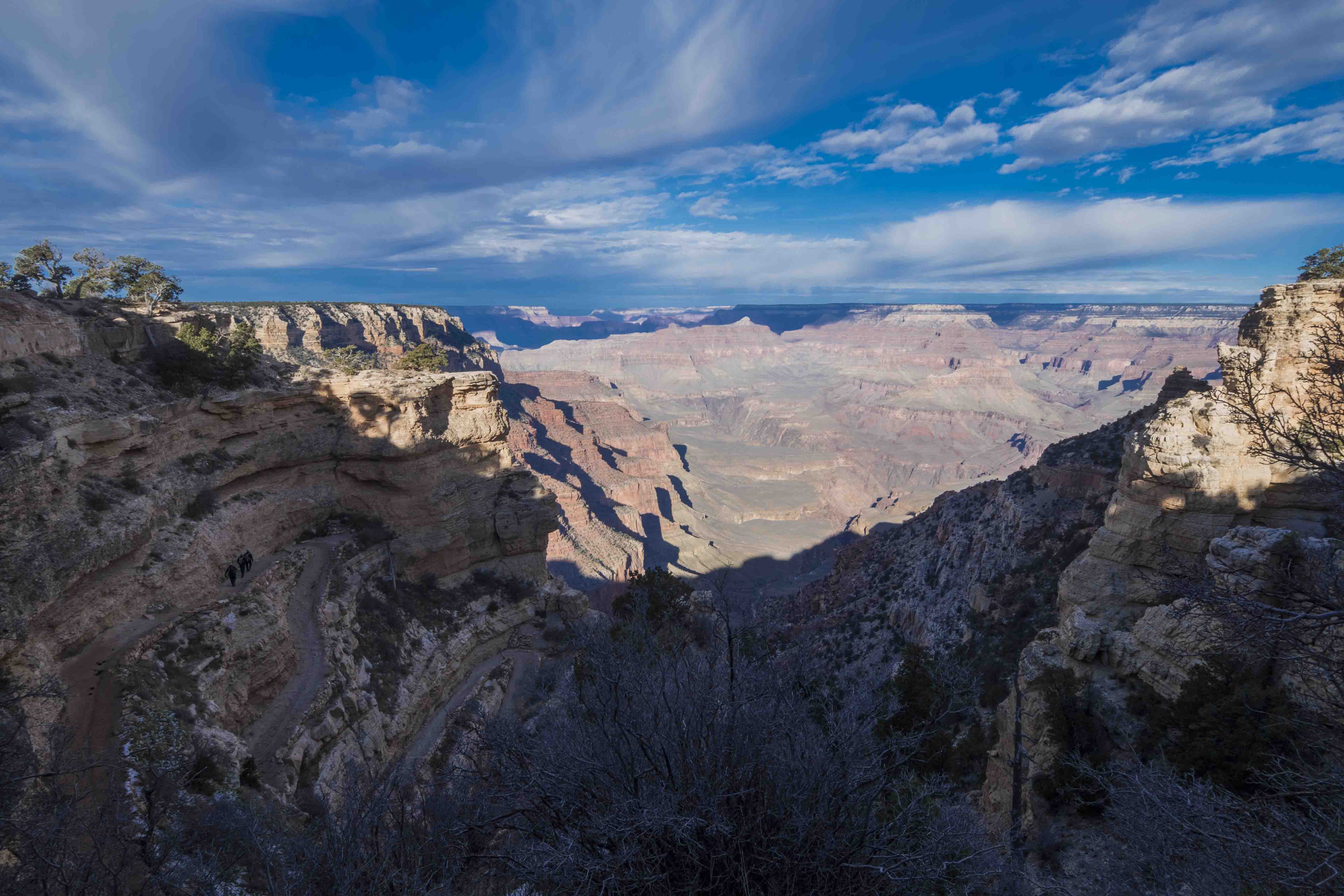
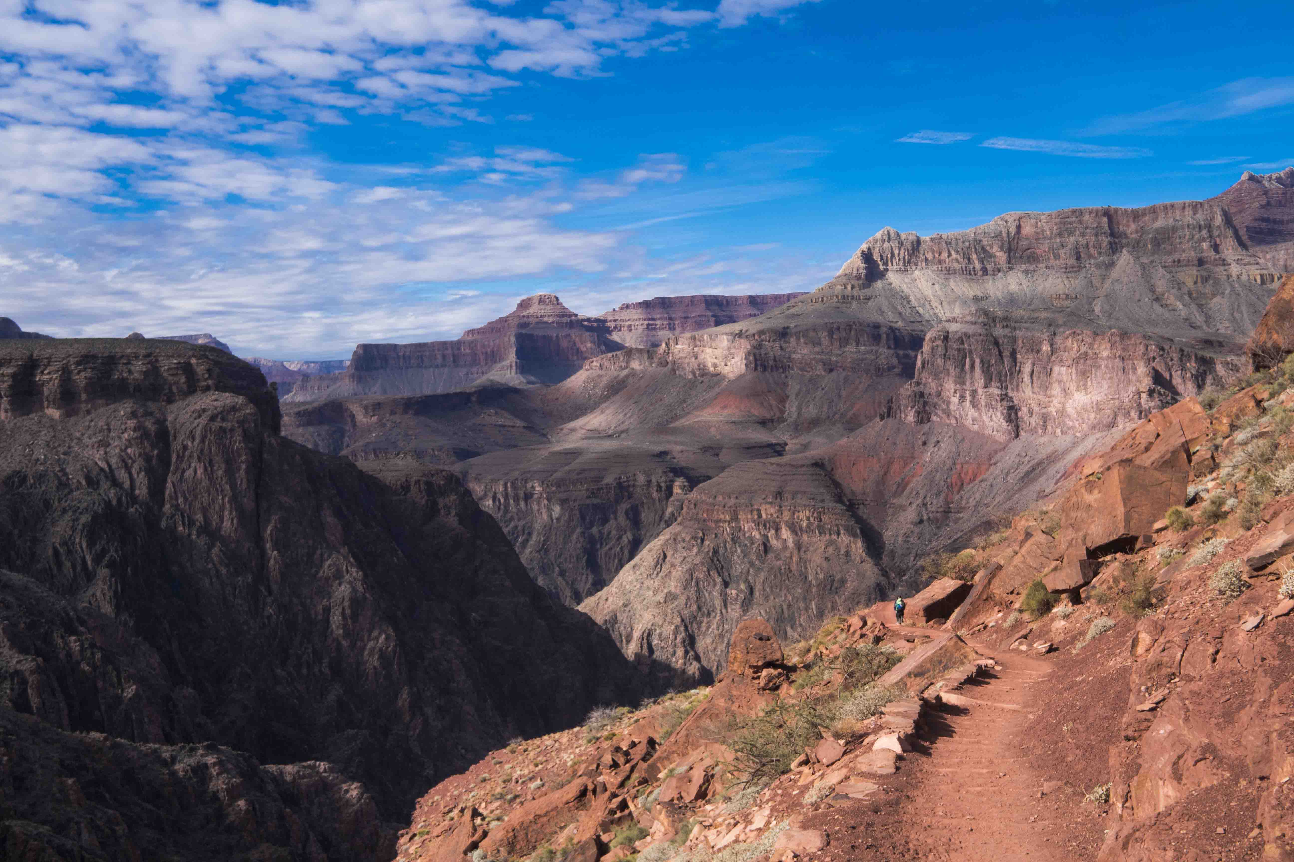
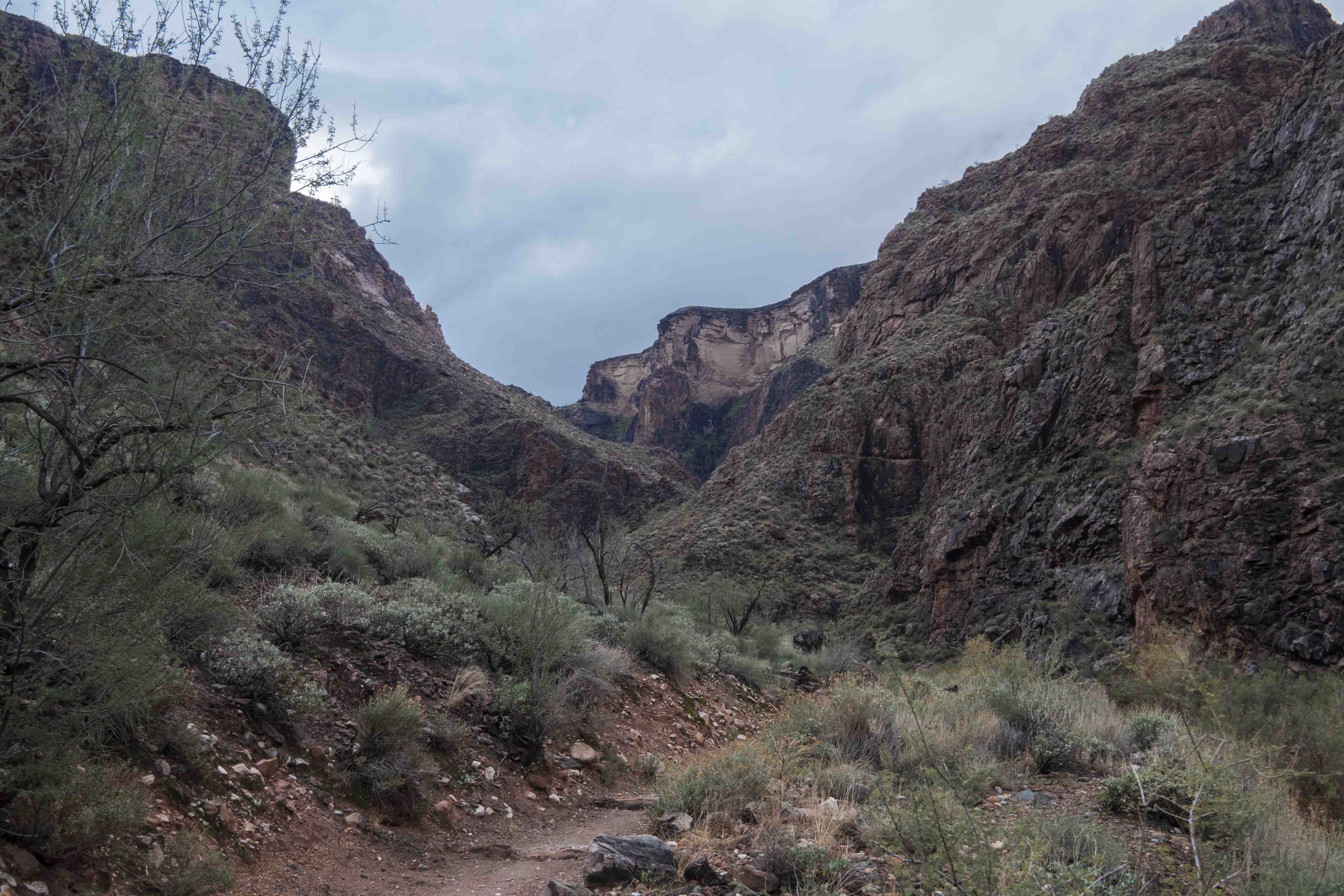
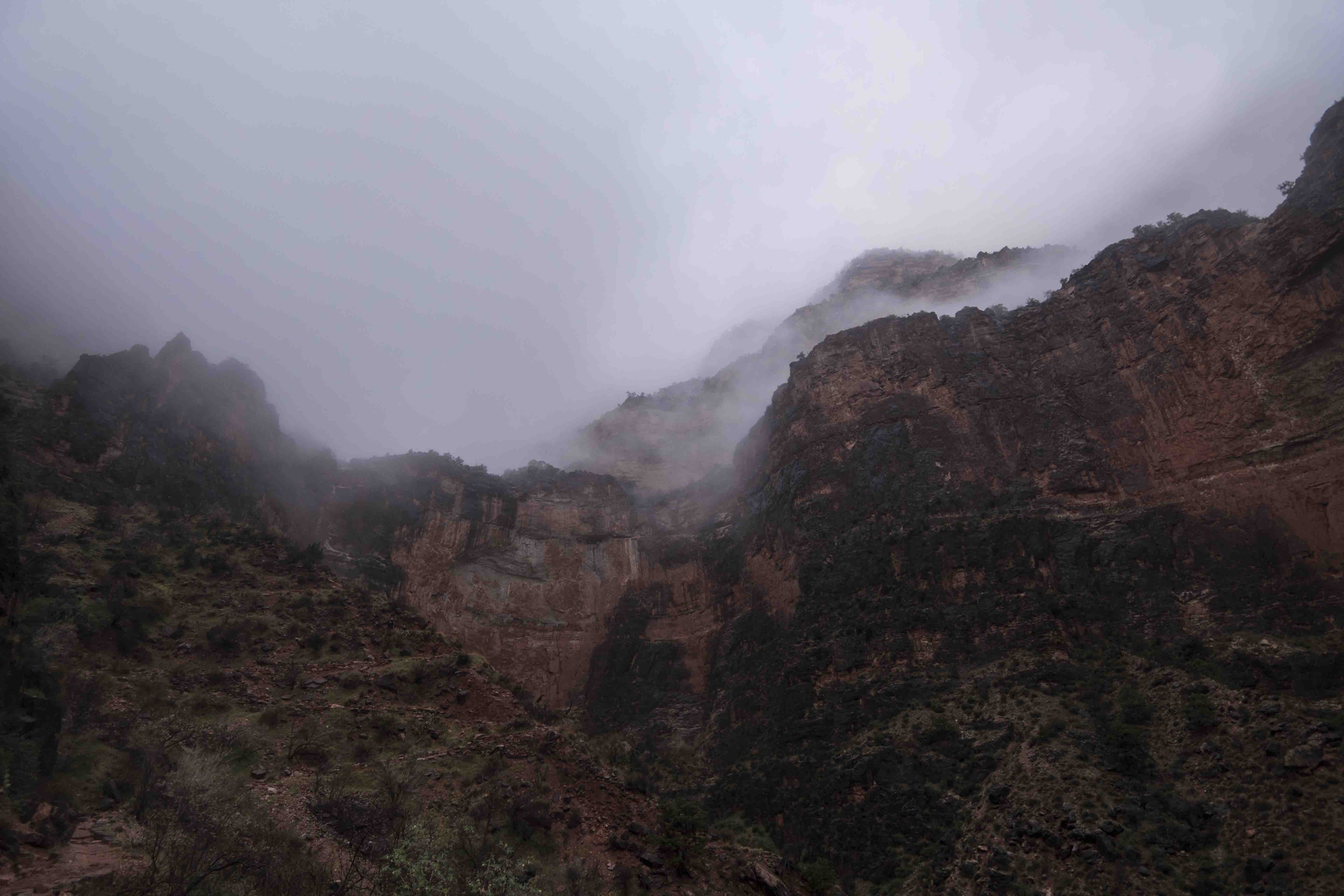
Despite the lack of precipitation it was still very overcast and the clouds were well below the rim of the canyon, which hid the enormity of the task before me. The South Kaibab trail from the day before is about 7 miles from top to bottom and, through the use of switchbacks, maintains a roughly constant gradient over its entire length. The Bright Angel trail, on the other hand, is on the longer side of 9 miles and has much more variation in slope. Its first section is right along the river and even when it starts climbing it does so in a large tributary valley that keeps the vertical gains modest. Because of these features I made great time (2 hours) to and past the half way point at Indian Gardens and it was there that I decided to push for a total trip time of 4 hours. The trail was good, there was no sun to bake me, and I was feeling strong so I felt confident I could complete the rest of the trail in time. Right after I set this goal the trail made an aggressive attempt to make up for previous shallowness by shooting straight up the end of the Indian Garden sub-canyon. Still, I pushed onward hard and was feeling good. It was just after I blew by the 3-mile rest house (i.e., 3 miles from the top) that I hit a major wall, almost as though I could feel the evaporation of last joule of energy from my morning apple. The 1.5 miles between the 3 and 1.5 mile rest houses were difficult and with each step I willed the next rest house to appear from the mist, but it seemed like and endless hike through a cloudy bubble before it finally did. Here I rested and ate a piece of bread for a little more energy, although with the elevation it was cold enough that I couldn’t rest for long. At this point I was hiking in the clouds and it was sprinkling so I was pretty soaked and in no condition to sit around in 35 degree weather.
Bread in belly, the last 1.5 miles were easier than the previous, but still difficult and when I finally made it to the top I was only a few legs away from my last. Still, I had just hiked up 5000 vertical feet over 9.5 miles in about four and a quarter hours, so, apart from being exhausted, I was feeling pretty strong. I quickly changed into some dry clothes and made my way over to the El Tovar hotel lounge where I got a prickly pear margarita on the recommendation of some of my fellow hikers.
I spent the night in the Backcountry Office parking lot and the next morning headed over to the Yavapai Geology museum. There was snow on the ground, views down into the canyon were choked with fog, and I was glad to have come out the day before. The museum was very informative and confirmed my suspicion of granite (along with some schist) in the inner canyon. I tried driving out to the Desert View Watchtower, but the road was very treacherous and not even halfway through I made the prudent choice to turn around and point my wheels towards Flagstaff.
When I decided to go to the Grand Canyon I was worried that it would be too touristy, or rather that I would be annoyed by the throngs of tourists huddling around the canyon rim. On my way out it occurred to me that this was a pretty arrogant/pretentious expectation, as though there was something wrong with ways to enjoy these parks that are different than my own. What’s important is the fact that people come here in the first place, not what they do when they get here. The church of the wild is very light on strict rituals and rewards all those who seek its benefits in their own way. I had been out by myself for too long and had forgotten that an essential part of the American outdoors is that it is shared by us all. Wild land management in this country is a communal investment and its dividends are often magnified when experienced in the company of others. For me this was most obvious along the Colorado river where a room full of complete strangers needed nothing more than a shared pleasure of the outdoors to form a temporary collective. For others the benefits are felt most acutely when taking pictures of their friends standing on the rim, or spending Christmas at a lodge overlooking one of the best views the world has to offer. Rather than begrudge the “tourists” for their choice of experience I should take solace in the fact that they are here at all. After all, we are all tourists in the grand scheme of things.
Other Observations:
- The night I spent at Bright Angel Campground was the shortest day of the year. I’m not sure it will really affect me over the next few weeks, but the knowledge that there is more light in the world is reassuring.
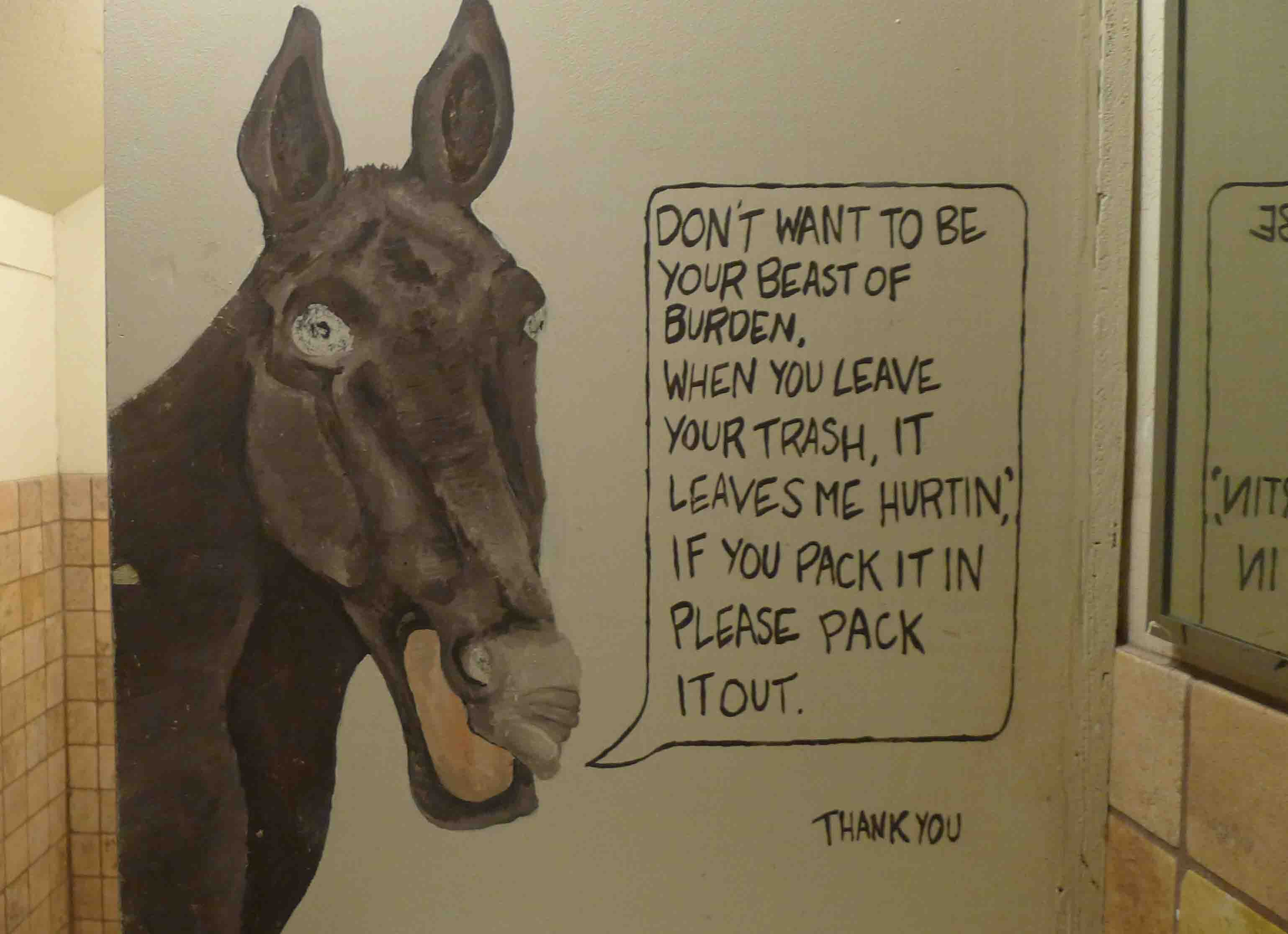
Most/all of the supplies at Phantom Ranch are taken via mule. I’ll just leave this picture here:
Few foods are more satisfying than a PB&J that has been sitting in a pack for a few hours. Everything gets smooshed together and the result is culinary perfection.
Williams, AZ is full of fraudsters of the lowest kind. All signs on I-40 pointed Grand Canyon-bound travelers to exits in Williams when the real turn off was a few miles out of town. As a result most people will probably have to navigate Williams’ slow, narrow streets while looking in vain for a continuation of the “Grand Canyon” signs that led them to this tourist trap in the first place. Furthermore, my AAA map lists AZ 64 north of Williams as a scenic highway, and, while usually such a rating is spot on, I failed to be inspired by the vast expanses of ranch land along this road. I suspect that the Williams chamber of commerce once again sold their dignity for a few tourist bucks. Attracting business is one thing, but blatantly incorrect signage is an affront to everything Good and True in this country. May their souls never find rest.
Comments
Dusty Swiftlips
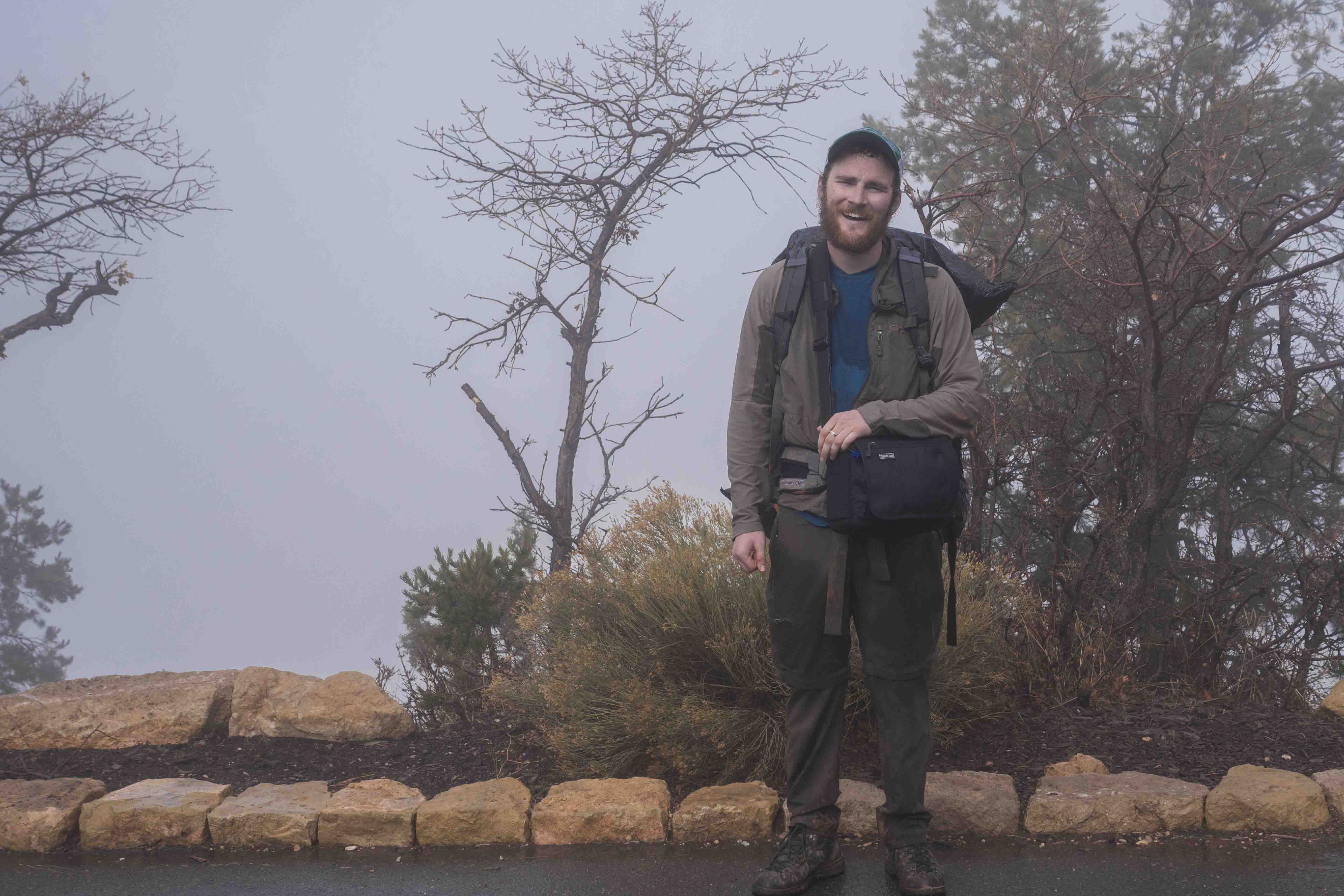
Great pictures. And you’re looking more like a bum every day, so good work on that front.
Leave a Comment
Your email address will not be published. Required fields are marked *